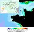
The availability of light in the water column and at the seabed determines the euphotic zone and constrains the type and the vertical distribution of algae species. Light attenuation is traditionally quantified as the diffuse attenuation coefficient of the downwelling spectral irradiance at wavelength 490 nm (Kd490) or the photosynthetically available radiation (KdPAR).
The availability of light in the water column and at the seabed determines the euphotic zone and constrains the type and the vertical distribution of algae species. Light attenuation is traditionally quantified as the diffuse attenuation coefficient of the downwelling spectral irradiance at wavelength 490 nm (Kd490) or the photosynthetically available radiation (KdPAR).
Satellite observations provide global coverage of these parameters at high spatial and temporal resolution and several empirical and semi-analytical models are commonly used to derive Kd490 and KdPAR maps from ocean colour satellite sensors. Most of these existing empirical or semi-analytical models have been calibrated in open ocean waters and perform well in these regions, but tend to underestimate the attenuation of light in coastal waters, where the backscattering caused by the suspended matters and the absorption by the dissolved organic matters increase light attenuation in the water column.
