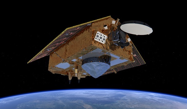
Sentinel-6 (credit: ESA/ATG medialab)
With global mean sea level rising because of climate change, Copernicus Sentinel-6 Michael Freilich is the next radar altimetry reference mission to extend the legacy of sea-surface height measurements, until at least 2030.
Sentinel-6 is a collaborative Copernicus mission, implemented and co-funded by the European Commission, ESA, EUMETSAT and the USA, through NASA and the National Oceanic and Atmospheric Administration (NOAA).
 |
 |
 |
 |
 |
The LEOP (Launch and Early Orbit Phase) was completed 24 November 2020, ESA's mission control team has handed over command and control of the satellite to EUMETSAT – Europe's weather and climate satellite organisation – who have completed the final 'orbit acquisition' and taken on responsibility for commissioning, routine operations and distribution of the mission's vital data.
For mission planning information, see the Copernicus Mission pages
The categories are:
-
Overview
Gives a brief description as well as the main thematic areas and services. -
Mission Objectives
Describes primary objectives of the Copernicus Sentinel-6 Michael Freilich mission. -
Satellite Description
Describes the satellite platform and the communication links, as well as the orbit characteristics and the geographical coverage. -
Instrument Payload
Describes the main instruments of the Copernicus Sentinel-6 Michael Freilich mission. -
Data Products
Describes the data products the Copernicus Sentinel-6 mission offers.
Sentinel-6 Validation Team
Visit the Sentinel-6 Validation Team website to learn more about what the team does, or to get involved in support to the mission.
