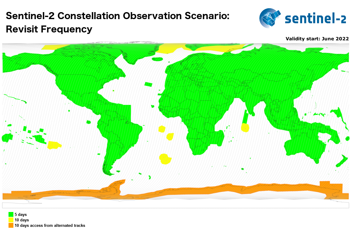
The SENTINEL-2 mission will provide systematic coverage over the following areas:
- all continental land surfaces (including inland waters) between latitudes 56° South and 82.8° North
- all coastal waters up to 20 km from the shore
- all islands greater than 100 km2
- all EU islands
- the Mediterranean Sea
- all closed seas (e.g. Caspian Sea).
In addition, the SENTINEL-2 observation scenario includes observations following member states or Copernicus Services requests (e.g. Antarctica, Baffin Bay).
Figures 1 and 2 illustrate the coverage foreseen for MSI acquisitions.
Figure 1: Illustrates the coverage and revisit time foreseen for SENTINEL-2 MSI acquisitions.
With two satellites all regular areas indicated above will be revisited every five days under the same viewing conditions.
Due to overlap between swaths from adjacent orbits, the revisit frequency will be increased with different viewing conditions.

Figure 2: Shows the geometric revisit frequency due to the overlap between adjacent orbits (Credits: Pascal Lacroix)
Please refer to the Sentinel-2 descending orbits.
