Pixel Classification
Before processing land or water pixels, or exempting them from further processing, it is necessary to sort them into four categories:
- cloud
- land
- water
- invalid.
The process described in the following figure is applied to the OLCI pixels to identify cloudy pixels, starting from the Level-1 geo-location based land/water a priori classification.
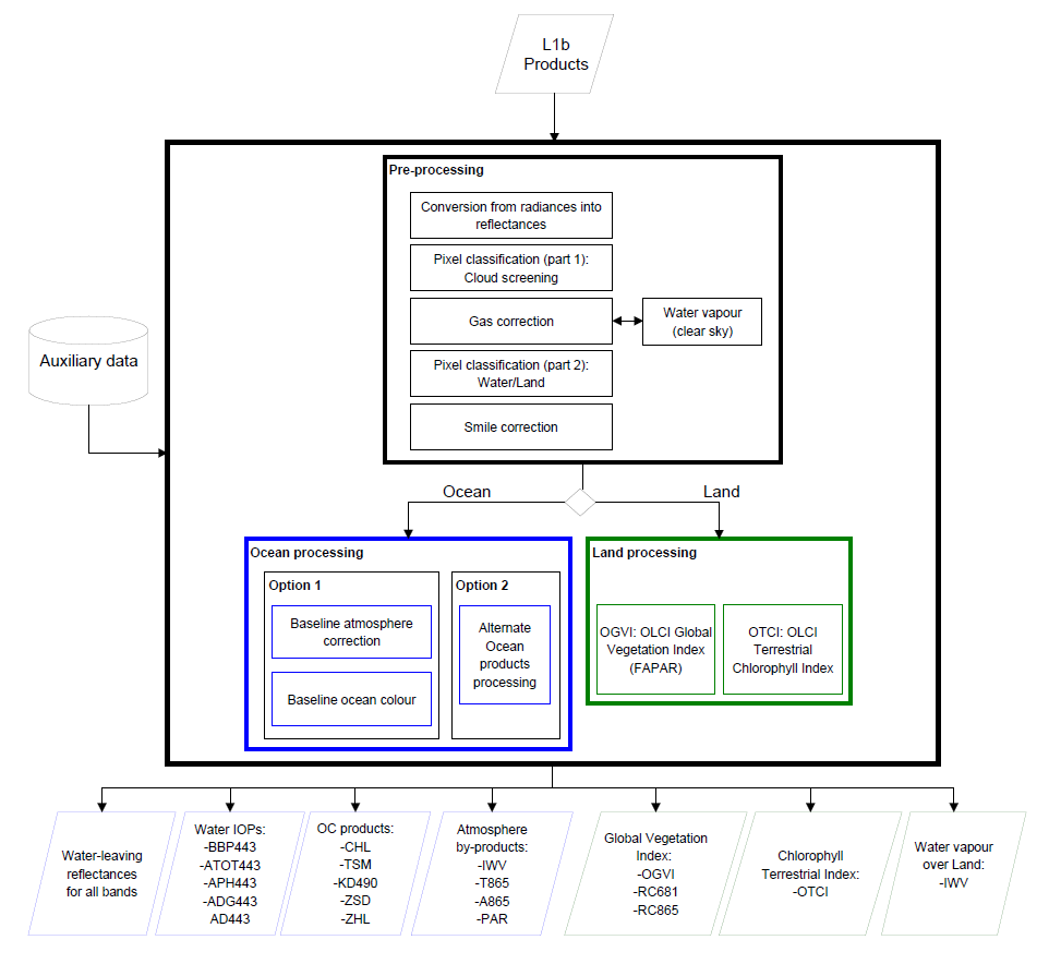
Clear sky pixels are corrected for absorption by atmospheric gases and a second classification step is applied. This second part aims to consolidate the Level-1B classification between water and land. The latter is a geographical indication under a flag LAND_F format. The algorithm makes use of radiometry to provide the consolidated (clear sky) land/water flag: LANDCONS_F.
Note that, in the frame of coming evolutions, the cloud detection performed at OLCI level 2 will be improved following the recommendations raised during the MERIS 4th reprocessing.
Functional Block Diagram of Pixel Classification 2 (land/water consolidation)