The Sentinel-2 Level-2A Collection 1 represents the product dataset generated starting from processing baseline 05.XX included.
The evolutions of the processing baseline (PB) are tracked and justified in the 'Processing Baseline Status' section of the Data Quality Report that is published on a monthly basis by the Mission Performance Center (MPC) and available from the Sentinel-2 Document Library.
Level-2A Dataset Specification
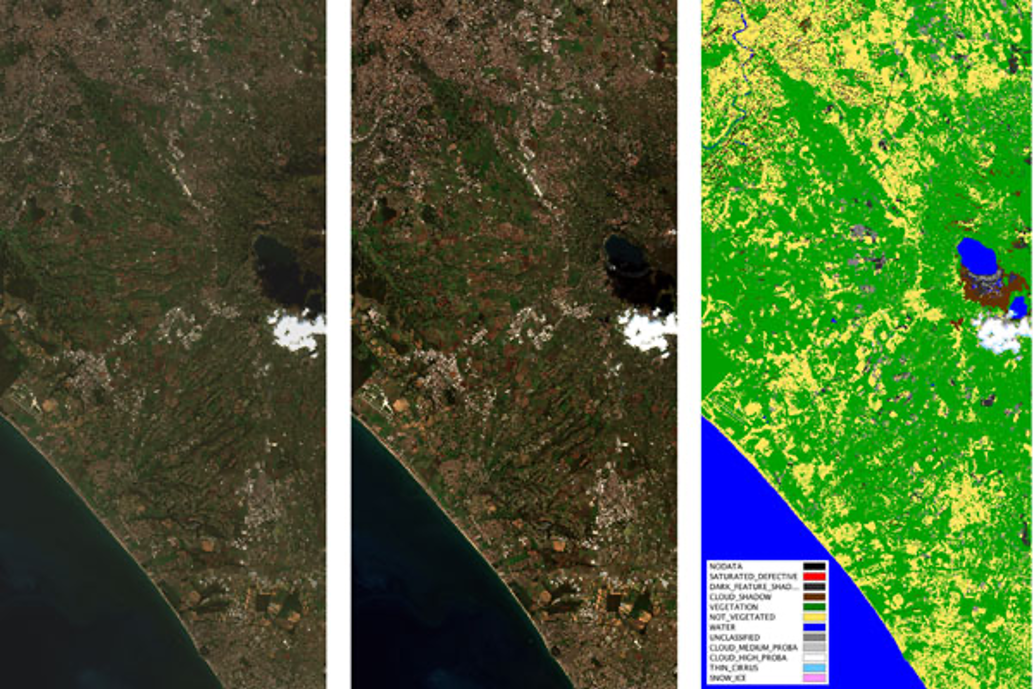
The Sentinel-2 Level-2A Collection 1 product provides orthorectified Surface Reflectance (Bottom-Of-Atmosphere: BOA), with sub-pixel multispectral and multitemporal registration accuracy. Scene Classification (including Clouds and Cloud Shadows), AOT (Aerosol Optical Thickness) and WV (Water Vapour) maps are included in the product. The main characteristics of L2A products are listed in the following table.
| Name | Level-2A |
| High-level Description | Surface reflectances in cartographic geometry for 12 spectral bands (Cirrus band B10 is not included). |
| Algorithm used | Sen2Cor – Version 2.10 |
| Data Characteristics |
|
| Additional Layers |
|
| DEM used | Copernicus DEM at 30 m |
| Auxiliary Data used |
|
| Quality Indicators |
|
| Production & Distribution | Systematic generation and on-line distribution |
| Data Volume | Data Volume 800 MB (each 110x110 km2) |
| Data Delivery | Available within 8 hours from sensing |
Additional details on the Processing Chain can be found on Sentinel-2 Products and Algorithms pages, and information on the L2A Processing Algorithm can be found on the Level 2A page. As far as Level-2A products are concerned, the geometric performance improvements are directly inherited from that of the Level-1C. Details on geometric methods can be found on the L1B processing page. Information on geometric accuracy of the Sentinel-2 data can be found in the Level-1C Sentinel-2 Data Product Quality Reports.
Resolution
The resolutions of the Copernicus Sentinel-2 mission and its payload, the MSI instrument, are threefold:
- The temporal resolution of a satellite in orbit is the revisit frequency of the satellite to a particular location. The revisit frequency of each single Sentinel-2 satellite is 10 days and the combined constellation revisit is 5 days
- The spatial resolution of an instrument is the at-ground representation of an individual detector in a satellite sensor array. Details on the spatial resolution of the MSI instrument resolution are provided in the Spatial Resolution section
- The radiometric resolution of an instrument is a determination of the incremental level of intensity or reflectance that can be represented or distinguished by the system. The higher the radiometric resolution, the more capable the device will be of detecting differences in intensity or reflectance. Details on the radiometric resolution of the MSI instrument are provided in the Radiometric Resolutions section.
See more information of the Sentinel-2 Spectral Response Functions (S2-SRF)
Coverage Acquisition Maps
The Sentinel-2 mission provides systematic global coverage over land masses and coastal areas. Read more about Sentinel-2's Revisit and Coverage.
Quality Reports
The Coordinating Centre of the Mission Performance Centre (MPC-CC) provides a monthly status of the Sentinel-2 product quality via the dissemination of a Data Quality Report (DQR). The report provides information on the monitoring and measurement of product performances against the proposed specification including: radiometric and geometric accuracy. It also documents observed anomalies and known issues, the list of defective pixels, and any processing chain improvements that lead to an increment of the Processing Baseline.
View available Sentinel-2 Data Product Quality Reports.
How to access this data
Products are freely available via the Copernicus Data Space Ecosystem. In addition to the download services, the Sentinel Data Products are available in the Copernicus Data and Information Access Service (DIAS) cloud environments. Each DIAS provides processing resources, tools and complimentary data sources at commercial conditions to further facilitate the access to Sentinel data. Learn more about how to access Sentinel data.
Resources
- Sentinel-2 Level-2A ATBD
- Level-2A Algorithm Overview
- Sentinel-2 Product Specifications Document
- Sentinel-2-Naming Convention
- CEOS EO HANDBOOK – INSTRUMENT SUMMARY - MSI (Sentinel-2)
- Sentinel-2 Spectral Response Functions (S2-SRF)
Tools
The Sentinel-2 Toolbox consists of a rich set of visualisation, analysis and processing tools for the exploitation of MSI data from the Sentinel-2 mission.
Data Citation Guidelines Collection 1
Users, who, in their research, use ESA Earth Observation data that have been assigned a DOI, are asked to use it when citing the data source in their publications:
Copernicus Sentinel-2 (processed by ESA), 2021, MSI Level-2A BOA Reflectance Product. Collection 1. European Space Agency. https://doi.org/10.5270/S2_-znk9xsj