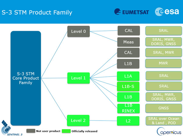
There are different data products associated with the three levels of processing of altimeter data.
- Level-0 product is the raw telemetered data.
- Level-1 product is the Level-0 product corrected for instrumental effects.
- Level-2 product is the Level-1 product corrected for geophysical effects.
The Level-1 scientific products (SR_1_SRA) and Level-2 scientific products (both water SR_2_WAT and land SR_2_LAN) are available to users.
NOTE: The Level-0 scientific products (SR_0_SRA), the SRAL calibration products (SR_0_CAL and SR_1_CAL) and the MWR products (MW_0_MWR, MW_1_MWR and MW_1_CAL), are not available to users and are considered only as an input to processing chains.

SRAL/MWR product tree
In the Level-1 processing chain, there are 3 main processing chains:
and
In the Level-2 processing chain, there are three main processing steps :
- Compute time-derived geophysical/environmental parameters,
- Perform re-tracking and compute physical parameters,
- Compute Level-2 altimeter/radiometer geophysical processing.