Title: Water extent on Biebrza wetlands
Description:
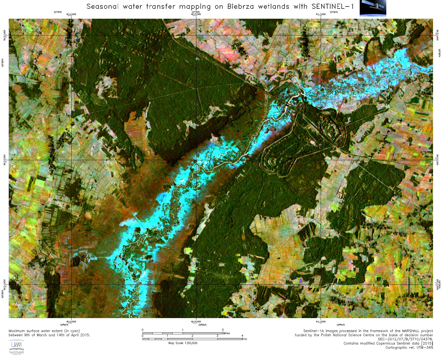
This Copernicus Sentinel-1 satellite image features part of the Biebrza National Park, located in northeast Poland. It shows the maximum surface water extent on wetlands between 9 March and 14 April 2015. Owing to Sentinel-1's high-temporal resolution, wide swath and all-weather acquisition capability, the water extent can be mapped on a large scale and in remote areas, which are not reachable for in-situ measurements.
Copyright: Contains modified Copernicus Sentinel data [2016], UWM