Mapping dynamic ocean depth is useful for marine geology researchers, tide modelling and prediction, coastal management and navigation—Copernicus Sentinel-2 satellites are proving to be a game changer in this respect.
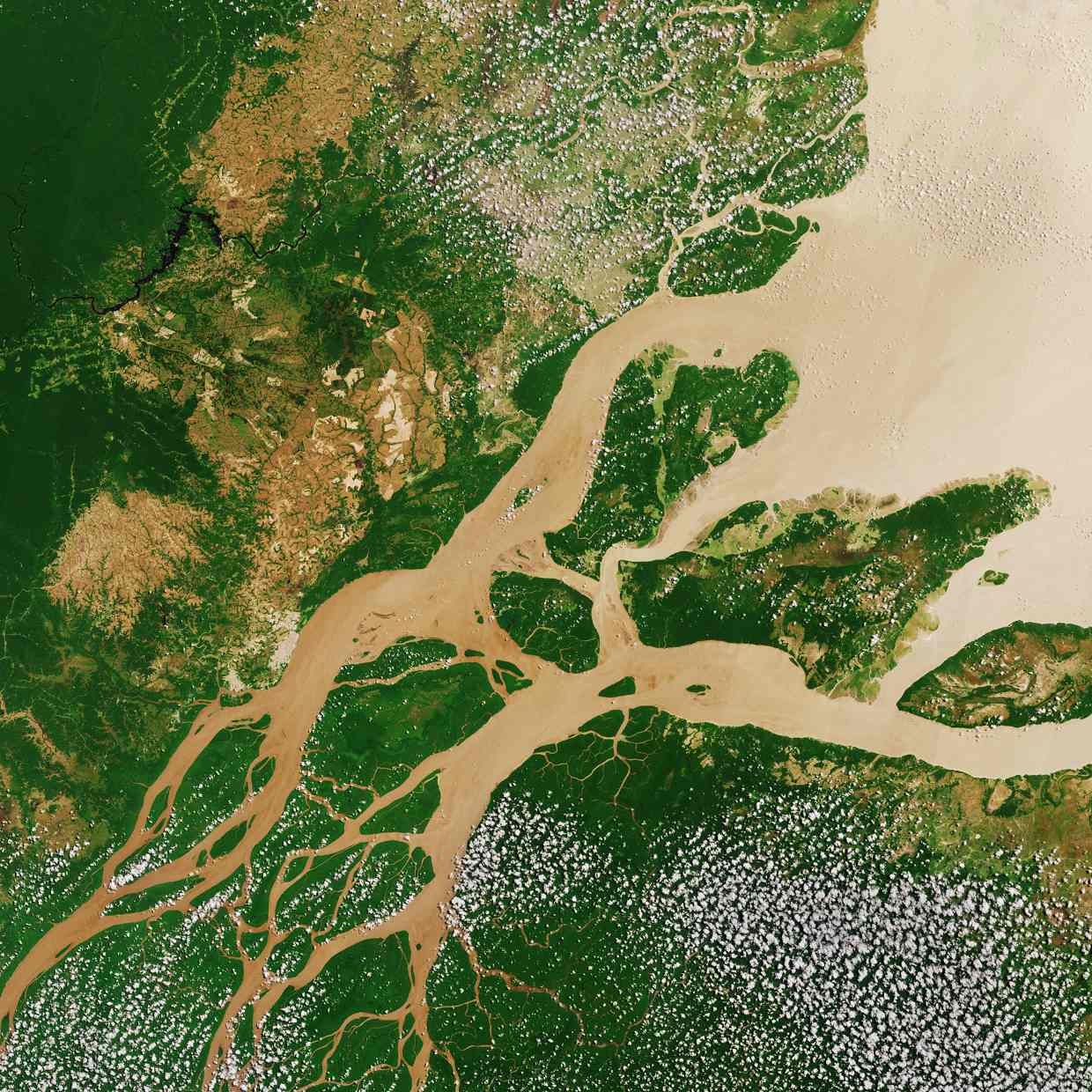
The sediment discharge of the Amazon River congregates into mud banks, which are then migrated by forces of waves and currents westward along the northeast South America coastline, reaching as far as Orinoco (Venezuela).
Waves, predominantly from the Northeast, liquefy the mud on the East (trailing edges) and the alongshore current transport the liquefied mud to settle on the leading edge. This erosion/accretion process continues ad infinitum with a westward movement of 1-5 km/year.
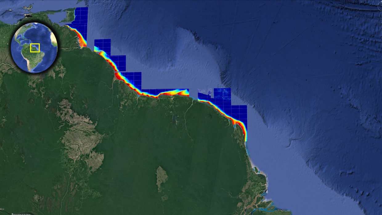
Thus, the entire 1500 km coast from the Amazon to the Orinoco has an ever-changing ocean depth – so-called bathymetry - up to 40 km offshore. The mud banks are most dynamic on the shorelines of the three Guianas: Guyana, Suriname and French Guiana.
Sentinel-2A Amazon River
Copyright:Contains modified Copernicus Sentinel data (2017), processed by ESA
In 2016, the Maritime Authority of Suriname (MAS) surveyed a 190 km stretch of coastline with a single-beam echo sounder (see Figure 1a). In 2020, with a National Science Foundation grant (NSF SBIR Phase II: Project Trident), researchers from jOmegak Consulting and TCarta Marine demonstrated that Copernicus Sentinel-2 could do the same survey faster and cheaper.
MAS single-beam echo sounding survey
Copyright:Contains modified Copernicus Sentinel data (2017-22)/processed by R.Abileah (jOmegak Consulting)
The traditional (and better known) satellite-derived bathymetry (SDB) is the inversion of bottom reflected sunlight. It works well in clear waters (for instance, the Bahamas), but is very limited in turbid waters.
Most of the world's coasts are moderately turbid, and SDB is limited to a few meters. On the Amazonian mud coast, there is constant sediment transport and very high turbidity, so traditional SDB is even more limited.
The method described by the team is independent of water turbidity. The depth is derived using the gravity wave dispersion law, which describes the change in wave celerity as the waves shoal and "feel the bottom." Wave motion is measured with the 1.79 s time delay between bands B08 and B8A. This method is best in mid-latitudes and tropics, on shorelines with exposure to oceanic storm swell waves. Such conditions are met on the Amazonian mud belt.
Three Sentinel-2 granules, 21NVG, 21NWG and 21NG, cover the extent of the MAS echo-sounding survey. Figure 1(b) is the bathymetry derived using Copernicus Sentinel-2 images from 2017-2022 and compares well with the MAS echo-sounding in Figure 1(a). (The root-mean-squared differences are < 1 m after accounting for mud movement and tides.)
(a) MAS single-beam echo sounding survey.(b) Bathymetry derived with Sentinel 2, composite of all images 2017-2022
Copyright:Contains modified Copernicus Sentinel data (2017-22)/processed by R.Abileah (jOmegak Consulting)
Figure 2 features a movie of Sentinel-2 derived bathymetry in five one-year steps, 2017-2022. The entire Suriname coastline (370 km) is shown. The movie demonstrates the westerly motion of mud banks. Just East of Paramaribo (the capital of Suriname), the team discovered two shallow ridges extending 40 km from shore. These navigation barriers are not in current nautical charts.
Suriname 5 years 2017-2022
Copyright:Contains modified Copernicus Sentinel data (2017-22)/processed by R.Abileah (jOmegak Consulting)
The workflow, from downloading data from the Copernicus portal, through cloud masking, depth inversion, and point cloud processing is automated. While the original study goal was just a 190 km stretch of Suriname coastline (three granules), it was easy to extend to a 1500 km coastline (Figure 3) by repeating the workflow processing on 14 granules.
Bathymetry derived with Sentinel-2
Copyright:Contains modified Copernicus Sentinel data (2017-23)/processed by R.Abileah (jOmegak Consulting).
The team demonstrated the potential to replace expensive, time-consuming echo-sounding surveys with periodic Copernicus Sentinel-2-derived updates to monitor dynamic shallow bathymetry as in the Amazonian mud belt.
The free distribution of Sentinel-2 images is key to the economic advantage of satellite over ship echo-sounding. The processing easily scales up to regional/continental scales.
Ron Abileah, researcher at jOmegak Consulting, states, “The Sentinel-2 satellites have been game-changers for remote sensing coastal phenomena such as wave dynamics, currents, shorelines and bathymetry. Both academia and commercial efforts favour the Copernicus Sentinel-2 satellites because of their excellent radiometric accuracy, the worldwide 5-day revisit, pixel resolution (10m), and price competitiveness (since they are free)”.
About the Copernicus Sentinels
The Copernicus Sentinels are a fleet of dedicated EU-owned satellites, designed to deliver the wealth of data and imagery that are central to the European Union's Copernicus environmental programme.
The European Commission leads and coordinates this programme, to improve the management of the environment, safeguarding lives every day. ESA is in charge of the space component, responsible for developing the family of Copernicus Sentinel satellites on behalf of the European Union and ensuring the flow of data for the Copernicus services, while the operations of the Copernicus Sentinels have been entrusted to ESA and EUMETSAT.
Did you know that?
Earth observation data from the Copernicus Sentinel satellites are fed into the Copernicus Services. First launched in 2012 with the Land Monitoring and Emergency Management services, these services provide free and open support, in six different thematic areas.
The Copernicus Land Monitoring Service (CLMS) provides geographical information on land cover and its changes, land use, vegetation state, water cycle and Earth's surface energy variables to a broad range of users in Europe and across the World, in the field of environmental terrestrial applications.
It supports applications in a variety of domains such as spatial and urban planning, forest management, water management, agriculture and food security, nature conservation and restoration, rural development, ecosystem accounting and mitigation/adaptation to climate change.
References:
R. Abileah, “Monitoring the complex and dynamic Amazon-influenced muddy coast (from the Amazon to the Orinoco) with the Sentinel 2 satellites,” p 138-139, Proceedings of Oceans From Space V, Scuola Grande di San Marco, Venezia, 24-28 October 2022. https://www.oceansfromspacevenice2020.org/wp-content/uploads/2023/04/OceansFromSpaceV-2022-PROCEEDINGS-.pdf
R. Abileah and J. -Y. Blot, "Bathymetry of the Golfe d’Arguin, Mauritania, derived with the moderate resolution Sentinel-2 satellites," OCEANS 2021: San Diego – Porto, San Diego, CA, USA, 2021, pp. 1-7, doi: 10.23919/OCEANS44145.2021.9705992. https://ieeexplore.ieee.org/document/9705992

