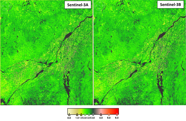
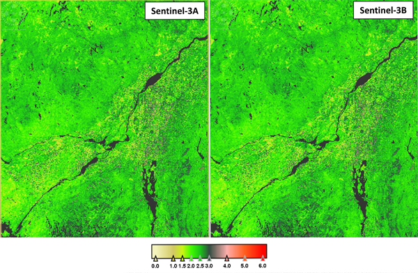
With two sensors now in orbit, the Copernicus Sentinel-3 satellites could monitor some parts of the world almost daily. This capability could be crucial in monitoring rapidly developing events such as biotic/abiotic stress on crops and provide accurate and timely information from farmers to policy-makers, to develop appropriate mitigation strategies.
Launched on 16 February 2016, with its twin Sentinel-3B following on 25 April 2018, the Sentinel-3 satellites of the European Union's Copernicus programme carry a suite of cutting-edge instruments, systematically measuring Earth's oceans, land, ice and atmosphere to monitor and understand large-scale global dynamics. They provide essential information in near-real time for ocean and weather forecasting as well as terrestrial vegetation state.
The mission consists of two identical satellites orbiting in constellation for optimum global coverage and data delivery. For example, with a swath width of 1270 km, the Ocean and Land Colour Instrument (OLCI) will provide global coverage every two days.
Due to the operational requirements of the mission, it is necessary to ensure that the OLCI land products are produced at the level of accuracy that is required by the users. In addition, to ensure that the datasets are consistent there should be no difference in the products generated by both OLCI instruments.
To ensure this, a team of scientists at the University of Southampton is working collaboratively with the Copernicus Sentinel-3 Mission Performance Centre to undertake a series of inter-comparison and validation activities.
The near simultaneous acquisition regime during the tandem phase showed very close agreement between land products derived from the A and B satellites. To date, these products were compared with ground data at four European sites covering agriculture to forest surface types, all showing a good agreement with ground data. This activity is planned to be extended in future, to cover more land cover types and geographical areas.
"The arrival of Copernicus Sentinel-3B has completed the Sentinel-3 constellation giving us an unprecedented 1-2 day repeat coverage at high accuracy for vegetation monitoring. The tandem period has been highly successful in revealing instrument characteristics linked to measurement uncertainties, essential for linking -3A and -3B measurements to provide a consistent dataset," stated Professor Jadu Dash of the University of Southampton.
About the Copernicus Sentinels
The Copernicus Sentinels are a fleet of dedicated EU-owned satellites, designed to deliver the wealth of data and imagery that are central to the European Union's Copernicus environmental programme.
The European Commission leads and coordinates this programme, to improve the management of the environment, safeguarding lives every day. ESA is in charge of the space component, responsible for developing the family of Copernicus Sentinel satellites on behalf of the European Union and ensuring the flow of data for the Copernicus services, while the operations of the Copernicus Sentinels have been entrusted to ESA and EUMETSAT.

