Earth Observation data offer a powerful approach for accurate and cost-effective monitoring of hydrological regimes and seasonal inundated transition zones. Leveraging the capacity provided by the Copernicus Sentinel-1 and Sentinel-2 missions, the Centre for Research and Technology Hellas (CERTH) has developed automatic services for the creation of inundation maps.
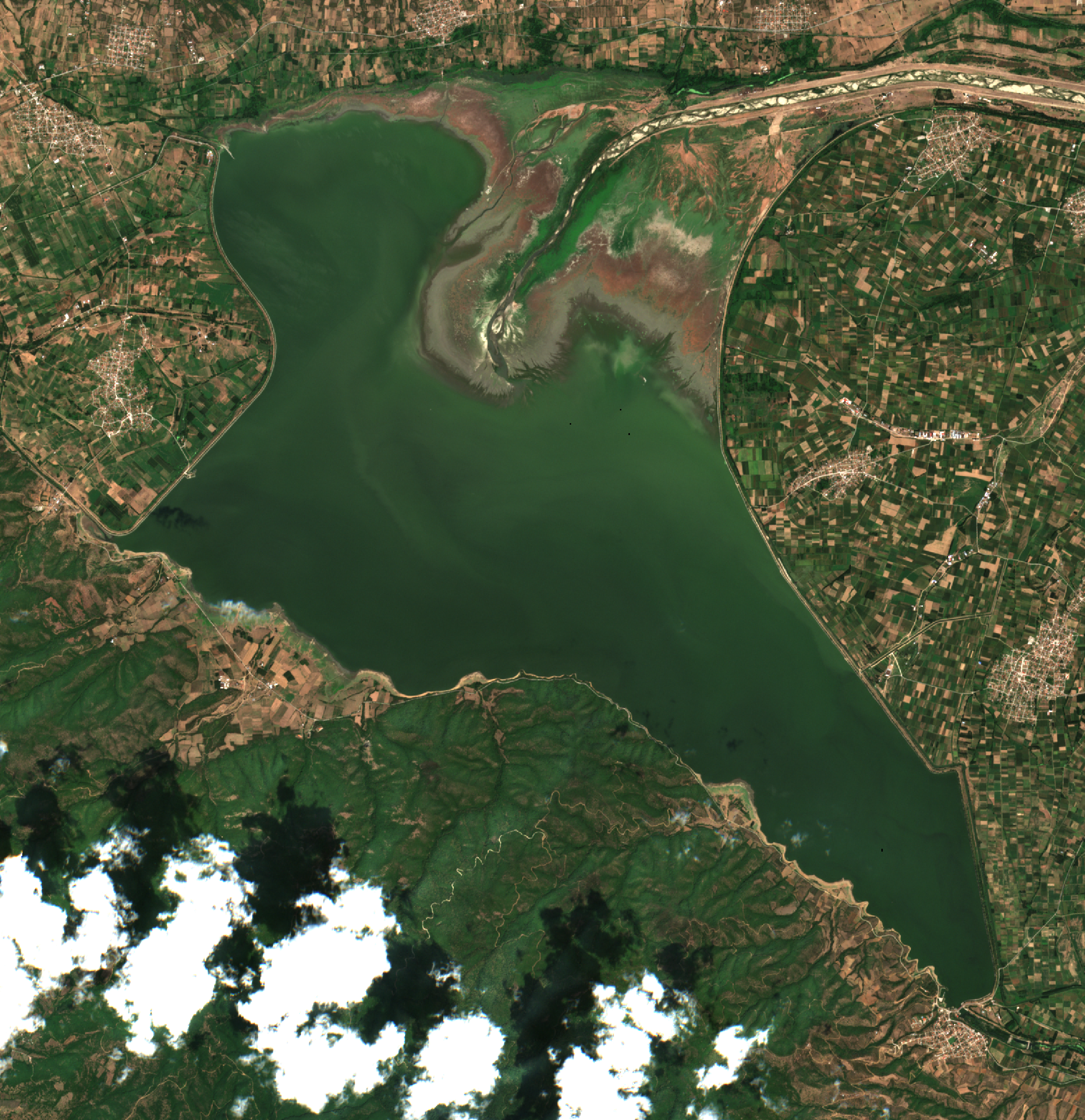
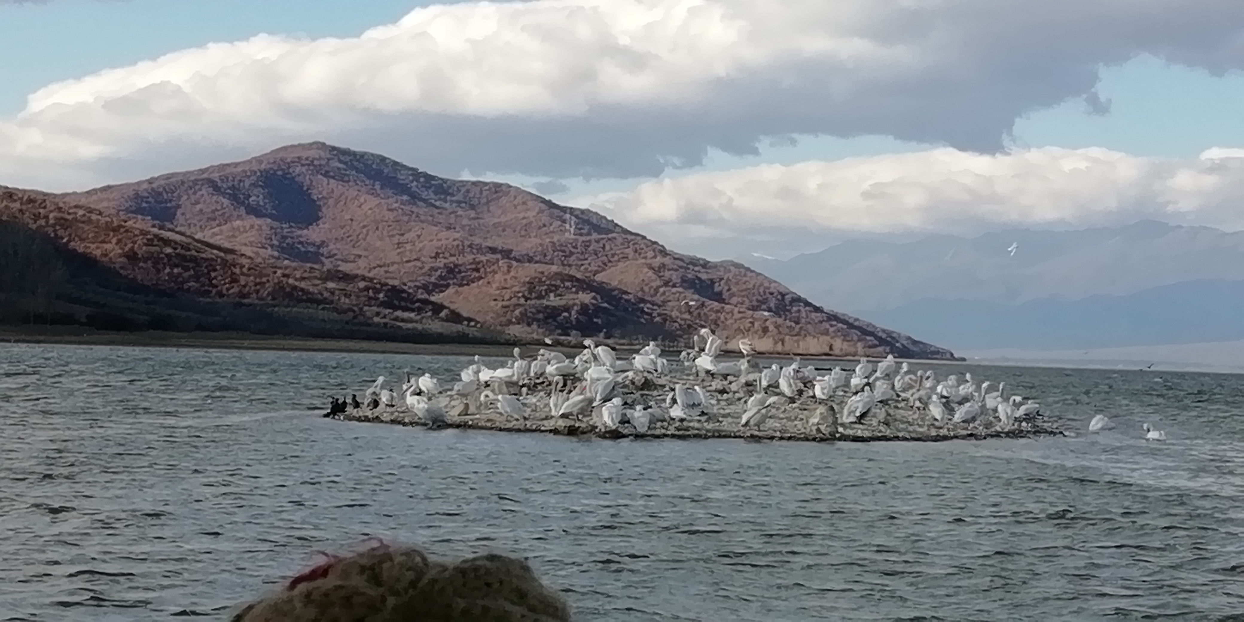
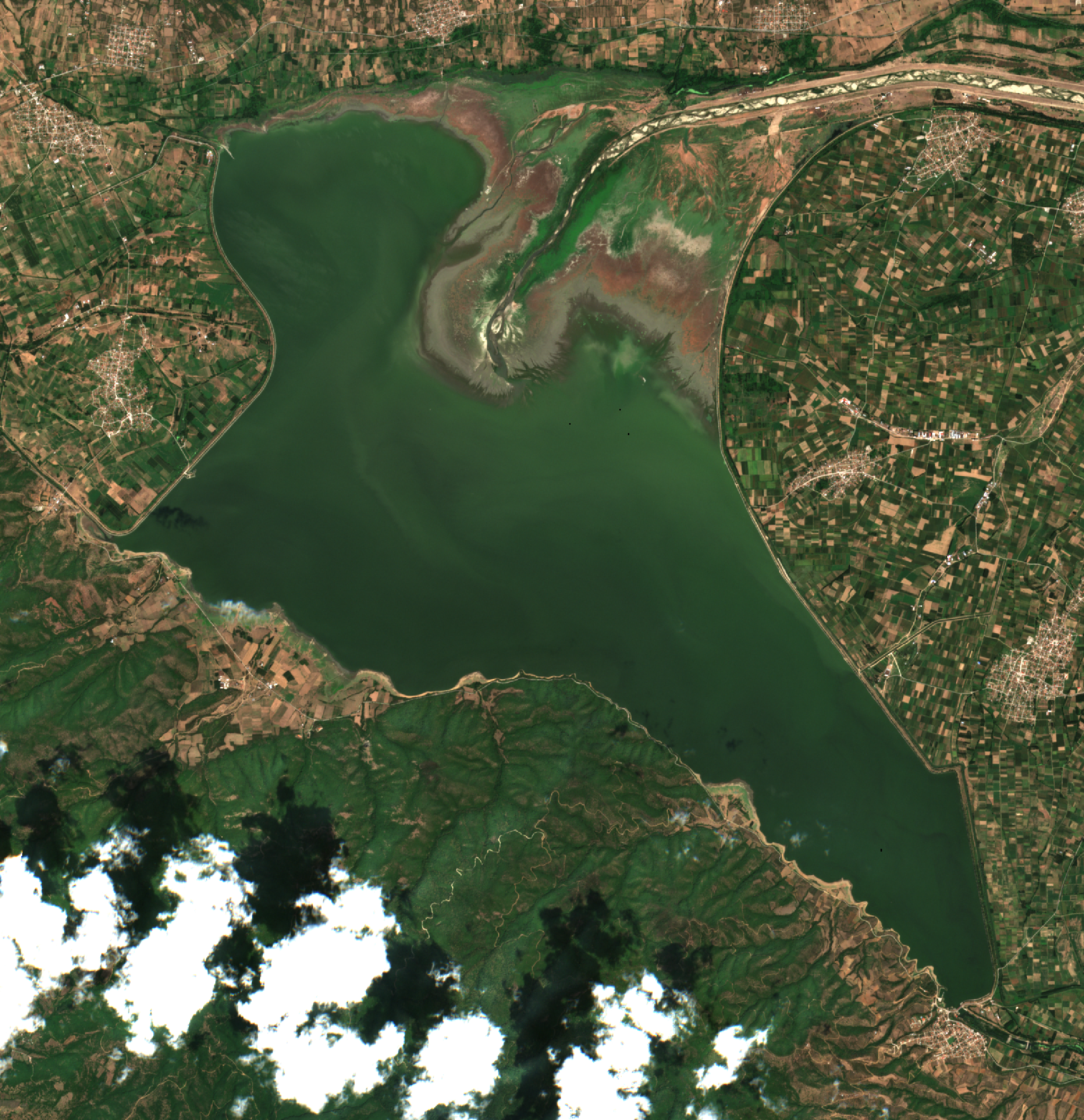
Lake Kerkini is an artificial reservoir located in Northern Greece, constituting an area of abundant biodiversity as well as a prominent nesting site for migratory birds. With a spatial coverage of 70-76 km2 and a basin extending over 11,600 km2, Kerkini is a Natura 2000 protected site and a RAMSAR wetland of international importance.
An ecosystem of notable diversity has developed here, hosting over 300 species of birds, 1300 plant species and the largest water buffalo population on a national level. However, Kerkini’s ecosystem has been impacted from the intense use of its resources throughout the years and changes to water extent due to human-induced pressures, along with uncontrolled, frequent, and extreme flooding events.
By monitoring the inundation status and understanding the seasonal patterns associated with it, Kerkini Lake Management Authority can support the preservation of Kerkini’s ecosystem dynamics and achieve an effective balance between the seasonal nesting and nutritional needs of its fauna (e.g., migratory birds and water buffalo populations), and the irrigation needs of the adjacent Serres plain.
The processing chains of Copernicus Sentinel data, originally developed and tested in the Doñana and Camargue regions in Spain and France [1] & [2], respectively, demonstrated both high accuracy in terms of water extent estimation and the transferability to other areas with similar characteristics. They are further enhanced and developed as a service in the H2020 e-shape project [3].
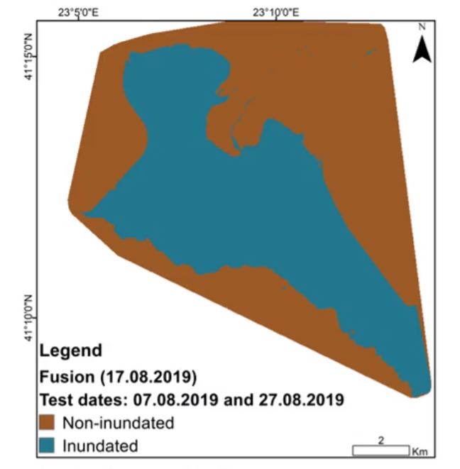
For the creation of inundation maps from Copernicus Sentinel-2 images, the developed unsupervised local-thresholding service, named WaterMask [1], takes advantage of the physics of light interaction with water. To further overcome the limitations imposed by unfavourable weather conditions in multispectral data, Sentinel-1 and Sentinel-2 images can be fused together with machine learning [2], provided there are Sentinel-2 reference inundation maps available and Sentinel-1 data in close temporal proximity.
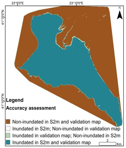
Kerkini Lake and inundation estimation maps
In the case of Kerkini Lake, the focus was on multi-temporal monitoring of inundated areas from June 2017 until August 2019. Dates with in-situ measurements coinciding with available Copernicus Sentinel-2 data were selected for the validation.
Creation of the validation layers took into account not only the in-situ data, but also bathymetry maps, expert knowledge of the area and added information derived from the Scene Classification Layer (SCL) of Copernicus Sentinel-2 L2A products.
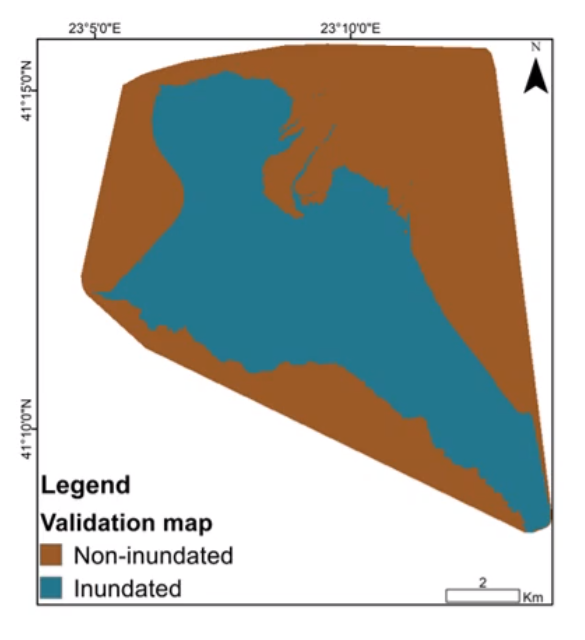
The inundation maps created from Copernicus Sentinel-2 multispectral data showed high mapping accuracy of the water extent and results were consistent year-round, proving the efficacy and transferability of the methods in inland water bodies and wetlands.
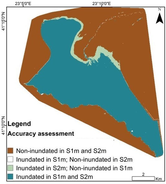
Inundation maps of Kerkini Lake
Copernicus Sentinel-1 data were also acquired for the same period and Sentinel-1 dates closely coinciding with Sentinel-2 dates were selected as the period of interest. This was performed for the reason of cross-validating the Sentinel-1 produced inundation maps with the inundation maps created from Sentinel-2 for the same dates, as the approach had already been verified for the high-quality results produced.
Results were promising, even at times where there were limited Copernicus Sentinel-2 data for the training process.
The automatic services can serve protected areas by monitoring the extent of wetlands and inland water bodies. Their solid basis on the fundamentals of remote sensing and the robustness of the integration can potentially make them universally applied. This is evident with the case of Kerkini Lake and its effective high-quality multi-temporal monitoring.
Ioannis Manakos, Principal Researcher at the Centre for Research and Technology Hellas (CERTH), comments, “The new generation of satellites, with the improved spatial and temporal coverage provided by the Copernicus Programme, offer incredible capacity for the monitoring of seasonal inundation regimes".
“The freely available Copernicus Sentinel data and their potential for integration into complete online automatic services will allow all interested parties, even non remote sensing professionals, to greatly benefit from the abundance of Sentinel spaceborne data— indispensable tools of modern era in Earth observation” concluded Dr Manakos.
About the Copernicus Sentinels
The Copernicus Sentinels are a fleet of dedicated EU-owned satellites, designed to deliver the wealth of data and imagery that are central to the European Union's Copernicus environmental programme.
The European Commission leads and coordinates this programme, to improve the management of the environment, safeguarding lives every day. ESA is in charge of the space component, responsible for developing the family of Copernicus Sentinel satellites on behalf of the European Union and ensuring the flow of data for the Copernicus services, while the operations of the Copernicus Sentinels have been entrusted to ESA and EUMETSAT.
Did you know that?
Earth observation data from the Copernicus Sentinel satellites are fed into the Copernicus Services. First launched in 2012 with the Land Monitoring and Emergency Management services, these services provide free and open support, in six different thematic areas.
The Copernicus Land Monitoring Service (CLMS) provides geographical information on land cover and its changes, land use, vegetation state, water cycle and Earth's surface energy variables to a broad range of users in Europe and across the World, in the field of environmental terrestrial applications.
It supports applications in a variety of domains such as spatial and urban planning, forest management, water management, agriculture and food security, nature conservation and restoration, rural development, ecosystem accounting and mitigation/adaptation to climate change.
Acknowledgements: This study has been partially funded and supported by the European Union's Horizon 2020 Innovation Action program under Grant Agreement No. 820852, e-shape (https://e-shape.eu/). This article is based on previous works [1], [2], and in particular [3]. It is compiled by Michail Sismanis and Ioannis Manakos (Centre for Research and Technology Hellas - CERTH, GR).
References:
[1] G. Kordelas, I. Manakos, D. Aragones, R. Diaz-Delgado, J. Bustamante, Fast and automatic data-driven thresholding for inundation mapping with Sentinel-2 data, 2018, Remote Sensing, 10, 910, DOI: 10.3390/rs10060910.
[2] I. Manakos, G. Kordelas, K. Marini, Fusion of Sentinel-1 data with Sentinel-2 products to overcome non-favourable atmospheric conditions for the delineation of inundation maps, 2019, European Journal of Remote Sensing, DOI: 10.1080/22797254.2019.1596757.
[3] I. Manakos, M. Kanj, M. Sismanis, I. Tsolakidis, C. Kalaitzidis, Multi-Temporal Inundated Areas Monitoring Made Easy: The Case of Kerkini Lake in Greece, 7th International Conference on Geographical Information Systems Theory, Applications and Management, April 23-25 2021, Prague, Czech Republic, doi:10.5220/0010555700480055.
