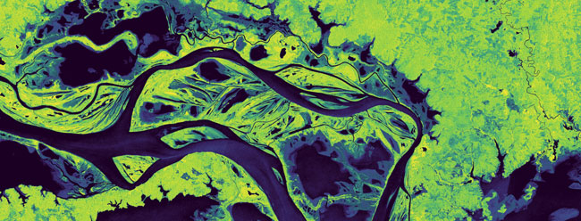
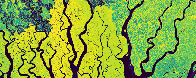
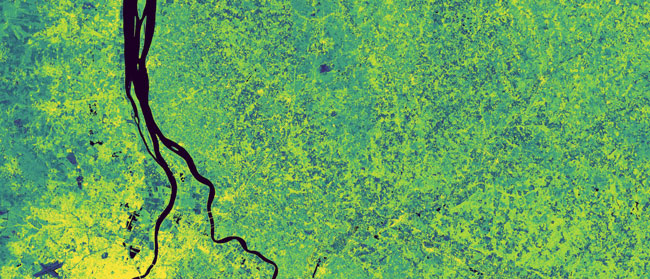
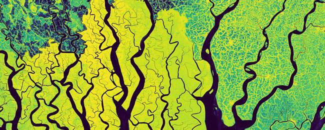
In the frame of ESA’s Sentinel-1 Project, scientists at TU Wien processed and subsequently aggregated 500,000 individual Copernicus Sentinel-1 SAR scenes to a set of global mosaics, describing our planet as perceived by a radar—as such, the obtained radar signals depict an additional source of information, measuring ground variables from another physical perspective, revealing new properties.
Earth’s land surface is covered by a rich variety of soils, vegetation, human land uses, and many more features forming our planet’s multifaceted landscape. Being an every-day business of many researchers and users in satellite remote sensing, the characterisation of land-cover and -use lays the foundation for applications, for instance in agriculture, administration, climate change, or hazard management.
In contrast to well-known optical imagery from multispectral sensors, the high-resolution C-band SAR-sensors on-board the Copernicus Sentinel-1A/B satellites operate in the microwave spectrum independent of sunlight and undisturbed by clouds, responding to different physical processes.

The Sentinel-1 Global Backscatter Model (S1GBM) describes Earth’s surface for the period 2016-17 by the mean C-band radar cross section in VV- and VH-polarisation at a 10 m pixel sampling. Copernicus Sentinel-1 ground range detected (GRD) data and intermediate products totalled a volume of 1.1 PB, and the team at TU Wien performed semi-automatic quality curation and backscatter harmonisation related to orbit geometry effects. The overall mosaic quality excels (the few) existing datasets, with minimised imprinting from orbit discontinuities and incidence angle normalisation in large parts of the world. Supporting the design and verification of upcoming radar sensors, the obtained S1GBM data potentially also serve land cover classification and determination of vegetation and soil states, as well as water body mapping.

ESA’s Sentinel-1 Project Manager, Ramón Torres, highlights, “that the Copernicus Sentinel-1 GBM composite not only serves the design of Sentinel-1C and other future radar missions, but it is in itself an impressive showcase for the capabilities of the Sentinel-1 mission”.
Bernhard Bauer-Marschallinger, from TU Wien, adds, “Every time I zoom into the mosaic, I’m astonished of the clear image, for instance, when resolving the capillary structure of the Amazon’s water bodies and its shorelines. Our planet is quite beautiful as perceived by SAR”.

About Data Access
Developers from the broader user community are invited to exploit this novel data resource and to integrate Copernicus Sentinel-1 GBM parameters in models for various variables of land cover, soil composition or vegetation structure.
Data access is provided openly via the TU Data repository, following the FAIR-principles on digital data.
For more details on generation methods and an in-depth dataset analysis please read The normalised Sentinel-1 Global Backscatter Model, mapping Earth’s land surface with C-band microwaves.
In this publication – as an example of the Copernicus Sentinel-1 GBM's potential use – the mapping of permanent water bodies is demonstrated and evaluated against the Global Surface Water (GSW) benchmark.
About the Copernicus Sentinels
The Copernicus Sentinels are a fleet of dedicated EU-owned satellites, designed to deliver the wealth of data and imagery that are central to the European Union's Copernicus environmental programme.
The European Commission leads and coordinates this programme, to improve the management of the environment, safeguarding lives every day. ESA is in charge of the space component, responsible for developing the family of Copernicus Sentinel satellites on behalf of the European Union and ensuring the flow of data for the Copernicus services, while the operations of the Copernicus Sentinels have been entrusted to ESA and EUMETSAT.
Did you know that?
Earth observation data from the Copernicus Sentinel satellites are fed into the Copernicus Services. First launched in 2012 with the Land Monitoring and Emergency Management services, these services provide free and open support, in six different thematic areas.
The Copernicus Land Monitoring Service (CLMS) provides geographical information on land cover and its changes, land use, vegetation state, water cycle and Earth's surface energy variables to a broad range of users in Europe and across the World, in the field of environmental terrestrial applications.
It supports applications in a variety of domains such as spatial and urban planning, forest management, water management, agriculture and food security, nature conservation and restoration, rural development, ecosystem accounting and mitigation/adaptation to climate change.
