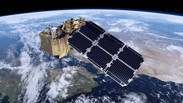
SENTINEL-2 is a wide-swath, high-resolution, multi-spectral imaging mission, supporting Copernicus Land Monitoring studies, including the monitoring of vegetation, soil and water cover, as well as observation of inland waterways and coastal areas.
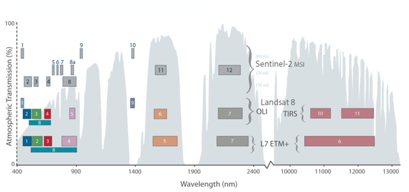
The SENTINEL-2 MultiSpectral Instrument (MSI) samples 13 spectral bands: four bands at 10 metres, six bands at 20 metres and three bands at 60 metres spatial resolution.
The acquired data, mission coverage and high revisit frequency provides for the generation of geoinformation at local, regional, national and international scales. The data is designed to be modified and adapted by Users interested in thematic areas such as:
- spatial planning
- agro-environmental monitoring
- water monitoring
- forest and vegetation monitoring
- land carbon, natural resource monitoring
- global crop monitoring

Figure 1: SENTINEL-2 and LANDSAT spectral bands - Source: USGS
Granules and Tiles
The elementary level of SENTINEL-2 MSI products are granules of a fixed size. The granule size is dependent on the product level.
- For Level-0, Level-1A and Level-1B products: These granules are a sub-image of a given number of lines along track separated by detector. They are 25 km across track and 23 km along track in size. The Level-0, Level-1A, and Level-1B products are not made available to Users.
- For orthorectified products (Level-1C and Level-2A): Earth is subdivided on a predefined set of tiles, defined in UTM/WGS84 projection. Subdivision is done using a 100 km step. However, each tile has a surface of 110x110km² in order to provide large overlap with the neighbouring. The acquired datastrip is divided into these pre-defined 110km x 110km tiles in the adequate UTM/WGS84 projection. The Level-1C and Level-2A products are made available to Users.
Datatakes and Datastrips
The maximum continuous acquisition of an image from one SENTINEL-2 satellite is 15'000 km. The continuous acquisition is called "datatake", and a datatake forms the base of the subsequent product tree. If a datatake is downlinked by two separate receiving stations, it may be sub-divided into datastrips. When the satellite is switched from one observation mode to another, a datastrip may include several distinct observation segments separated by gaps of an integer number of granules.
Figure 2 illustrates the data item classes in the SENTINEL-2 product levels and shows their relationship to associated levels of processing and generated products.
Figure 2: Product Breakdown Structure
The data items include:
- image data in granules or tiles and covering the product Area of Interest (AOI)
- preview data, that provides an overview of the product for subsequent image browsing and user selection purposes
- ancillary data from the satellite telemetry
- auxiliary data information describing the parameters used
- quality indicator data, describing the product relative to radiometric, geometric and image properties.
The metadata structure describes the content of the product.