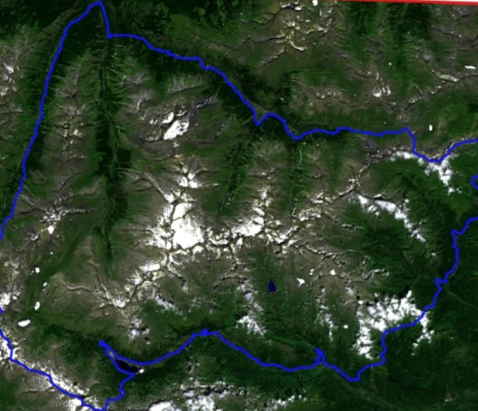
Located in the western Alps, between the Aosta Valley and Piedmont regions, the Gran Paradiso National Park is home to the original surviving Alpine ibex, chamois, mountain hares, weasels, marmots, foxes and many bird species, such as white ptarmigans and eagles—monitoring its grasslands with satellite data is helping to preserve them.
Established in 1922, the Gran Paradiso National Park (GPNP) is the oldest National Park in Italy. It borders with the Vanoise National Park in France, and together they form a huge system of high-elevation protected areas in the Alps, characterised by the presence of significant glaciers and high-altitude environments.
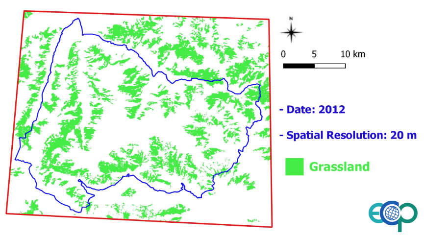
High-altitude grasslands, essential for the sustainment of mountain herbivores, are semi-natural habitats resulting from agro-pastoral activities and represent more than 30% of the surface in the park. The abandonment of traditional management practices, together with climate change, are altering their plant composition and growth, leading to tree encroachment, causing a potential biodiversity loss and possibly affecting the net ecosystem CO2 exchange.
Remote areas, covered with snow for most of the year, make the needed detailed surveys extremely difficult to carry out—but data from the Sentinel-2 satellites of the European Union's Copernicus programme are making a difference.
ECOPOTENTIAL is a project funded by the European Union's Horizon 2020 research and innovation programme, which focuses its activities on a targeted set of internationally recognised Protected Areas, blending remote sensing Earth Observations with field measurements and data analysis.
The project assessed the status of mountain grasslands in Gran Paradiso National Park, by investigating the ongoing and expected changes in rainfall, plant productivity, biodiversity and carbon cycling in meadows under different climatic, environmental and land-use regimes.
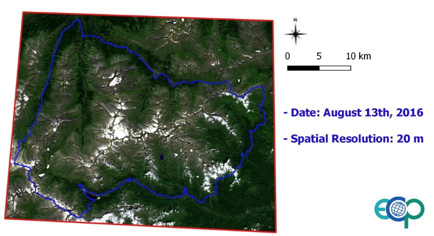
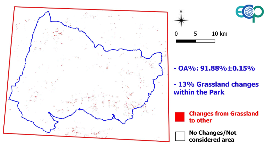
Changes in the vegetation cover of grasslands, as well as in snow cover, were analysed in a range from 1,200 to 3,200 m, using the Copernicus semi-natural grasslands service layer (2012) and August 2016 Copernicus Sentinel-2 data.
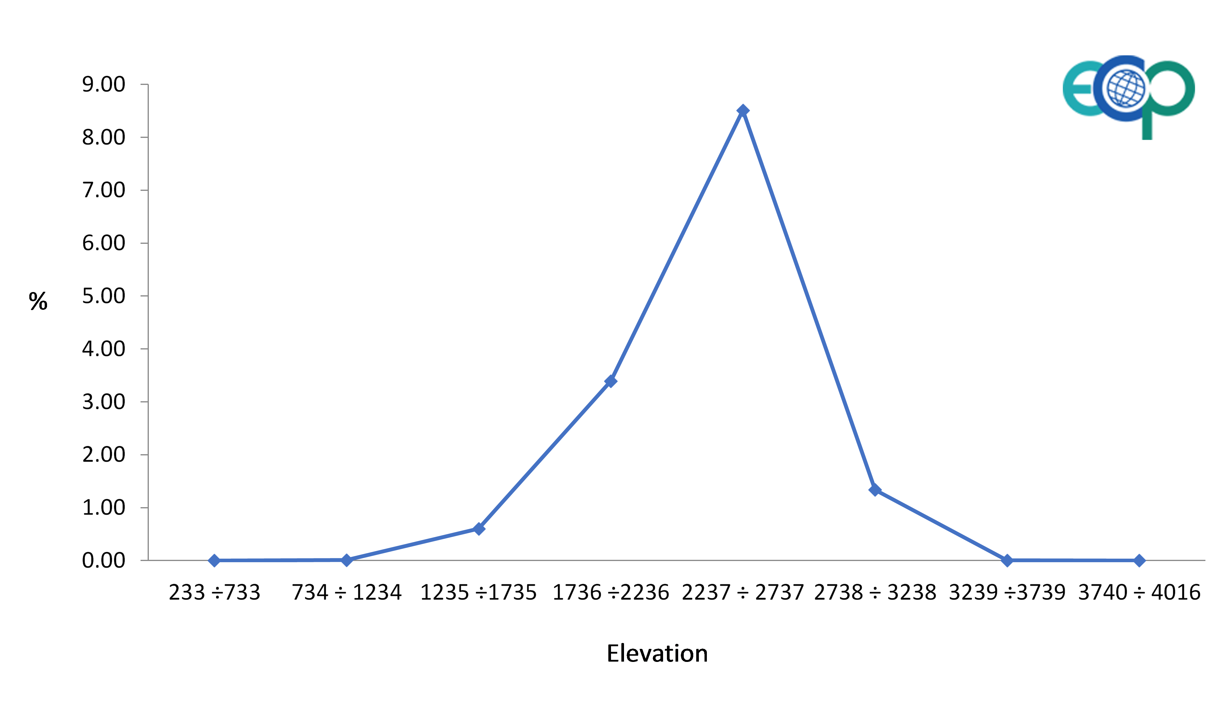
Cross Correlation Analysis (Tarantino et al. 2016; 2018) was applied to quantify changes that occurred at different quota.
The findings indicate that the area showing the highest percentage of changes is located within the 2200-2700 m range (up to 8% of changes are within this range of altitude), which corresponds to the grasslands above the treeline, an area subject to tree encroachment and to annual changes of mean snow cover.
The detected changes seem equally related to the impact of climate change (that lead to an upward shift of the treeline) and to the abandonment of agro-pastoral activities.
Field surveys and management actions are programmed and optimised by the park managers and the scientific staff, who are now relying on Earth observation derived data.
The scientists at Gran Paradiso blend information provided by field measurements of soil chemistry and hydrology, vegetation and invertebrate biodiversity, and carbon fluxes, with satellite value added products (e.g., change maps) and modelling of the soil-vegetation-atmosphere system.
These combined data enable scientists working at the park to quantify the health status and the ongoing changes of the herbivore habitat and the possible impact that such changes will have on herbivore population dynamics.
On top of the research activity, the park's technical staff has been trained to use data such as vegetation biomass growth, snow cover maps and anticipation of green-up, to identify environmental criticalities potentially affecting population trends.
Ramona Viterbi, biologist and researcher at Gran Paradiso National Park, states, "The use of Copernicus Sentinel data have improved the control and management of high altitude grasslands, providing plenty of information for remote areas".
About the Copernicus Sentinels
The Copernicus Sentinels are a fleet of dedicated EU-owned satellites, designed to deliver the wealth of data and imagery that are central to the European Union's Copernicus environmental programme.
The European Commission leads and coordinates this programme, to improve the management of the environment, safeguarding lives every day. ESA is in charge of the space component, responsible for developing the family of Copernicus Sentinel satellites on behalf of the European Union and ensuring the flow of data for the Copernicus services, while the operations of the Copernicus Sentinels have been entrusted to ESA and EUMETSAT.
Acknowledgments:
This article refers to the work conducted within the framework of the H2020 project ECOPOTENTIAL (Grant Agreement n. 641762) by researchers from the National Research Council of Italy (CNR) and the Gran Paradiso National Park. Mariasilvia Giamberini, Antonello Provenzale, Maria Patrizia Adamo, Ilaria Baneschi, Palma Blonda, and Cristina Tarantino contributed to this article.
Scientific references:
- C. Tarantino, M. Adamo, R. Lucas, P. Blonda. (2016). "Detection of changes in semi-natural grasslands by cross correlation analysis with Worldview-2 images and new Landsat 8 data", Remote Sensing of Environment, Vol. 175C, pp. 65-72, doi: 10.1016/j.rse.2015.12.031
- C. Tarantino, M. Adamo, R. Lucas, P. Blonda. "Change detection in (semi-) natural grassland ecosystems for biodiversity monitoring using open data", in Proc. of the IEEE International Geoscience and Remote Sensing Symposium IGARSS 2018, Valencia, Spain, 23-27 July 2018, pp.8981-8984, https://ieeexplore.ieee.org/document/8519148