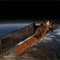
Those who need satellite data for a wide range of applications, from mapping sea ice and tracking maritime traffic to monitoring geohazards over land, are eagerly awaiting the launch of Sentinel-1. ESA is helping users get ahead of the game by offering test data and simulated images.
Those who need satellite data for a wide range of applications, from mapping sea ice and tracking maritime traffic to monitoring geohazards over land, are eagerly awaiting the launch of Sentinel-1. ESA is helping users get ahead of the game by offering test data and simulated images.
With the launch of the first satellite planned for April 2014, Sentinel-1 is the first of five satellite missions dedicated to supplying a stream of data for Europe's Global Monitoring for Environment and Security ‘Copernicus' programme.
This particular satellite will provide timely high-quality radar images of our planet's surface to support European operational services that use Earth observation data in areas such as emergency response, marine and land monitoring, civil security and climate studies.
