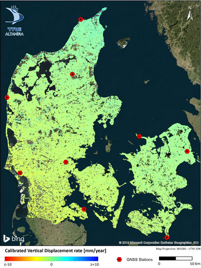
Title: InSAR map of Denmark
Description: This Copernicus Sentinel-1 InSAR dataset, acquired during 2014-2020 shows ground motion and movements in infrastructure throughout Denmark. Red dots are reference points. The dataset contain several million measurement points and are displayed in an online web interface with tools for data analysis and download.
Copyright: Contains modified Copernicus Sentinel data (2014-2020)/ processed by TRE Altamira and provided by SDFE
