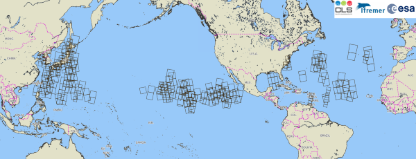
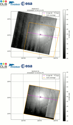
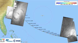
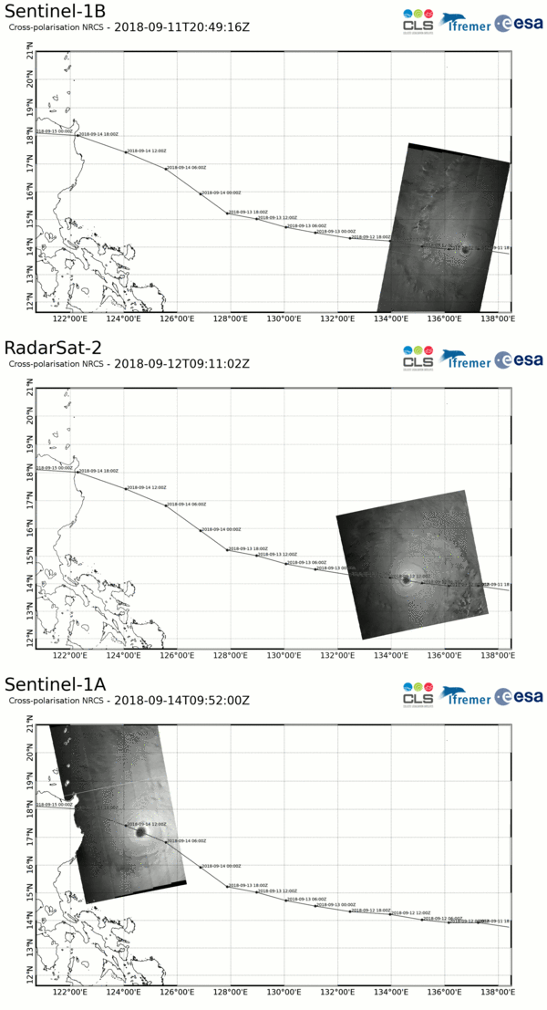
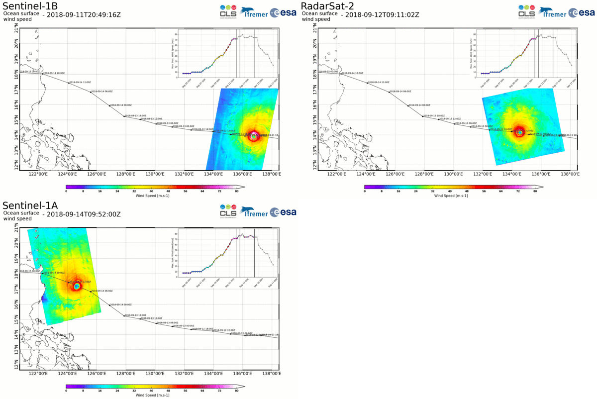
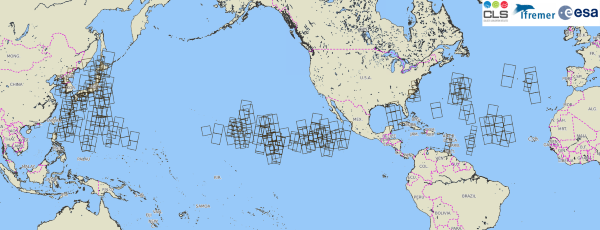
A team of experts from the French institutes IFREMER and CLS recently implemented a strategy with ESA, in order to acquire Sentinel-1 images over tropical cyclones, while developing an algorithm that enables the extraction of hurricane characteristics at a very high resolution from space. Information such as the ocean surface wind field provided at 1 km resolution could trigger perspectives for improving hurricane forecast information.
A tropical cyclone (TC) is a rotating low-pressure weather system that develops over tropical or sub-tropical waters and has organised convection (i.e. thunderstorm activity) but no fronts (a boundary separating two air masses of different temperatures and densities).
Tropical cyclones with maximum sustained surface winds of less than 17 m/s (34 knots) are called tropical depressions. Once their maximum sustained winds reach at least 17 m/s they become tropical storms. Mature tropical cyclones with maximum winds of at least 33 m/s (64 knots) are called hurricanes in the US and typhoons in Asia.
In some regions, tropical cyclones are also ranked using a classification with category system, rating the storms from Category 1 to 5 depending on the maximum winds reached. This is the case in Australia and in the US with the Saffir-Simpson Hurricane Wind Scale. The higher the category, the greater the strength of the hurricane and of the potential damage.
Philippe Caroff, Head of the Cyclonic Forecast Centre at Météo-France/La Réunion (South-West Indian Ocean), indicates that, "Tropical cyclones are major hazards representing 20% of the damage and casualties caused by natural hazards, all phenomena included. Hence, it is crucial to closely inspect them in order to monitor and predict them as accurately as possible.
"The first step is to detect and observe them, but as tropical cyclones develop over the oceans, observing tools are limited. Unless aircraft reconnaissance is available, surveillance relies almost exclusively on spaceborne observations. But most satellite tools—like satellite imagery—are unable to observe what happens near the inner core of the storms adequately or at sufficiently high resolution (in particular the critical eyewall region surrounding the storm's centre), adds Caroff.
"Getting access to high resolution surface observations within tropical storms and cyclones in all basins would certainly most valuably complement existing data and help to issue more accurate analyses and forecasts on tropical cyclones, in particular their direction and intensity".
In 2016, experts from IFREMER and CLS proposed organising, in collaboration with ESA, a campaign called SHOC (Satellite Hurricane Observation Campaign), in order to gather extreme wind observations from European spaceborne sensors. The primary objective was to provide Copernicus Sentinel-1 acquisitions over hurricanes, to feed research and development activities in the framework of SEOM (Scientific Exploitation of Operational Missions), an element of the Earth Observation Envelope Program 4.
One objective of this SEOM R&D project called "Sentinel-1 for Science Ocean" was to develop and validate the algorithms deriving extreme wind direction and intensity from SAR (Synthetic Aperture Radar) observations of the sea / ocean.
Initially intended to last two months during cyclone season, SHOC activities are still on-going. Two years down the line, their efforts have proven to be extremely decisive, enabling acquisitions over some of the strongest tropical cyclones such as Irma, Maria or José in the Atlantic Ocean for the 2017 season, Michael for the 2018 season, but also of Typhoons such as Jebi or Mangkhut in 2018.
To do this, the team's experts are following hurricanes throughout their entire lifespan (from Category 1 and above), thanks to dedicated "late-programmed" Sentinel-1 acquisitions by ESA's Mission Planning team.
When a cyclone starts to materialise, precise track forecasts available from WMO (World Meteorological Organisation) Regional Specialised Meteorological Centre are provided by IFREMER/CLS to ESA's mission planning team which, in return, identifies and plans the most suitable Sentinel-1 observations intersecting the expected location of the hurricane's eye over the next 5 days.
However, depending on both the evolution and duration of the phenomenon, updates on track forecasts are expected every 3 days and, consequently, the planning loop needs to be repeated to capture the new trajectory.
The recent hurricane season allowed the consolidation and improvement of the SHOC mechanisms and interfaces between IFREMER, CLS and ESA's mission planning team, leading to more than 100 hurricane hits (i.e. capturing the eye of hurricanes) by the Copernicus Sentinel-1 constellation, since 2016.
The corresponding SAR observations (L1+L2) are intended for use by a broad community, from science to operational applications, such as tropical cyclone forecasters. The SHOC approach has been crucial to support this new application.
Alexis Mouche, scientist at IFREMER, underlines that, "More than 99% of the hurricane eyes captured by Copernicus Sentinel-1 have been obtained via SHOC. This validates the need for a dedicated acquisition strategy with Sentinel-1, in order to observe tropical cyclones."
During their research and development activities, the team realised that the Sentinel-1 satellites of the European Union's Copernicus program carry the only sensors capable of observing the ocean surface night and day or through clouds and measuring ocean surface wind fields with such high resolution over extremes.
Mouche further indicated that, "The Copernicus Sentinel-1 mission provides the unique capability of simultaneous acquisitions in co- and cross- polarisations with an accurate calibration that enables a combined use of the two channels.
"In addition, because of its high resolution, the on-board SAR instrument is able to provide information regarding the hurricane eye properties, such as the radius of maximum wind speed, the eye diameter and the 2D wind field structure at 1 km resolution over all oceanic basins".
The combined use of the two Sentinel-1 satellites have also proven to be mandatory to maximise the tropical cyclone description during its full lifetime. In addition, the strong consistency observed with other high resolution SAR missions, such as RADARSAT-2, provides additional opportunities for synergy and complementarity for TC monitoring at global scale.
Results obtained with SHOC data, during the particularly intense 2017 season in the North Atlantic were presented at the 40th WMO Hurricane Committee for USA/Caribbean regions in April 2018. Among hurricane experts' recommendations and conclusions, "Special acquisition plans during Irma, José and Maria demonstrated the high value of kilometric-scale information derived from Sentinel-1 SAR data, hence HC40 recommends that these data are made available to help monitor critical aspects of the TC structure (wind radii, maximum wind, eye diameter, etc...)".
The team is now working to provide Copernicus Sentinel-1A and -1B acquisitions acquired during the past 2018 southern hemisphere hurricane season (January/March) over the Indian Ocean, to operational forecasters from WMO Regional Specialised Meteorological Centre/Météo-France at La Réunion, to assess the potential of the measurements by TC experts.
The northern hemisphere summer 2018 season (July/October) is now almost over and the team has gathered more data, and on a worldwide basis, than during all the previous SHOC campaigns. These data will be very useful to the team.
"There are still many open questions regarding the impact of the rain near the eye's wall, the possible use of the Doppler information in both co- and cross- polarisations and the measurements of hurricanes' wind-generated waves than can be addressed with Copernicus Sentinel-1 data. Synergy with other ESA missions, such as SMOS, featuring higher observation frequency but lower spatial resolution, as well as altimeter missions, is also a way forward", concludes Alexis Mouche.
About the Copernicus Sentinels
The Copernicus Sentinels are a fleet of dedicated EU-owned satellites, designed to deliver the wealth of data and imagery that are central to the European Union's Copernicus environmental programme.
The European Commission leads and coordinates this programme, to improve the management of the environment, safeguarding lives every day. ESA is in charge of the space component, responsible for developing the family of Copernicus Sentinel satellites on behalf of the European Union and ensuring the flow of data for the Copernicus services, while the operations of the Copernicus Sentinels have been entrusted to ESA and EUMETSAT.
Acknowledgments:
The SHOC initiative has been possible thanks to SAR data access supported by the Sentinel-1 ground segment. In particular, the implication of ESA's Mission Planning team has been decisive. Access to RADARSAT-2 data was supported by public funds (Ministère de l'Education Nationale, de l'Enseignement Supérieur et de la Recherche, FEDER, Région Bretagne, Conseil Général du Finistère, Brest Métropole) and by Institut Mines Télécom, received in the framework of the VIGISAT project managed by "Groupement Bretagne Télédétection" (GIS BreTel – Brittany Remote Sensing).
Contains modified Copernicus Sentinel data (2016-2018) and RADARSAT-2 data from Maxar, routinely used by the SHOC team.
