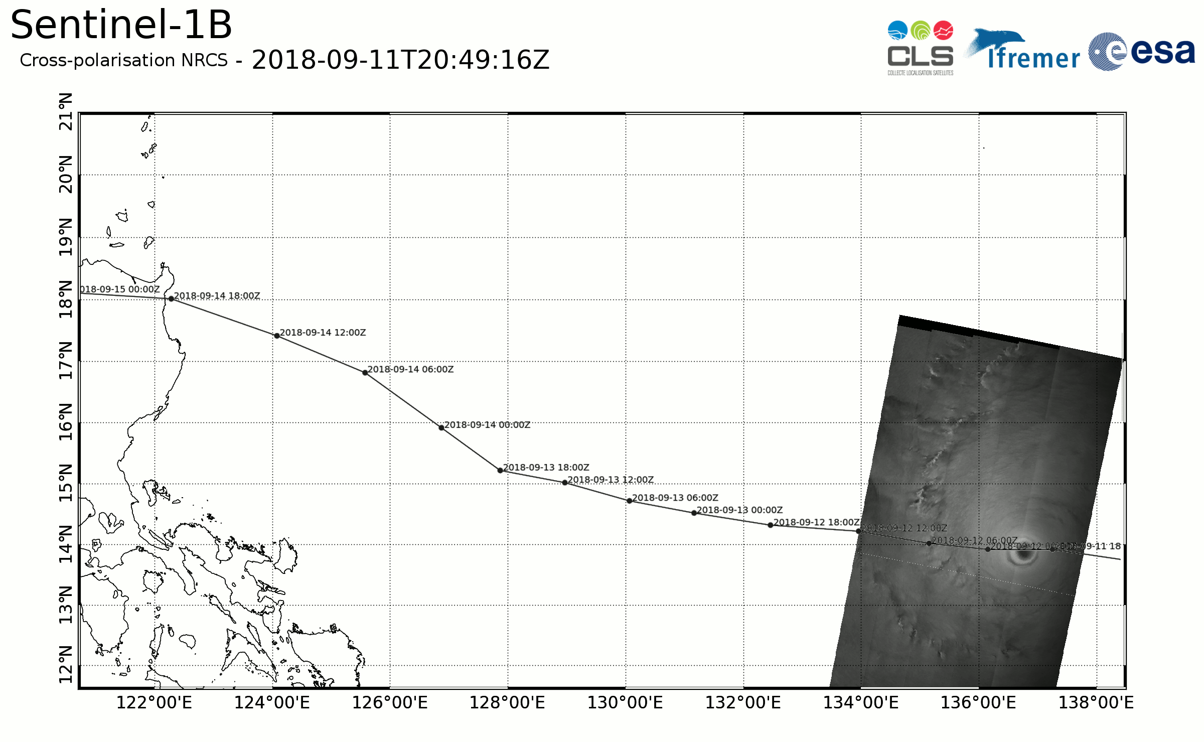
Title: Copernicus Sentinel-1 and RADARSAT-2 over Tropical Cyclone Mangkhut
Description: Top image - Animation displaying the SAR images in cross-polarisation acquired over Tropical Cyclone Mangkhut while approaching Luzon, the main island of the Philippines, at Category 5 strength. Copernicus Sentinel-1B, RADARSAT-2 and Copernicus Sentinel-1A data were used to produce the animation.
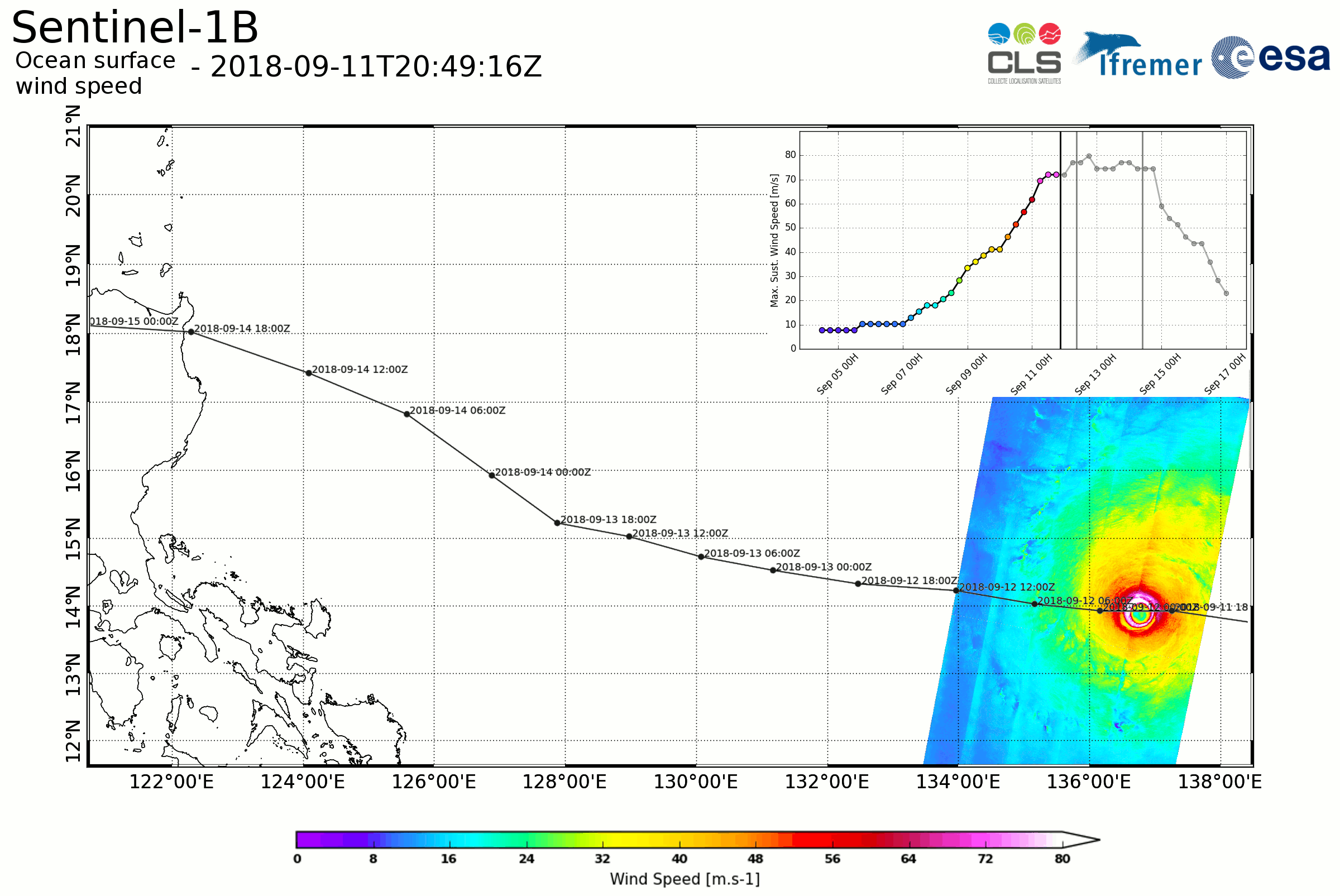
Bottom image - The associated wind speed derived from SAR dual-polarisation images. Maximum measured wind speeds reach 80m/s. Operational best-track analysis performed by NOAA are shown for comparison, indicating the maximum sustained wind speed evolution. SAR images acquisition times are indicated by vertical black bars on the graph in the top right corner.
Copyright: Contains modified Copernicus Sentinel data (2018)/Contains RADARSAT-2 data from Maxar whose access was granted by GIS BreTel/Contains NOAA operational best-track analysis