Title: Seasonal changes in Biebrza's wetland inundation regimes
Description:
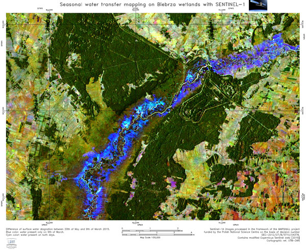
This image shows the difference in surface water stagnation between 9 March and 20 May 2016, in Poland's Biebrza National Park. The shades of blue show areas where water was present only on 9 March, whereas areas where water was present on both dates are represented in cyan.
Radar images from the Copernicus Sentinel-1 satellite give us new insight into the water regime on wetlands, allowing to observe not only the extent of flooding, but also the transfer of surface waters; this information helps experts to evaluate habitat conditions for various valuable fauna and flora species.
Copyright: Contains modified Copernicus Sentinel data [2016], UWM
