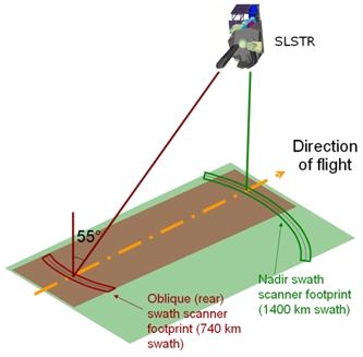
The SLSTR uses two independent scan chains each including a separate scan mirror. While more complex than the single scan system employed by the ATSR instrument, this configuration especially increases instrument swath coverage.
- Oblique view swath: ~ 740 km
- Nadir view swath: ~ 1 400 km.
The nadir swath is asymmetrical with respect to the nadir point to provide identical and contemporaneous coverage with OLCI ocean/land colour measurements.

Figure 1: Outline sketch of the SENTINEL-3 SLSTR instrument viewing geometry highlighting the asymmetric nadir swath with respect to the nadir point
Following a trade-off analysis between topography and optical mission requirements, the choice of orbit for SENTINEL-3 is a sun-synchronous orbit at 814.5 km altitude (14 + 7/27 revolutions per day) with a local equatorial crossing time of 10:00 am. This satellite orbit provides a 27-day repeat.
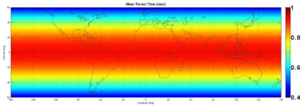
The mean global coverage revisit time for dual view SLSTR observations is 1.9 days at the equator (one operational spacecraft) or 0.9 days (in constellation with a 180° in-plane separation between the two spacecraft) with these values increasing at higher latitudes due to orbital convergence.
| Constellation configuration | Revisit at equator | Revisit for latitude > 30° | Specification | ||
| SLSTR dual view (day and night) | One satellite | < 1.8 days | < 1.5 days | < 4 days | |
| Two satellites | < 0.9 days | < 0.8 days | |||

Figure 2: SLSTR Mean Revisit Time with Two-Satellite Configuration