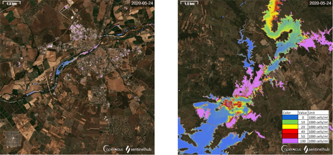
Title: Time lapses of cyanobacteria distribution maps
Description: These images feature screenshots of two time lapses of the distribution of cyanobacteria in two regions of the Guadiana River with particular characteristics: intense urban land use (Badajoz, left panel), and low-density urban use (Alqueva dam, right panel). Both images were generated in the EO-Browser web-platform for cloud-computing, using L2A Copernicus Sentinel-2 products.
Both maps were generated with a custom script to map the cyanobacteria distribution (colour scale) and a true colour background, which highlights the clusters of urban land use. Human activities along the river, associated to agriculture and urban centres, have an impact on the regions downstream. Satellite imagery provide an important tool to study these correlations.
Copyright: Contains modified Copernicus Sentinel data (2020)/processed by A. Escoto, F. Dullemond, T. Jongmans, M. Backer
