Spring floods occur when snow melts over large areas in short time periods, often combined with rain—so-called rain-on-snow events that add water, further intensifying snow melt. As their name suggests, such floods typically occur in spring – except for a few weeks ago, when Southern Norway was struck with this phenomenon.
During the weekend of 13 October 2018, snow had already fallen over large mountain areas in Southern Norway. An exceptional warm spell from the south hit Norway and melted away most of the mountain snow within a few days. In the village of Tafjord, for instance, the temperatures rose from 11 °C to over 25 °C within one hour. The runoff from this sudden and massive snow melt caused strong floods and associated severe damage in the surrounding valleys.
Optical satellite instruments such as those on the Copernicus Sentinel-2 satellites could not see through the clouds that covered Norway during these events, and the low sun angle would have complicated data interpretation.
However, the radiation from the two advanced radar satellites Sentinel-1A and Sentinel-1B of the European Union's Copernicus programme penetrated through the clouds and was able to provide data regardless of cloud cover and sun illumination. The reflection of radar waves on the ground (called backscatter) is particularly sensitive to humidity and water on the ground.
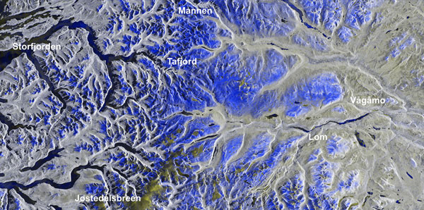
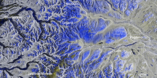
Researchers of the Department of Geosciences at the University of Oslo have compared Copernicus Sentinel-1 data from before (Sentinel-1B of 10 October 2018) with those after the snow melt and during the floods (Sentinel-1A of 16 October). They were able to map the areas where the snow had melted away, and areas that were under water due to flooding. The Copernicus Sentinel-1 data were thus able to both show the reason and effects of the floods in one set.
"The combined images show that large areas in Southern Norway were covered by snow on 10 October, which melted away within a few days due to an exceptionally warm spell from the south. Areas where the snow had disappeared appear in blue on the combined radar images", explains Andreas Kääb, from the University of Oslo.
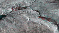
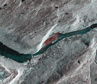
"Further down in the valley we can see the result of this massive snow melt, with flooded areas appearing in red. We obtained the Copernicus Sentinel-1 radar images within a few hours after their acquisition, and were thus able to analyse them almost in real-time."
About the Copernicus Sentinels
The Copernicus Sentinels are a fleet of dedicated EU-owned satellites, designed to deliver the wealth of data and imagery that are central to the European Union's Copernicus environmental programme.
The European Commission leads and coordinates this programme, to improve the management of the environment, safeguarding lives every day. ESA is in charge of the space component, responsible for developing the family of Copernicus Sentinel satellites on behalf of the European Union and ensuring the flow of data for the Copernicus services, while the operations of the Copernicus Sentinels have been entrusted to ESA and EUMETSAT.


