Researcher, Sai Kiran Kuntla, recently authored a review article that emphasises the potential of three of the Earth observation satellites of the European Union’s Copernicus programme - Sentinel-1, Sentinel-2, and Sentinel-3 - at various phases of flood management and the overall transformation this fleet of satellites has brought to the field of flood research and applications.
Sai states that floods are uncertain, powerful, and a phenomenon of multidimensional interrelated factors, due to which although not always avoidable, appropriate flood management measures can minimise their adverse impacts. Sai Kiran adds that the Riverine floods are overall the most frequent and destructive compared to other flood types, as presented in the same review article. Efficacious flood management at all three phases – mitigation and preparedness (before the flood), rescue and relief (during the flood), and recovery (after the flood) – demands reliable and timely information. Most primary informational requirements are complex and sometimes impossible to procure in conventional ways. Moreover, it is an expensive and tedious task even for limited spatial coverage, making it unreliable for flood management and hindering research and applications in this field. However, with its near-real-time (NRT) monitoring, coverage of transboundary and otherwise inaccessible areas, high spatial resolution, ability to capture in different spectral radiances, high accuracy, and other such characteristics, the satellite remote sensing technology has paved an excellent scope for flood-related research and efficient management.

Sai Kiran Kuntla
Born in 1996 in India, Sai Kiran Kuntla holds a Bachelor's degree in Civil Engineering and a Master's degree in GeoInformatics, from the Jawaharlal Nehru Technological University Hyderabad (JNTUH), India. Currently, he is a Ph.D. Candidate at the Indian Institute of Technological Delhi (IIT Delhi), India, where he works with the HydroSense Lab, headed by Prof. Manabendra Saharia, to characterise and map flooding over India, utilising large-sample hydrology. He primarily uses Geospatial technology, Data Science and Machine Learning, to embark on his research interests. These include analysing the physical processes of floods, real-time flood monitoring, and interactions between floods and society. Sai Kiran mentions his parents, Venkatesham Kuntla and Suvarna Kuntla, as his biggest motivation and strongest supporters throughout his career.
ESA: How and when did you decide you wanted to focus on Earth observation and choose research as a career?
Sai Kiran: Natural Science has always amazed me since childhood. Believe it or not, to date, I will have the same excitement and curiosity to witness the live aerial view of Earth and observe its happenings every time I fly. However, the triggering event towards the research field and Earth observation occurred when I did an internship in my undergraduate at IIT Guwahati, India, with Prof. Archana M Nair. There, I was introduced to satellite imagery for the first time, and I had to find the efficacy of different classification algorithms for Land Use Land Cover (LULC) classification, over a highly urbanised Indian city - Mumbai. I followed it up with another project with the same Professor, where I worked with high-resolution satellite images to analyse how a change in LULC over a well-planned micro watershed would impact its runoff. Some of these works at that time got accepted into international conferences. Consequently, I discovered that I enjoy learning and solving real-world natural science problems with Earth observation data, which made me focus and continue my career in the same line.
ESA: How did you approach the field of flood management?
Sai Kiran: Although a few of my earlier projects in undergrad, and work I did out of my interest in collaboration with my friends during the first year of my Master's degree, are directly linked to satellite remote sensing, watersheds and their hydrology, the actual full-fledged work on floods started during my Master's second year. When I had an opportunity to work at the Indian Space Research Organisation (ISRO) with a senior scientist, Dr Panchagnula Manjusree, to develop a highly efficient stand-alone tool/algorithm known as "Multi-Mission Flood Mapper (MMFM)" to delineate flood extent from Synthetic Aperture Radar (SAR) images without any human intervention. This developed tool’s - MMFM - novelty lies in its capability of delineating floods from SAR images captured by multiple microwave SAR satellite missions. Also, the user-friendly Graphical User-Interface (GUI) of MMFM helps do its job effortlessly and rapidly on a timely basis, whenever required. MMFM deploys ESA’s Sentinel Application Platform (SNAP) operators to pre-process the data. More details on this project are available as a journal article and recently presented in the AGU Fall Meeting 2021 (Conference) (https://doi.org/10.1002/essoar.10509405.2), where step-by-step processing at the backend of the tool was discussed in detail, to manifest its performance by taking a flood event captured by Copernicus Sentinel-1 SAR along the Ganga River in India, as a case study. MMFM would benefit flood monitoring, and rescue and relief operations during a disaster. In addition, the flood inundation layers generated will help calibrate and validate hydrological/hydraulic models, geospatial planning and generating flood hazard maps.
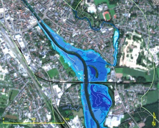
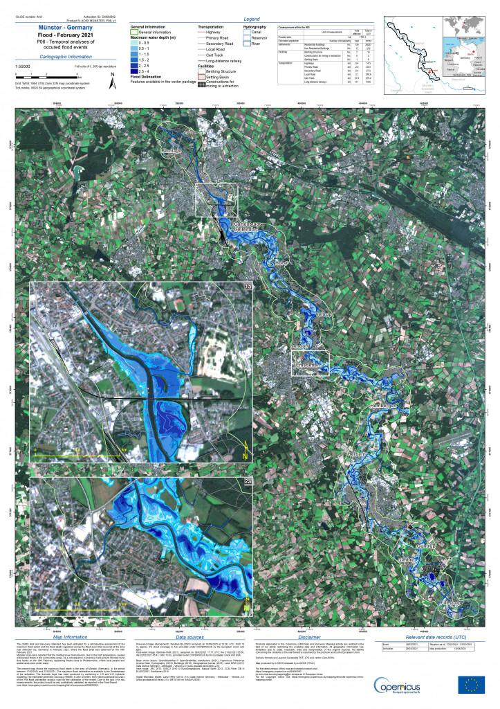
Temporal analysis of flood event at Münster, Germany
ESA: How did your studies help you to approach this research?
Sai Kiran: My courses during my Master’s degree at JNTUH, India, nourished me with a lot of knowledge in the geoinformatics field with subjects like Advanced Remote Sensing, Global Navigation Satellite System, Photogrammetry, Geographic Information Systems, and Digital Image Processing. While the course work at IIT Delhi, India, brushed up my knowledge in Hydrology and Machine Learning. I believe familiarity with this wide range of courses allowed me to understand the research papers well from roots, and ignited ideas for their application. My experience in broad applications of flood management utilising multiple geospatial technologies - Optical Remote Sensing, SAR, GNSS, and Radar Altimetry - in my earlier projects and extensive literature reviews carried out throughout all those projects, have further advanced my knowledge in this field. Notably, the literature survey carried out in preparing my Ph.D. research proposal also has a considerable role in accumulating the insights presented in this review article. Apart from the learnings and experience, my interest in acknowledging its capabilities and expressing gratitude for the new opportunities the wealth of Copernicus Sentinel-1, -2 and -3 satellites data have provided to flood researchers and managers worldwide, made me embark on this project/paper.
ESA: How have Sentinel data made a difference in your research and flood management in general?
Sai Kiran: Sentinel data have always been the first option, sometimes the only option, to look for throughout my research projects where I needed a SAR, high-resolution optical or radar altimetry data. With many distinctive features compared to their predecessors and other active missions, as highlighted in the paper, Copernicus Sentinel-1, -2 and -3 satellites are top-notch in their respective categories. The three satellites, which carry different state-of-the-art technologies, are equally important for successful all-around reliable flood management, contributing in their ways and complementing each other at various phases of flood management. Besides, the rapid dissemination ability of these satellites to provide data within hours of acquisition is another added advantage to aid emergency response, during and immediately after a disaster. In addition, the open and free access of Copernicus Sentinel-1, -2, and -3 data products to all its users (general public, scientific and commercial), irrespective of their country, has paved the way for researchers and flood managers, especially in lower-middle-income countries, and other places where acquiring HR data would have become an expensive affair and consequently hindered research and applications within disaster management. Furthermore, open and free access to the complete long archives of this wealth of data has made machine learning and deep learning techniques popular and resulted in an escalation of big-data inclusion in multiple aspects of disaster management studies and applications. It provides an excellent opportunity for research and applications at a higher resolution on a continental and global scale. Overall, it built an immense scope for broad application and transferability, developing new techniques and methodologies, thereby supporting effective policymaking and management of the environment, including floods, to mitigate its adverse effects. Apart from this, some future Sentinel missions under the Copernicus Programme, LSTM and ROSE-L - could contribute to flood-related research and management with their unique contributions and complement the existing one. For instance, ROSE-L, an L-band SAR, inherently would have the additional capability to penetrate through vegetation that helps in accurate mapping of inundation underneath the foliage. Hence, it becomes advantageous in vegetation-dominated areas. Last but not least, I would like to thank the European Commission and ESA for initiating the ambitious Earth observation programme - Copernicus. I firmly believe that the wealth of Sentinels data covering a broad spectrum of Earth observations globally will play a significant role in the various research fields and applications for a sustainable future.
About the Copernicus Sentinels
The Copernicus Sentinels are a fleet of dedicated EU-owned satellites, designed to deliver the wealth of data and imagery that are central to the European Union's Copernicus environmental programme.
The European Commission leads and coordinates this programme, to improve the management of the environment, safeguarding lives every day. ESA is in charge of the space component, responsible for developing the family of Copernicus Sentinel satellites on behalf of the European Union and ensuring the flow of data for the Copernicus services, while the operations of the Copernicus Sentinels have been entrusted to ESA and EUMETSAT.
Did you know that?
Earth observation data from the Copernicus Sentinel satellites are fed into the Copernicus Services. First launched in 2012 with the Land Monitoring and Emergency Management services, these services provide free and open support, in six different thematic areas.
The Copernicus Land Monitoring Service (CLMS) provides geographical information on land cover and its changes, land use, vegetation state, water cycle and Earth's surface energy variables to a broad range of users in Europe and across the World, in the field of environmental terrestrial applications. It supports applications in a variety of domains such as spatial and urban planning, forest management, water management, agriculture and food security, nature conservation and restoration, rural development, ecosystem accounting and mitigation/adaptation to climate change.

