Title: Surface Water Extent comparison
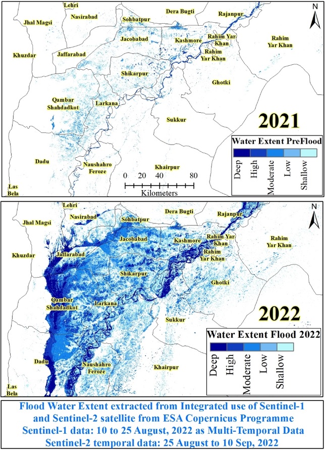
Description: Satellite extracted surface water extent of 2021, represent either flood irrigated rice crop fields or water bodies like lakes, river, streams, irrigation channels and storage dams, under normal condition. While, surface water extent of 2022 demarcates the flood impact in upper Sindh as torrential run off, water ponding in depressions and High River flows.
Copyright: Contains modified Copernicus Sentinel data (2022)/Spatial Information extracted by I. H. Akhtar