Title: Ice jam in Fort McMurray - before and after
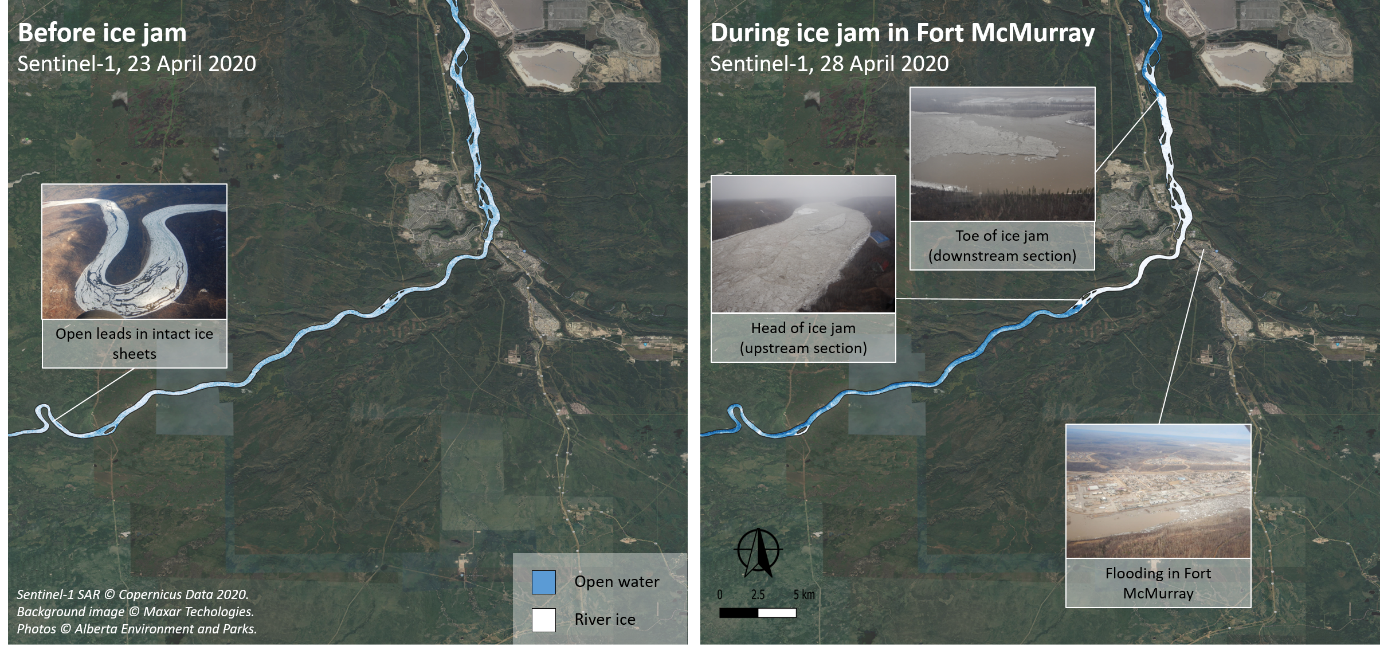
Description: These two images acquired on 23 and 28 April 2020, by the Copernicus Sentinel-1 satellites, feature the progression of river ice accumulation and jamming using Synthetic Aperture Radar for detection.
On the left hand side, a stretch of the Athabasca River before the ice jam is shown. The light-blue colour indicates open leads in intact ice sheets. On the right image, the ice sheets are wedged together at Fort McMurray, forming the ice jam that caused the flooding at the end of April. The open water and river ice stages were derived from the backscatter in VV-polarization of the Copernicus Sentinel-1 images.
Copyright: Contains modified Copernicus Sentinel data (2020)/processed by Deltares