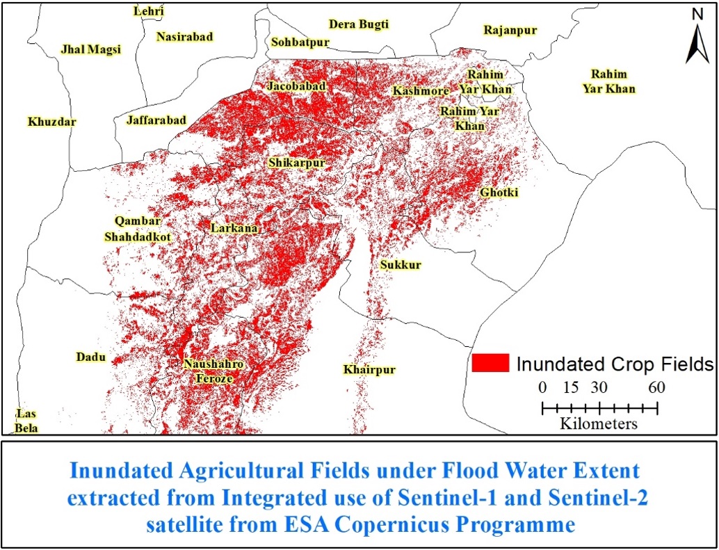
Title: Flood inundated agriculture fields in Upper Sindh
Description: Copernicus Sentinel-2 cloud free temporal data of 2021 and pre-flood 2022 were classified to extract the agricultural fields that are submerged under the flood. This map helped to identify the spatial spread of inundated crop fields, which are not visible on satellite images and inaccessible on ground.
Copyright: Copernicus Sentinel data (July to September, 2021 and 2022) processed by I. H. Akhtar