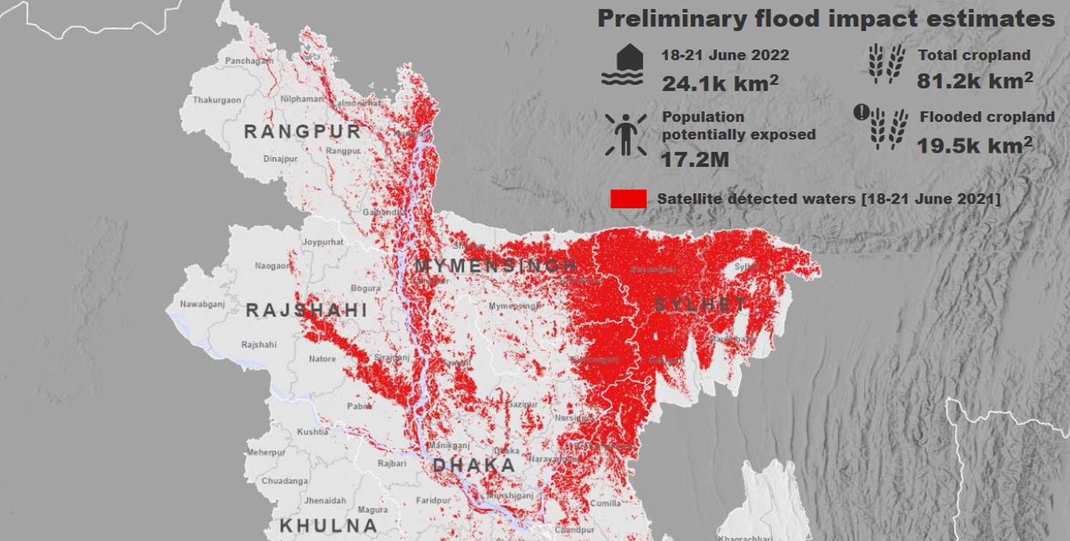
Title: Copernicus Sentinel-1 reveals impact of Bangladesh floods
Description: Copernicus Sentinel-1 captured images over northeast Bangladesh to reveal the extent of the floods. The presence of surface water was determined using an automated machine learning method. By 18 to 21 June, a total of 25 000 square kilometres of land was submerged, with the Sylhet, Mymensingh, Rajshahi and Rangpur divisions of the country being particularly impacted. The region over which imagery was acquired contains around 81 000 square kilometres of cropland, with about 20 000 square kilometres of this area being flooded. In addition, analysis that combined information on population distributions with the estimated surface water data suggested that more than 17 million people have been impacted by the floods.
Copyright: Contains modified Copernicus Sentinel data (2022), processed by UNITAR/UNOSAT