Rheticus® Wildfires User Interface for Alta Murgia National Park - Rheticus® Wildfires User Interface for Alta Murgia National Park
Title: Rheticus® Wildfires User Interface for Alta Murgia National Park
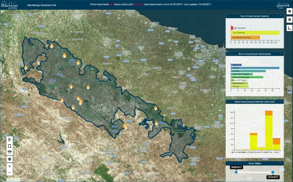
Description: With this July 2017 image, using Copernicus Sentinel-2 data processed by the Rheticus® service, the numbers and hectares of burnt areas of the park are clearly visible –the latter downloaded image was processed together with the former one, to detect new burn scars that occurred over the area of interest.
Copyright: Contains modified Copernicus Sentinel data (2017)/processed by Planetek Italia
- Copernicus Sentinel-1A unavailability
- Copernicus Sentinel-5P Chemistry Transport Model TM5 auxiliary files release
- Copernicus Sentinel-3 unavailability due to an on-going issue at PDGS level
- Copernicus Sentinel-2 production issue - 23rd February
- Temporary unavailability of Copernicus Sentinel-2 production - 22nd February
Calling on all interested users of Sentinel data, who would like to submit their results, turning their experiences into 'success stories'.
If you have a good story to tell, of how any of the Sentinel satellites are producing data that bring benefit to your work and/or to society, please contact the Sentinel Online Editor Malì Cecere at: mali.cecere@ejr-quartz.com with your proposals.