Copernicus Sentinel data help strengthen policy decisions on European peatland restoration – possibly reducing greenhouse gas emissions.
Peatlands – moors, bogs, marshes and swamps - are a dominant type of wetland, made up of thick water-logged layers of decaying plant material.
Together with organic soils, they cover over three percent of all land area and contain 30% of its soil carbon. Degradation of peatlands causes an increase of greenhouse gas emissions.
As impacts of the climate crisis continue, tracking the carbon uptake and anthropogenic gas emissions of peatlands is essential.
A recent study over a vast area of Polish peatlands drew on Copernicus Sentinel-2 and -3 data to rapidly monitor the absorption of carbon dioxide by vegetation through photosynthesis.
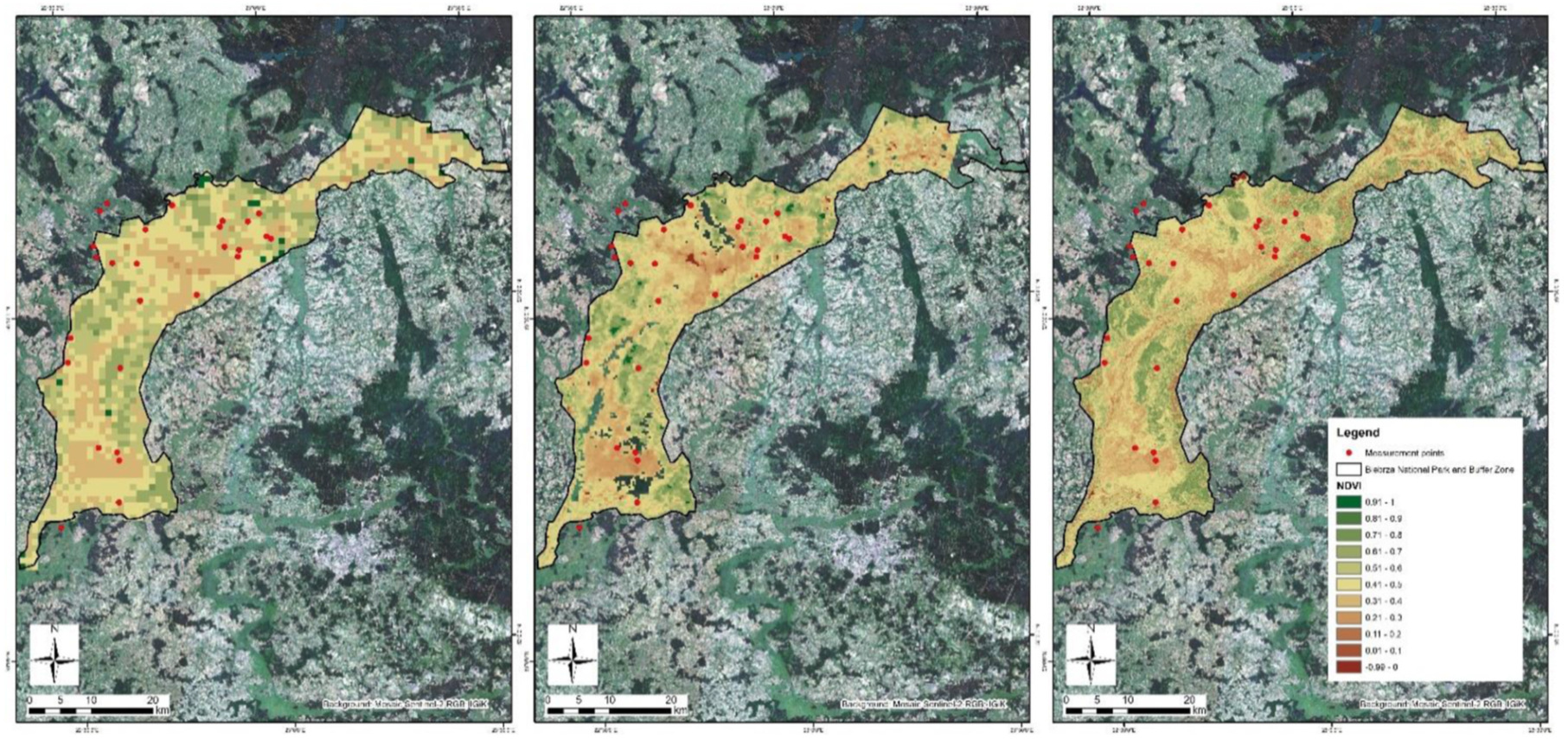
Photosynthetic carbon uptake - described by vegetation indices
The research, led by the Remote Sensing Centre at the Institute of Geodesy and Cartography, Poland, aims to support peatland restoration policy with key information on carbon flux.
The study drew on data delivered by Sentinel-2 and Sentinel-3 of the European Union’s Copernicus Programme and targeted a large study area of 26 peatland sites in the Biebrza National Park, in north-eastern Poland – host to a unique European wetland, rich in biodiversity [1].
The chosen study sites are covered by vegetation - grass, sedges and reeds - during the time of the vegetation growth from April to October.
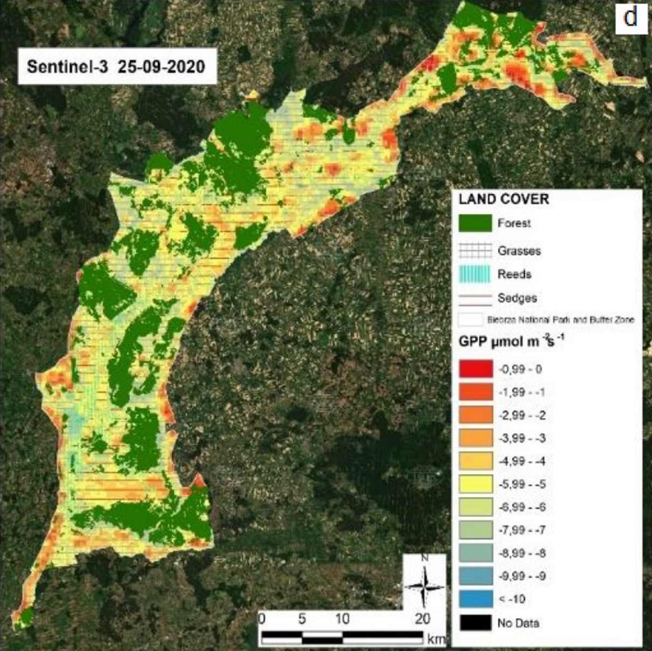
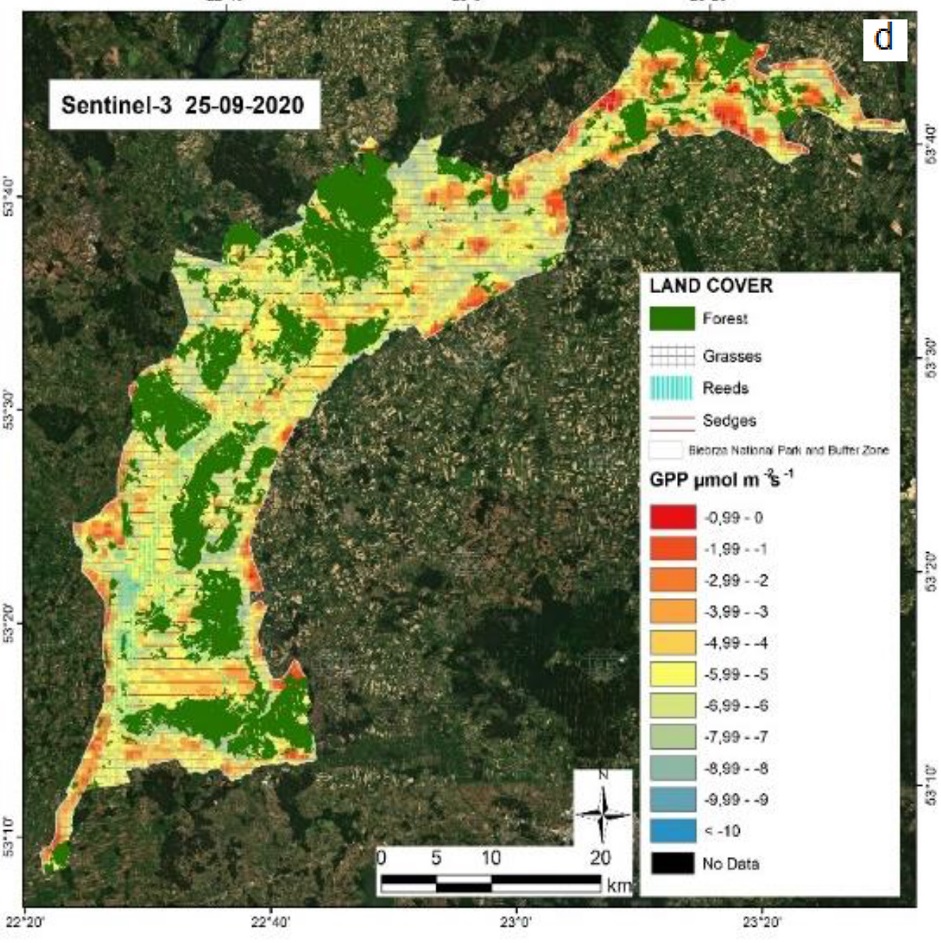
The main goal of the study was to determine the Gross Primary Production (GPP) at the Biebrza Wetlands for sedges, reeds and grasses habitats, using Copernicus Sentinel satellite data.
GPP is considered as a major driver of the peatland carbon cycle as it determines the amount of atmospheric carbon dioxide sequestered into biomass. Thus, detailed knowledge of spatio-temporal GPP dynamics is crucial for predictions of peatland carbon balance in response to global change.
Since previous methods for estimating GPP are unsatisfactory for spatial validation, the researchers chose to use vegetation indices and other parameters derived from remote sensing techniques, to successfully assess plant photosynthetic capacity.
In total, four types of satellite data were used to create a model to assess the spatiotemporal distribution of GPP at Biebrza wetlands for grasses, sedges and reeds.
The full dataset included high-resolution optical data from Copernicus Sentinel-2 and medium resolution satellite images from Sentinel-3 and Terra MODIS. Optical images have been used for wetlands habitats classification and estimation of surface temperature.
Daily Gross Primary Production
The remote sensing measurements of GPP were validated with field data. Ground measurement campaigns of the chosen habitats in the 26 sites were synchronised with overpasses of Copernicus Sentinel-2 and Sentinel-3.
For the period 2015-2020, a total of 57 multi spectral images for the study area were acquired by Sentinel-2A and Sentinel-2B, fulfilling the cloudiness requirement.
Two types of data from Copernicus Sentinel-3 were used, including optical images from the Ocean and Land Color Instrument (OLCI) instrument and temperature images from the Sea and Land Surface Temperature Radiometer (SLSTR) instrument.
The results from the study are valuable – showing that the GPP for wetlands, such as the peatlands of Biebrza, can be assessed solely on the basis of satellite data.
This creates the possibility of rapid monitoring of carbon dioxide uptake over large wetland areas, thus contributing to global assessments of greenhouse gas emissions.
Continuation of the monitoring of GPP at the Biebrza wetlands using Sentinel satellites will be essential for calculations of the amount of carbon uptake in photosynthesis processes, within these times of climate change.
As Europe strives to meet global international agreements on carbon budget, understanding carbon flux in peatlands is salient.
The results from this study help strengthen policy decisions on peatland restoration, which can bring significant reductions in greenhouse gas emissions.
About the Copernicus Sentinels
The Copernicus Sentinels are a fleet of dedicated EU-owned satellites, designed to deliver the wealth of data and imagery that are central to the European Union's Copernicus environmental programme.
The European Commission leads and coordinates this programme, to improve the management of the environment, safeguarding lives every day. ESA is in charge of the space component, responsible for developing the family of Copernicus Sentinel satellites on behalf of the European Union and ensuring the flow of data for the Copernicus services, while the operations of the Copernicus Sentinels have been entrusted to ESA and EUMETSAT.
Did you know that?
Earth observation data from the Copernicus Sentinel satellites are fed into the Copernicus Services. First launched in 2012 with the Land Monitoring and Emergency Management services, these services provide free and open support, in six different thematic areas.
The Copernicus Land Monitoring Service (CLMS) provides geographical information on land cover and its changes, land use, vegetation state, water cycle and Earth's surface energy variables, to a broad range of users in Europe and across the World in the field of environmental terrestrial applications.
References
[1] Dąbrowska-Zielinska, K. et al: “Spatiotemporal estimation of gross primary production for terrestrial wetlands using satellite and field data.”Remote Sensing Applications: Society and Environment 27 (2022) 100786


