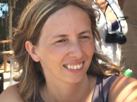
Dr Marie-Hélène Rio is a scientist from CLS, a subsidiary of the French Space agency CNES. She is responsible for developing and merging new algorithms to exploit Sentinel-3 data.
Dr Rio is currently at ESA working on bringing further benefits to users by combining data from different ocean sensors.
Sentinel-3 is part of the family of EU-owned satellites, which are developed and operated in the context of Copernicus – the European Union's Earth Observation and Monitoring Programme. The mission is the result of close collaboration between ESA, the European Commission, EUMETSAT, CNES, industry, service providers and data users.
Focusing mainly on oceans, Sentinel-3 measures the temperature, colour and height of the sea surface as well as the thickness of sea ice, and other aspects of our planet. These measurements will be used, for example, to monitor changes in sea level, marine pollution and biological productivity.

Born in Champigny sur Marne, France, Marie-Hélène Rio received her degree in Space Engineering at SUPAERO and her Master's in Ocean, Atmosphere & Biosphere at the University Paul Sabatier, Toulouse, France. She later spent three years at CLS and obtained her PhD in Physical Oceanography from the University of Toulouse III.
In 2005, she was recruited by CLS as a research scientist. Her research focused on calculating ocean Mean Dynamic Topography (MDT), which is a key reference surface for estimating absolute dynamic topography from altimeter and gravity data. She had started this research during her PhD, for which she is internationally renowned.
She has been involved in many ESA activities related to the GOCE (Gravity and Ocean Circulation Experiment) Earth Explorer mission. She has also worked on combining altimeter and gravity data with in-situ measurements of the ocean state (temperature, salinity, currents) to best estimate ocean currents, both at the surface and at depth.
In 2014, she applied for an EC senior Marie-Curie fellowship and spent the next three years in the Space Oceanography Group at ISAC, CNR in Rome, Italy, with a team mostly dedicated to processing and analysing sea-surface temperature and ocean-colour data (both space and in-situ). She developed a new approach to optimally combine space measurements of sea-surface height, sea-surface temperature and ocean colour for a better retrieval of ocean-surface currents.
In October 2016, she started a one year collaboration as visiting scientist at ESA's Earth observation centre, ESRIN, with the double objective of pursuing her work on the exploitation of GOCE data and of applying her new expertise in merging and analysing Sentinel-3 sea-surface height, temperature and ocean-colour data.
ESA: What does your work with Sentinel-3 data entail?
Rio:
My objective in ESRIN is to prepare for the optimal scientific exploitation of Sentinel-3 data. This involves two main activities: the first is related to the calculation of the ocean MDT. The Sentinel-3 radar altimeter data can be used to accurately estimate temporal variations of the ocean sea level. The MDT is the missing component needed to reconstruct the full dynamical signal. It is a key reference surface for the full exploitation of altimeter data, including its assimilation into operational ocean forecasting systems.
The computation of the MDT is a complex task, involving the in-depth knowledge of the processing and physical content of different satellite data, such as altimetry and gravity, and in-situ oceanographic measurements, such as drifting buoy velocities and hydrological profiles, along with the development of optimal merging methodologies.
I am currently working on two new MDTs, one for the global ocean, which will benefit from the use of the best GOCE geoid models recently calculated and a specific, higher resolution MDT in the Mediterranean Sea, for which I will be exploiting the high-resolution geoid model that is being calculated for the Mediterranean Sea in the framework of the GEOMED-2 project.
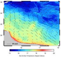
My second activity is related to exploiting synergies from the Sentinel-3 mission to improve estimates of ocean-surface currents. While there is currently no satellite observing system that directly measures ocean-surface currents, the instruments on Sentinel-3 all provide indirect and complementary information about this fundamental variable.
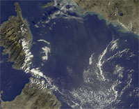
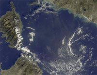
The radar altimeter provides measurements of dynamic topography, a quantity directly linked to the geostrophic component of surface currents (other components include tidal currents and wind-driven currents). The spatial and temporal resolution of an altimeter ocean current map, however, is roughly 200 km and 1 week, which is by far too coarse for most applications that rely on knowledge of surface currents. A radiometer that measures sea-surface temperature and a spectrometer that measures ocean colour are also on Sentinel-3 that provide images at a spatial and temporal resolution of around 1 km and a few days, much higher than the altimeter maps. Interestingly, such images reveal very detailed ocean dynamic structures such as spiraling eddies or filaments, the shapes of which result partly from the advection of ocean currents.
Understanding how to best use the high resolution information from temperature and colour images to improve the current coarser resolution altimeter maps has been the objective of my Marie-Curie fellowship research project at ISAC. I developed an innovative approach, which I further validated in the framework of a CNES project and ESA's GlobCurrent project. My stay in ESA is therefore perfectly timely, as I will now be able to apply this new merging method directly to Sentinel-3's data, enabling a better estimation of ocean currents.
Last but not least, as a visiting scientist my door is open to anyone in ESA wishing to discuss Sentinel-3 data aspects with a scientific user. By sharing my expertise on data analysis and data merging, I hope to be able to contribute to the success of the mission.
ESA: Why are ocean currents important for people working at sea, and how can Sentinel-3 benefit these people?
Rio:
Ocean-surface currents transport momentum, heat and salt over large distances, therefore regulating both the local and large-scale climate conditions. They also transport a variety of chemicals (oxygen, carbon dioxide), which make them a key component of the biogeochemical cycle. Finally, they contribute to the lagrangian displacement of floating material, ranging from living resources to marine pollution. Ocean-surface currents are a key variable for many scientific, operational and commercial applications.
Let's consider, for instance, the case of a shipping company. Optimising a ship's route, thanks to accurate current estimates, can help reduce fuel consumption and consequently both company costs and the release of pollutants.
The tracking and recovery of oil spills, and search and rescue operations are two other fundamental examples. For such tasks, particle trajectory models are used to predict the drift and fate of oil and objects. Among the atmospheric, ocean and wave information needed as inputs for these models, the ocean current is often the most uncertain component.
Accurate ocean currents are also fundamental for the sustainable management of fishery resources: food concentration, which is modulated by oceanographic structures, has a direct and crucial effect on the fate of several fish species, especially during their larval and juvenile stages.
There are many other examples such as oil and gas, marine renewable energy, sailing, weather services, wave forecasting, etc. In each case, Sentinel-3 data will provide key information for better estimating ocean currents. The timeliness and accuracy of Sentinel-3's data will also contribute to improving the forecasting capability of operational ocean forecasting systems.
ESA: What are other possible applications of Sentinel-3 data?
Rio:
The combination of Sentinel-3 data with other spaceborne or in-situ data opens broad perspectives.
With colleagues at CLS and at ISAC we worked on projecting surface information of height, salinity and temperature onto deeper levels of the ocean, further combining satellite data with in-situ measurements from Argo floats to build 3D global maps of temperature, salinity and horizontal ocean currents.
Further developments aim at also estimating the vertical component of currents, key information for ecosystem oriented applications and at building 3D fields of Chlorophyll-a from spaceborne ocean colour measurements. These techniques may be further applied to Sentinel-3 measurements to derive new products useful for many applications such as marine debris studies (3D Lagrangian Diagnostics, dispersal of passive tracers), biological pump and carbon export studies (CO2 budget, water mass formation, subduction rates) and fisheries management (prediction of habitats for key exploitable species).
ESA: What are the difficulties or challenges you face in researching these algorithms?
Rio:
The challenges are two-fold. The first is scientific: when merging data from different sensors that measure different quantities, it is fundamental to understand exactly the physical content of the measurements and how they differ from and complement one another.
In addition to the principles of ocean dynamics, accurate knowledge of measurement techniques is needed together with a full understanding of the various processing steps needed to transform the raw measurement acquired by the sensor into a fully useable geophysical quantity.
This leads to the second challenge: working on sensor synergy means dealing with different science communities that are not always used to interacting and working together. It is like the ocean, a huge and beautiful puzzle, with each sensor offering different pieces of information. But the pieces are so intricate and cross-correlated that the only way to put them all together is to enable expert scientists to communicate and work together. Sentinel-3 is the perfect mission for addressing such a challenge.
About the Sentinels
The Sentinels are a fleet of dedicated EU-owned satellites, designed to deliver the wealth of data and imagery that are central to Europe's Copernicus environmental programme.
In partnership with EU Member States, the European Commission leads and coordinates this programme, to improve the management of the environment, safeguarding lives every day. ESA is in charge of the space component, responsible for developing the family of Copernicus Sentinel satellites and ensuring the flow of data for the Copernicus services, while the operations of the Sentinels have been entrusted to ESA and EUMETSAT.


