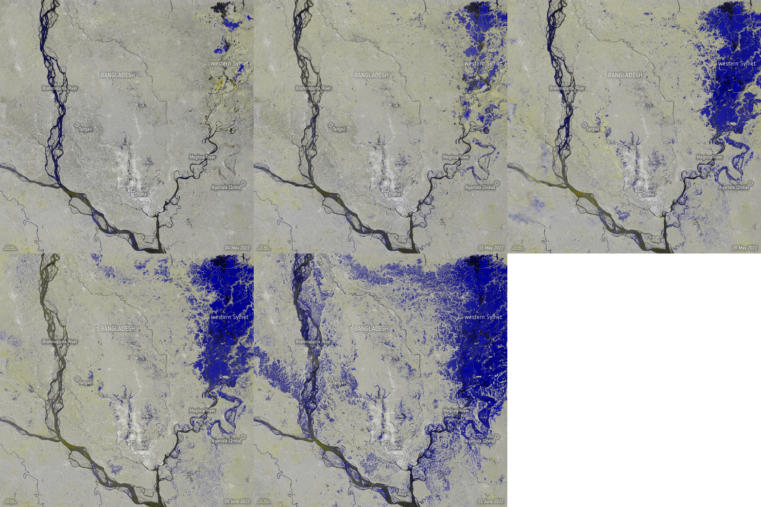
Title: Copernicus Sentinel-1 maps Bangladesh floods
Description: This animation uses Copernicus Sentinel-1 images that were acquired on 4 May, 16 May, 28 May, 9 June and 21 June, to show how the extent of the flooding in Bangladesh changed over time.
Copyright: Contains modified Copernicus Sentinel data (2022), processed by ESA, CC BY-SA 3.0 IGO