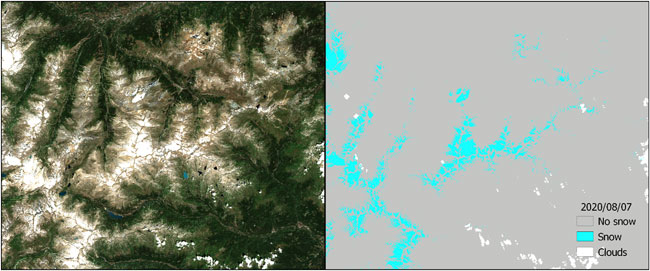
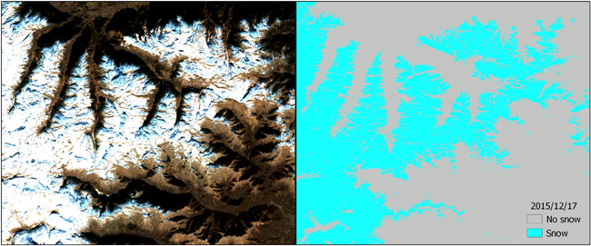
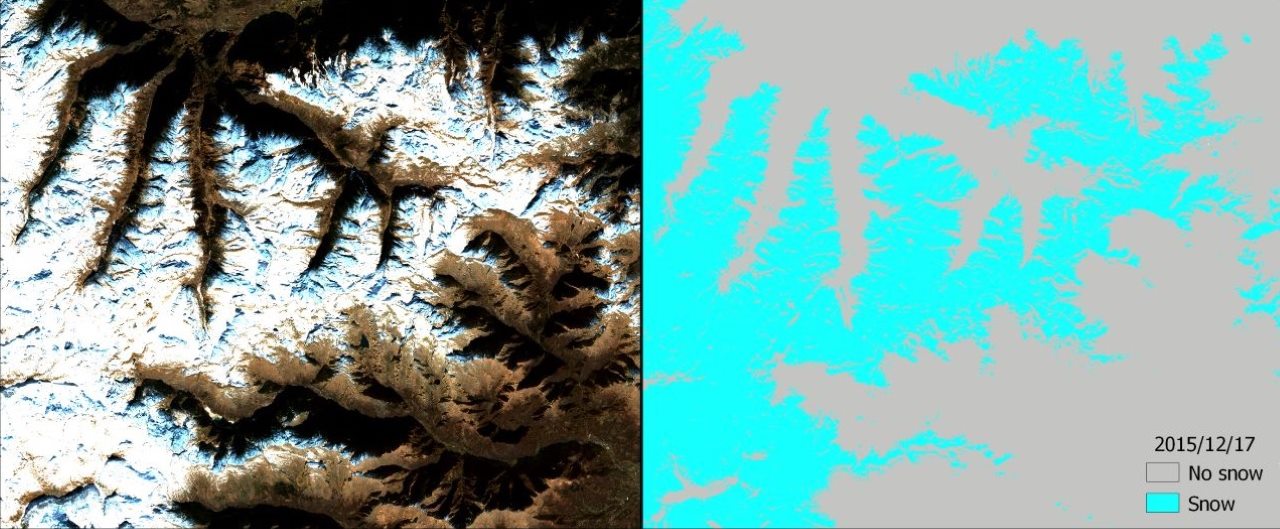
Within the framework of the showcase myECOSYSTEM of the H2020 e-shape project, improved Sentinel-2 snow cover data products could help support the management and the environmental assessment of selected Protected Areas.
The e-shape (EuroGEO Showcases: Applications Powered by Europe) project intends to provide remote sensing based information, able to support the management of selected Protected Areas and the environmental assessment in benchmark ecosystems.
Data products from the Sentinel-2 mission of the European Union's Copernicus programme were used, representing a game changer in assessing snow cover for developing potential maps.
Snow cover plays an important role in biotic and abiotic environmental processes, as well as in human activities, on both regional and global scales. Due to the difficulty of in situ data collection in vast and inaccessible areas, the use of optical satellite imagery represents a useful support for snow cover mapping.
Even though most operational snow cover algorithms offer an up-to-daily time scale, they do not provide sufficient spatial resolution for studies requiring high spatial details. By contrast, the Let-It-Snow (LIS) algorithm can produce high-resolution snow cover maps, based on the use of both the normalised-difference snow index (NDSI) and a digital elevation model.
In this study, researchers from CNR involved in the e-shape project, revised the LIS algorithm by introducing a new parameter, based on a threshold in the shortwave infrared (SWIR) band, and by modifying the overall algorithm workflow, such that the cloud mask selection could be used as an input.
The revised algorithm was applied to a case study in Gran Paradiso National Park. Unlike previous studies, researchers compared the performance of both the original and the modified algorithms in presence of cloud cover, in order to evaluate their effectiveness in discriminating between snow and clouds.


Ground data collected by meteorological stations, equipped with both snow gauges and solarimeters, were used for validation purposes. The changes introduced in the revised algorithm can improve the overall classification accuracy obtained by the original LIS algorithm, i.e., from 80.88% up to 89.17.
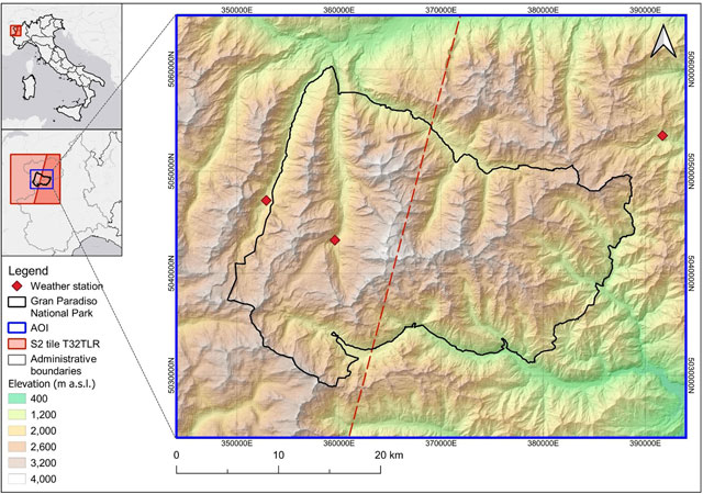
The Area of Interest (AOI) is entirely covered by the T32TLR tile. Thus, for this study, all the Copernicus Sentinel-2 Level 1C (top-of-atmosphere reflectance) data for the T32TLR tile available from the start of the mission (2015) to the start of the study (12 November 2020) were collected, for a total of 604 images).

The initial temporal coverage was six scenes per month, which has doubled since July 2017, when the twin satellite Copernicus Sentinel-2B became operational.
The AOI extends over 2065 km2 between the Val d’Aosta and Piedmont regions in northern Italy, on the border with France. This area includes the Gran Paradiso massif of the Graie Alps, and has an elevation ranging from 400 m above sea-level, up to more than 4000 m above sea level at the mountain peaks.

Glaciers and perennial snow dominate the landscape over 3000 m, which, as in the rest of the Alpine chain, have been dramatically decreasing due to climate change.
The AOI is centred on Gran Paradiso National Park, the first National Park established in Italy, for the conservation of the ibex (Capra ibex), which is also its symbol.
The area is characterised by a continental climate, with severe winters lasting from November to April/May. Typically, towards the beginning of the snow season, ephemeral snowfall heralds the arrival of persistent snow, which forms a snowpack that can be greater than 1 m.
Snow melting higher than 2000 m occurs, on average, in June. It is not unusual for snowfalls to occur out of season - even in the middle of summer - in which case, however, they have a duration limited to the meteorological event itself.
Furthermore, given its topography, the area is often covered by clouds and changes in the weather conditions can occur very quickly.
Time series of derived high spatial resolution snow cover maps are required by ecologists within models focusing on both fauna population dynamics and vegetation status.
Such time series can be provided for other locations because the algorithm was published on the Virtual Earth Laboratory (VLab) framework. This offers an automated procedure, which enables users to execute the algorithm through the VLab framework on different computing platforms (e.g., Copernicus Data and Information Access Services - DIAS platforms, Amazon Web Services - AWS cloud).
Dr Ramona Viterbi, biologist of Gran Paradiso National Park management team, affirms, "Time series of precise snow cover maps can be a useful tool for many biological researches in the park. The identification of snow pattern can contribute both to evaluate the quality of grassland as well as to identify the potential refuge areas for alpine species."
About the Copernicus Sentinels
The Copernicus Sentinels are a fleet of dedicated EU-owned satellites, designed to deliver the wealth of data and imagery that are central to the European Union's Copernicus environmental programme.
The European Commission leads and coordinates this programme, to improve the management of the environment, safeguarding lives every day. ESA is in charge of the space component, responsible for developing the family of Copernicus Sentinel satellites on behalf of the European Union and ensuring the flow of data for the Copernicus services, while the operations of the Copernicus Sentinels have been entrusted to ESA and EUMETSAT.
Did you know that?
Earth observation data from the Copernicus Sentinel satellites are fed into the Copernicus Services. First launched in 2012 with the Land Monitoring and Emergency Management services, these services provide free and open support, in six different thematic areas.
The Copernicus Land Monitoring Service (CLMS) provides geographical information on land cover and its changes, land use, vegetation state, water cycle and Earth's surface energy variables to a broad range of users in Europe and across the World, in the field of environmental terrestrial applications.
It supports applications in a variety of domains such as spatial and urban planning, forest management, water management, agriculture and food security, nature conservation and restoration, rural development, ecosystem accounting and mitigation/adaptation to climate change.
Scientific references:
Richiardi C, Blonda P, Rana FM, Santoro M, Tarantino C, Vicario S, Adamo M. A Revised Snow Cover Algorithm to Improve Discrimination between Snow and Clouds: A Case Study in Gran Paradiso National Park. Remote Sensing. 2021; 13(10):1957. https://doi.org/10.3390/rs13101957
