Glaciers typically move at slow speeds but, under certain conditions, surge events can accelerate ice flow to far higher velocities. Now scientists have mapped these short-lived and potentially dangerous phenomena using data from Copernicus Sentinel-1.
The study – published in the Journal of Glaciology – represents the first time surging glaciers have been detected systematically on a planetwide scale.
Copyright: University of Oslo
Global map of glacier surges
Both Sentinel-1 satellites of the EU’s Copernicus Earth observation programme host a C-band synthetic aperture radar (SAR) instrument that continues to gather observations during the day and night, and under all weather conditions.
This makes the mission a powerful tool for glacier monitoring as these ice flows are typically located in mountainous or polar regions where frequent cloud cover and long periods of darkness often hamper optical observations.
During a surge, glacial ice flows 10 to 100 times more quickly than in normal conditions, which can pose a threat to communities located in downstream areas by triggering severe flooding and even giant ice avalanches.
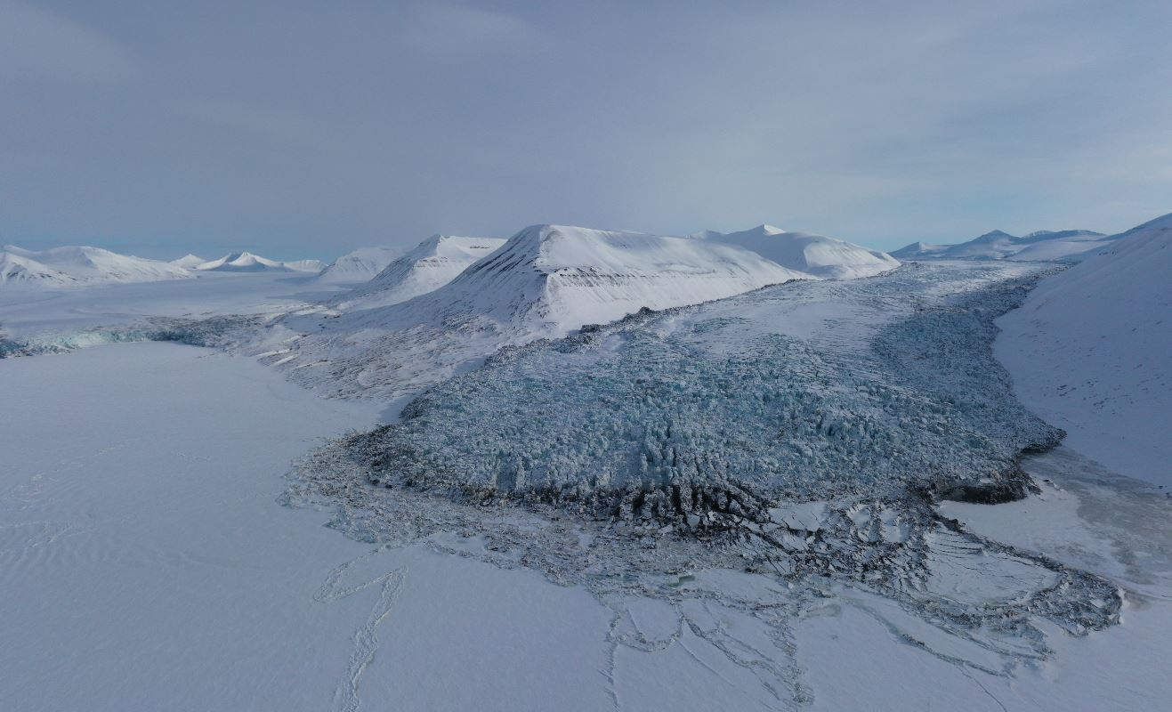
This massive increase in speed results in stresses that are known to rip flowing ice apart, leaving glaciers covered in a dense network of deep fractures.
Copyright: Erik Schytt Mannerfelt, University of Oslo
The Scheelebreen glacier in Svalbard experiences a surge
Copernicus Sentinel-1 can measure such changes in surface roughness with a high level of precision, as heavy glacier crevassing during a surge leads to increased backscatter in repeat radar images.
This means that images of glaciers under surge conditions appear brighter than images that capture glaciers moving at a more typical pace.
As part of the study, the research team – made up of scientists from the University of Oslo in Norway and Gamma Remote Sensing in Switzerland – applied image processing to large parts of the entire Sentinel-1 archive to detect glacier surges around the world.
Optical imagery from Copernicus Sentinel-2 also supported the analysis, by enabling scientists to visually confirm the source of the increased backscatter detected by Sentinel-1.
Copyright: Contains modified Copernicus Sentinel data (2017-2022)/processed by University of Oslo
Glacier surges in Svalbard
This helped the team to test the analysis method and avoid confusion with other events that impact glacier surface roughness, such as deposits from snow avalanches.
In total the team detected some 115 glaciers surges; interestingly, most of these events were concentrated in three regions, the Tibet plateau, Svalbard in Norway, and Yukon in Alaska.
Andreas Kääb, lead author of the study, explains, “This is the first time that glaciers surges have been mapped globally in a consistent way, and including timing information to show when these events happened. This gives us a number of new insights and possibilities for further research. In my view, though, the most surprising result is that the discovered surges were concentrated in just a few areas.
Copyright: Contains modified Copernicus Sentinel data (2012-2023)/processed by University of Oslo
Glacier surge in southern Svalbard
“While climate change – in particular rising air temperatures and changes in snow fall – could have caused the geographic surge clusters that we found, we need longer time series of glacier surge maps to closer investigate this theory. The long-term perspective and consistency of the Copernicus Sentinel missions is therefore of key importance for us.”
The project was supported by ESA’s Climate Change Initiative and performed in preparation for ESA’s tenth Earth Explorer, Harmony.
About the Copernicus Sentinels
The Copernicus Sentinels are a fleet of dedicated EU-owned satellites, designed to deliver the wealth of data and imagery that are central to the European Union's Copernicus environmental programme.
The European Commission leads and coordinates this programme, to improve the management of the environment, safeguarding lives every day. ESA is in charge of the space component, responsible for developing the family of Copernicus Sentinel satellites on behalf of the European Union and ensuring the flow of data for the Copernicus services, while the operations of the Copernicus Sentinels have been entrusted to ESA and EUMETSAT.
Did you know that?
Earth observation data from the Copernicus Sentinel satellites are fed into the Copernicus Services. First launched in 2012 with the Land Monitoring and Emergency Management services, these services provide free and open support, in six different thematic areas.
The Copernicus Land Monitoring Service (CLMS) provides geographical information on land cover and its changes, land use, vegetation state, water cycle and Earth's surface energy variables to a broad range of users in Europe and across the World, in the field of environmental terrestrial applications.
It supports applications in a variety of domains such as spatial and urban planning, forest management, water management, agriculture and food security, nature conservation and restoration, rural development, ecosystem accounting and mitigation/adaptation to climate change.
References:
Kääb, A., Bazilova, V., Leclercq, P., Mannerfelt, E., & Strozzi, T. (2023). Global clustering of recent glacier surges from radar backscatter data, 2017–2022. Journal of Glaciology, 1-9. doi:10.1017/jog.2023.35
