Title: WorldCover Imaging for Carbon Assessment
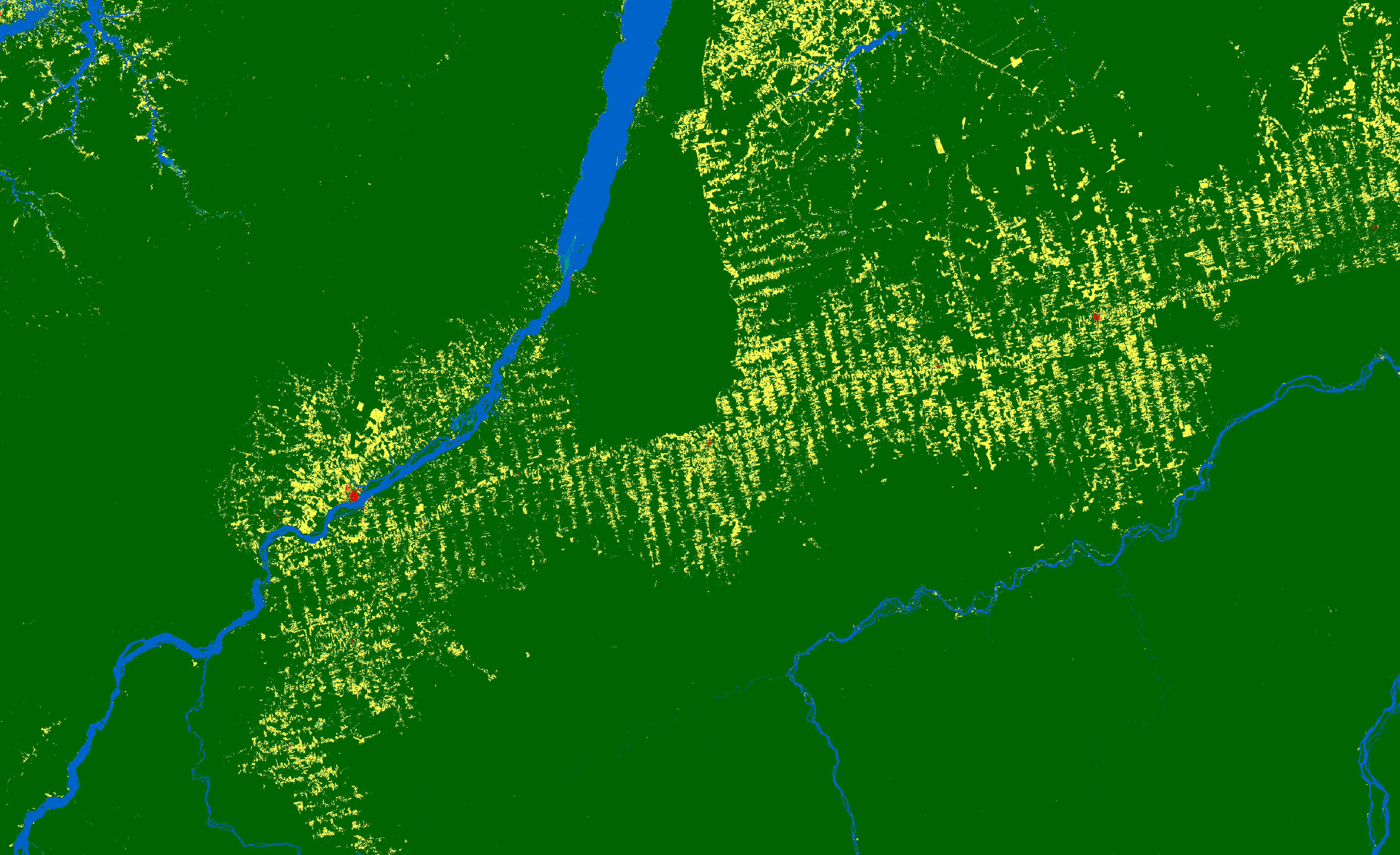
Description: This map shows land imaging of the Amazon in Brazil for Carbon Assessment applications using ESA WorldCover. Deforestation can be tracked by monitoring tree cover (dark green colour), which gives way to grassland (yellow colour).
Copyright: ESA