Title: Study area with heat map of oil spills
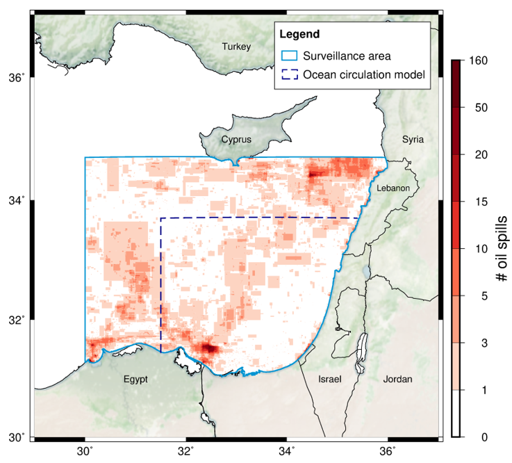
Description: A visualisation of the study area in the South-eastern Mediterranean Sea. The dashed blue outline marks the study area where the ocean circulation model is applicable for oil trajectory simulation and the solid blue outline defines the extent of Sentinel-1 SAR acquisitions. The red colour shows a heatmap of the number of oil spills collected and manually annotated from 2015 to 2018. Map is not definitive for political boundaries.
Copyright: Stevens (2020)/ Yang (2022)