Title: Southern ocean sea surface roughness
Description:
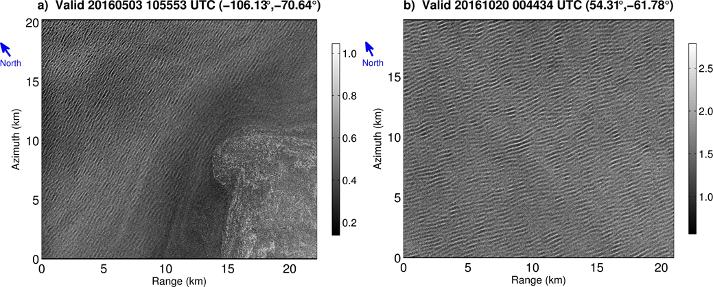
Copernicus Sentinel-1A images, acquired on 3 May 2016 at 10:55 (a) and 20 October 2016 at 00:44 (b) in the Amundsen Sea in ice covered waters, showing ocean waves propagating underneath sea ice.
On the left (a), example of rapid attenuation within a single image located 130 km into the ice. The top left corner of the image is closest to the ice edge with a wave height of 1.25 m, wavelength of 230 m, and propagating from the Northwest.
After several kilometres (range=14, azimuth=12~km), the wave height decreases to 0.4 m and the waves nearly vanish in the bottom right of the image. This example shows stronger wave decay than previously observed.
On the right (b), a uniform swell observed 150 km into the ice. The wave height is nearly uniform at 0.5 m with a wavelength of 330 m propagating from the North. Using the off-ice wave height, the decay is similar to what has been observed by previous studies.
Copyright: Contains modified Copernicus Sentinel data (2018)/ processed by the Laboratory of Ocean Physics and Satellite remote sensing (LOPS)