Researchers have used Copernicus Sentinel imagery collected over Peru to track the production of asparagus, a major Peruvian farming export that is widely consumed in Europe.
They hope this will inform improved decision-making and build resilience into the asparagus supply chain, benefiting local farmers, the environment and ensuring less food waste between farm and table.
While asparagus season in northern Europe is popularly celebrated from April to the summer solstice, year-round supplies of asparagus are grown in equatorial regions.
Peru is one of the largest exporters of asparagus in the world and the second-largest producer after China. The asparagus crop is a cornerstone in the Peruvian agricultural sector and is extensively consumed in Europe.
A new method for up-to-date monitoring and forecasting of Peruvian asparagus crops has been developed, using a fusion of Copernicus Sentinel-1 synthetic aperture radar (SAR) data with Copernicus Sentinel-2 optical data, to help reduce losses in the asparagus supply chain [1].
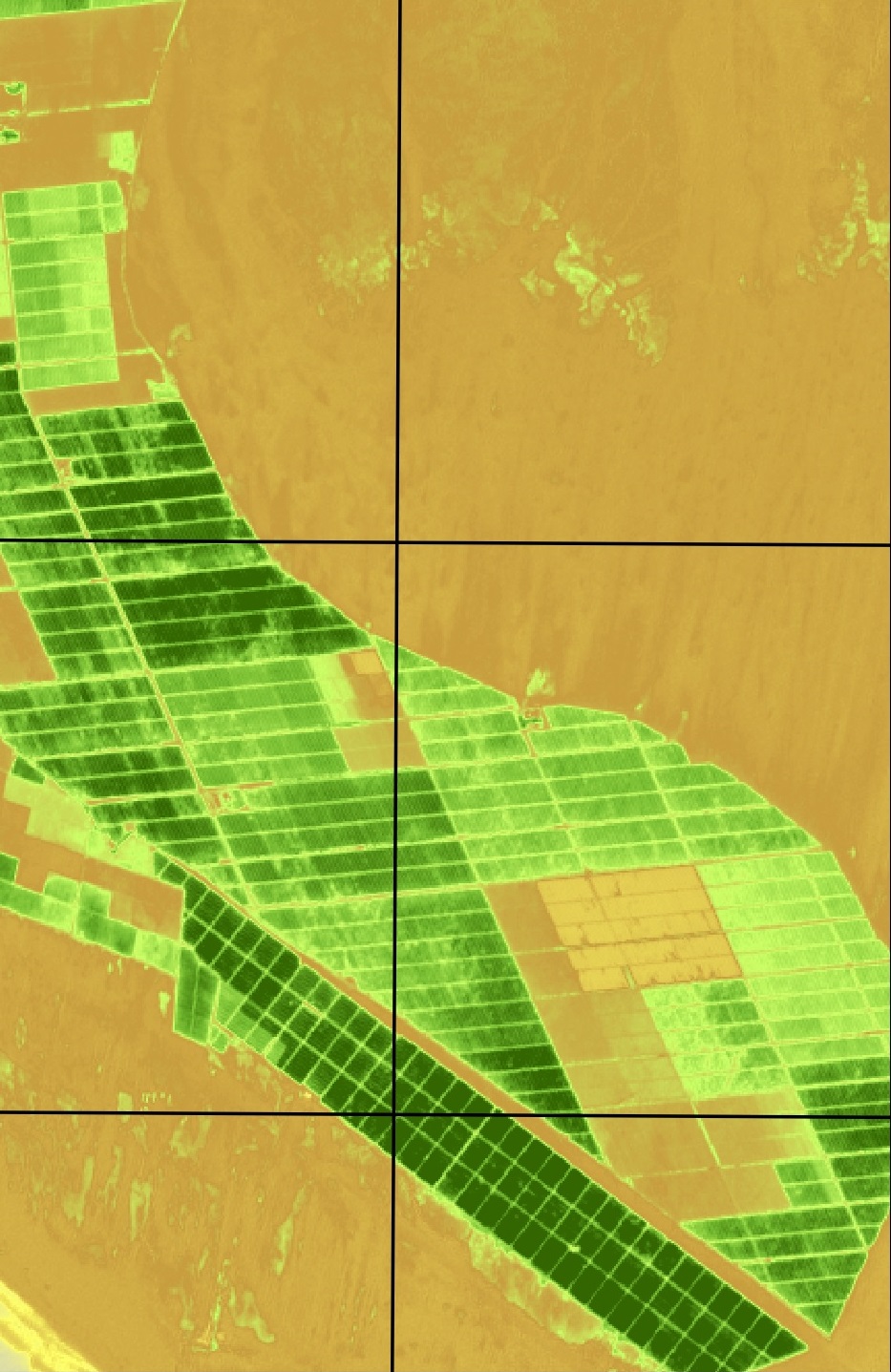
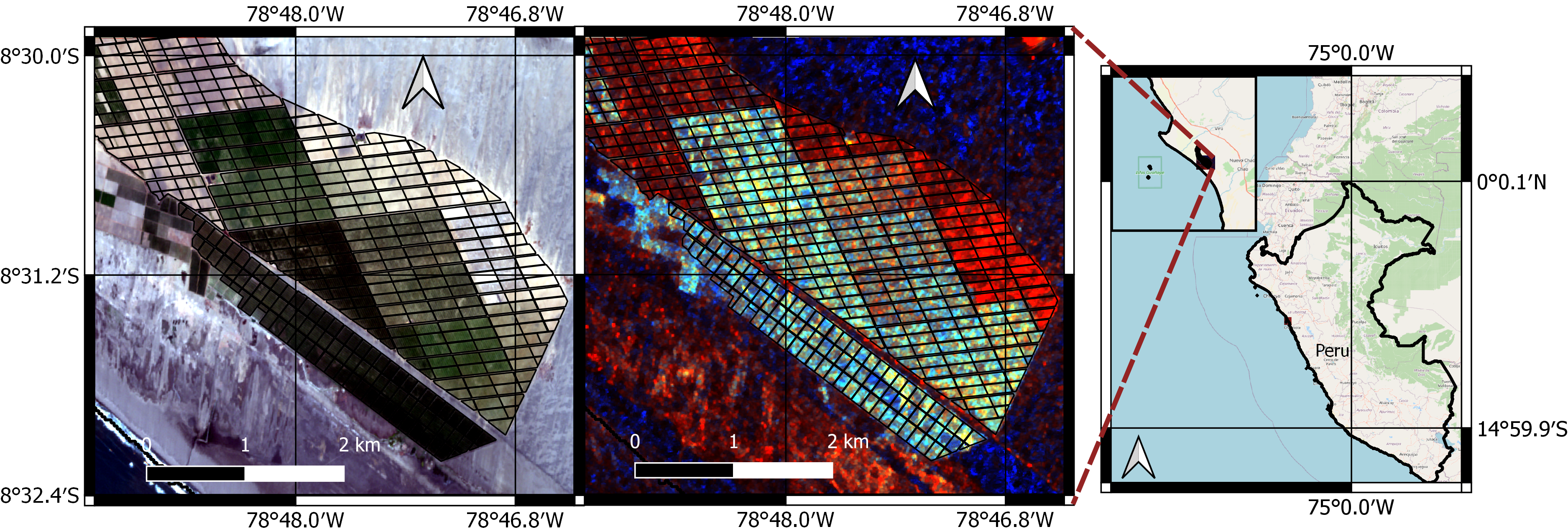
Research based at the University of Stirling, UK, drew on data delivered by both Sentinel-1 and Sentinel-2 of the European Union’s Copernicus Programme and targeted asparagus fields located in the Peruvian north coast – a total of 432 agricultural parcels.
This research is an ESA-backed Agri-track use case, supported by the project EO4cultivar - led by Environment Systems. EO4cultivar was co-funded by the UK Space Agency's International Partnership Programme, which is part of and funded from the UK Department for Business, Energy and Industrial Strategy’s Global Challenges Research Fund.
Remote sensing aiming to avoid destructive sampling
Lead researcher Cristian Silva-Perez, from the Department of Biological and Environmental Sciences at the University of Stirling, says, “We specifically wanted to measure an important variable in the asparagus crop, namely its below ground carbohydrate. The amount of carbohydrates stored below ground in the plant’s root system is highly associated with the yield of asparagus and its ability to establish a healthy canopy. Our idea was to use Earth observation data from Sentinel-1 and -2, to monitor the asparagus canopy and from this infer the available carbohydrates in the crop.”
Knowledge on canopy provides information to farmers on expected crop yields during a given season [2].
Remotely tracking below ground carbohydrates in this way may contribute towards reducing the destructive sampling required for its measurement in the field.
In equatorial regions winters are mild and so the asparagus crop can grow all year round. Farmers usually grow two seasons per year and the growth stage of individual parcels is not synchronised, making the study area dynamic.
Canopy data infer crop maturity
Consequently, the algorithm used learning-based dynamic filtering, allowing a fusion of data from multi-temporal Sentinel-1 and Sentinel-2 sensors, taken during the period 1 May 2018 to 31 December 2020.
“Using both radar and optical data from both missions provides complementary information. While Sentinel-1 may not be as accurate as Sentinel-2 for retrieving vegetation condition, it has the advantage of providing continuous acquisitions even during periods of cloud-coverage,” explains Silva-Perez.
“Using a fusion of data from both missions allows us to have accurate and near real-time measurements of the below carbohydrate content of asparagus crops.”
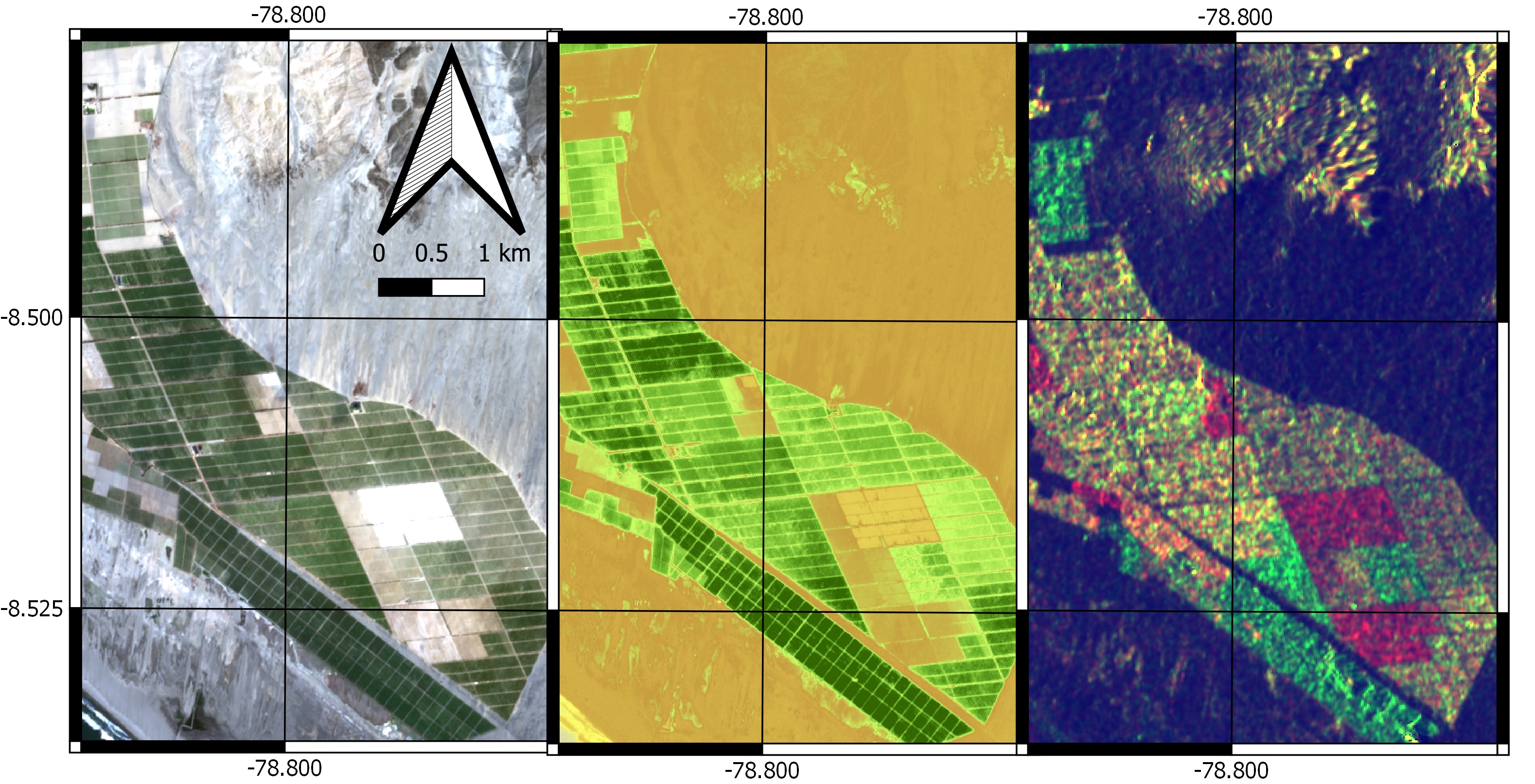
Asparagus fields in different stages of growth
Level-1 ground range detected (GRD) Sentinel-1 data were pre-processed by the researchers, while orthorectified and radiometrically-corrected Sentinel-2 Level 1C data were used.
Validation with ground truth showed that the use of Sentinel-1 combined with Sentinel-2 time series data provided the best performances for tracking asparagus carbohydrates. It is also a reliable way to handle missing data from a single sensor.
Results support sustainable development goal-2
The method tracked within-season below ground carbohydrates, crop age, and helped forecast crop key dates. Another result, days after the season started (DAS), is also useful for different stakeholders, such as insurance companies.
Earth observation intelligence of this kind supports the sustainable development goal SDG 2 – Zero Hunger, by improving agricultural decision-making - from ensuring farm workers are available for harvesting, to predicting peaks in transport, storage and processing.
While this method enables agri-businesses to make near-real time decisions, it is currently on a field scale and could be scaled up to provide country-wide intelligence.
About the Copernicus Sentinels
The Copernicus Sentinels are a fleet of dedicated EU-owned satellites, designed to deliver the wealth of data and imagery that are central to the European Union's Copernicus environmental programme.
The European Commission leads and coordinates this programme, to improve the management of the environment, safeguarding lives every day. ESA is in charge of the space component, responsible for developing the family of Copernicus Sentinel satellites on behalf of the European Union and ensuring the flow of data for the Copernicus services, while the operations of the Copernicus Sentinels have been entrusted to ESA and EUMETSAT.
Did you know that?
Earth observation data from the Copernicus Sentinel satellites are fed into the Copernicus Services. First launched in 2012 with the Land Monitoring and Emergency Management services, these services provide free and open support, in six different thematic areas.
The Copernicus Land Monitoring Service (CLMS) provides geographical information on land cover and its changes, land use, vegetation state, water cycle and Earth's surface energy variables to a broad range of users in Europe and across the World, in the field of environmental terrestrial applications.
It supports applications in a variety of domains such as spatial and urban planning, forest management, water management, agriculture and food security, nature conservation and restoration, rural development, ecosystem accounting and mitigation/adaptation to climate change.
References
[1] Silva-Perez et al, "Learning-based tracking of crop biophysical variables and key dates estimation from fusion of SAR and optical data" IEEE Journal of Selected Topics in Applied Earth Observations and Remote Sensing (2022).
[2] Silva-Perez et al, “Monitoring Agricultural Fields Using Sentinel-1 and Temperature Data in Peru: Case Study of Asparagus (Asparagus officinalis L.)” Remote Sens. 2020, 12(12), 1993.