Title: Pakistan inundated
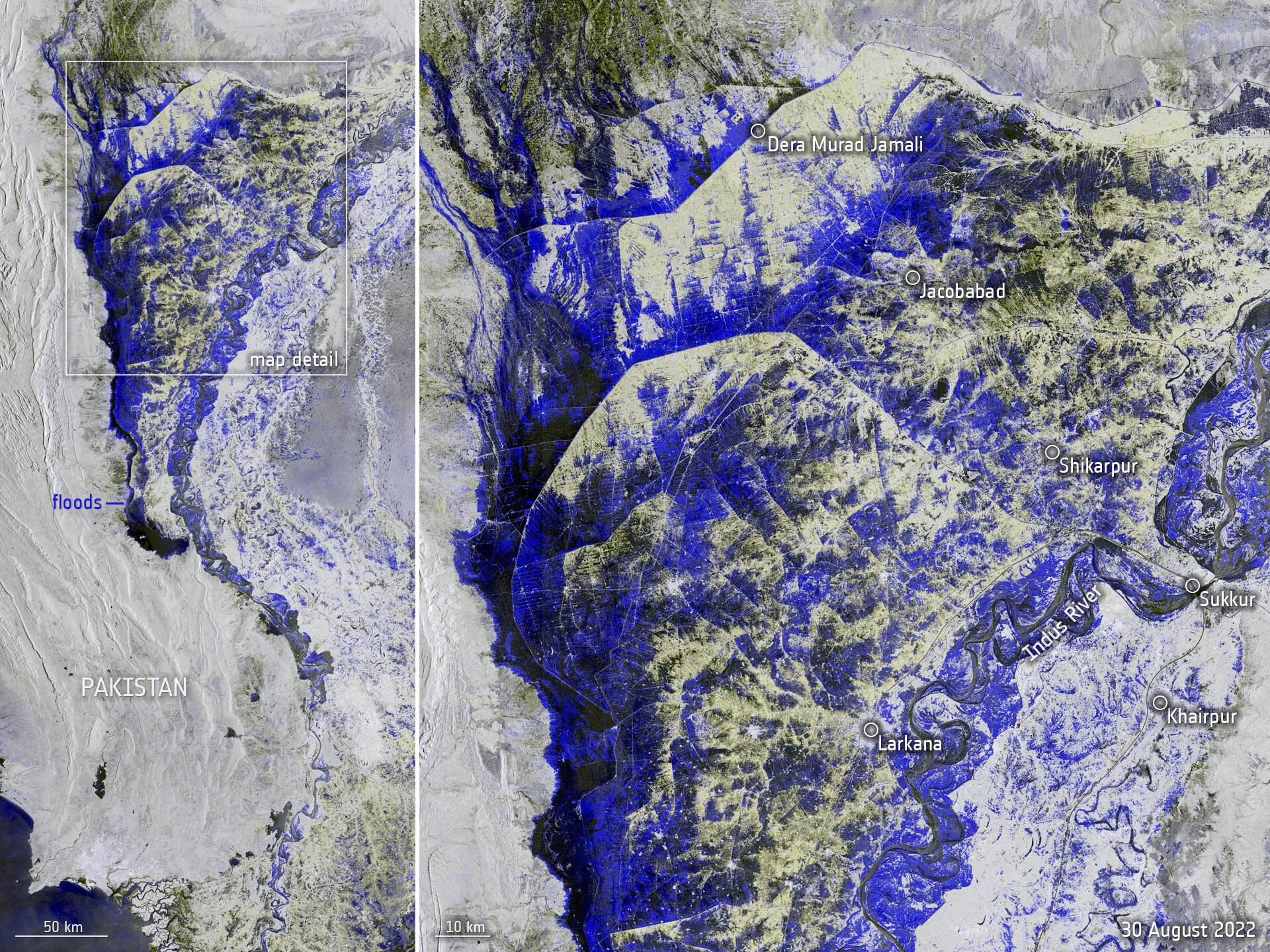
Description: Data captured from space by Copernicus Sentinel-1on 30 August was used to map the extent of flooding that is currently devastating Pakistan. The left side of the Copernicus Sentinel-1 image shows a wide view of the area affected and the image on the right zooms into the area between Dera Murad Jamali and Larkana.
Copyright: Contains modified Copernicus Sentinel data (2022), processed by ESA