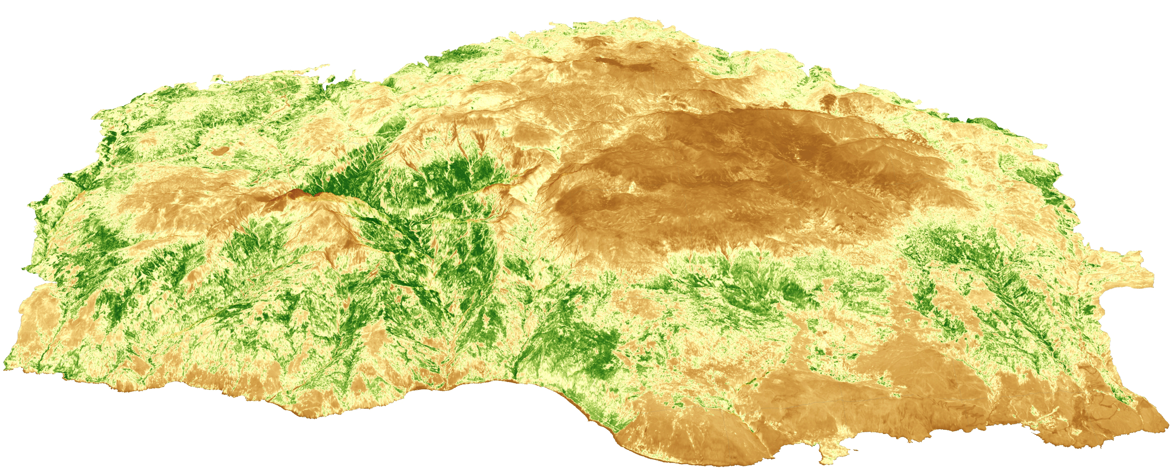
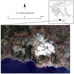
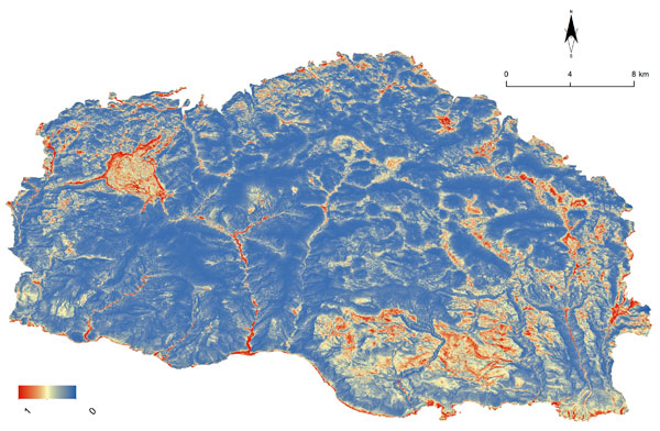
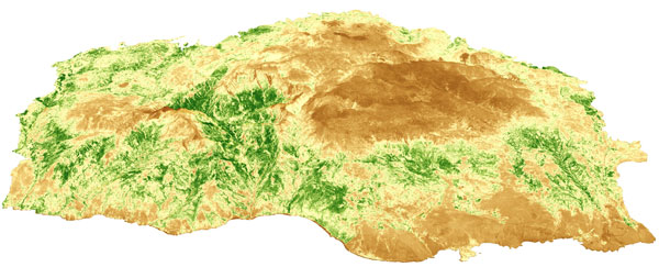
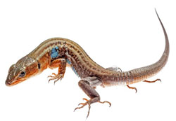
The conservation and protection of biodiversity is a fundamental activity of protected areas, such as the Samaria National Park, in Greece. The use of data from the Copernicus Sentinels, combined with geodiversity variables, are proving to be fundamental in monitoring certain areas where the Podarcis cretensis endemic lizard is found.
The fourth largest island of the Mediterranean, Crete hosts more than 50 mountain peaks that exceed 2000 m in elevation, the majority of them located at the west – such as the massif Lefka Ori. There, the Samaria National Park originates from the peaks down to the marine area, home to important seagrass meadows.
Since 1962, it has been a National Park, belonging to the network of Biosphere Reserves in the UNESCO Program "Man and Biosphere" (MAB), to the European Network of Biogenetic Reserves of the Council of Europe, and included in the European Network of Protected Areas NATURA 2000.
Mountainous areas like those in the Samaria National Park provide a diverse terrain where microclimate shapes ecological niches at local scales for animals and plants. Such areas also host endemic and rare elements of biodiversity, acting as islands of biodiversity. These processes can be identified by using high-resolution data, based either on satellite or airborne observations.
Both approaches have their limitations, however, since open access satellite data usually have high frequency but low spatial resolution. On the other hand, commercial satellite data have high spatial resolution with modular spectral resolution and extent, but are costly for temporal data collection.
Today, Sentinels-1 and -2 of the European Union's Copernicus programme are filling this gap, by providing data of high spatial resolution with an adequate temporal resolution (10 m pixel size every 5 days).
In addition, the Copernicus Sentinel-1 constellation (-1A and -B) can provide terrain data (e.g. Digital Elevation Model) and related topographic parameters describing the geodiversity after the analysis within the open access ESA SNAP toolbox or QGIS.
Products from Copernicus Sentinel-1 and -2, combined with species observations in the framework of species distribution modelling, are a powerful tool in the arsenal of conservation ecology and planning. The high temporal frequency data of Copernicus Sentinel-2 provide information on landscape dynamics, such as the vegetation growth and changes in landcover, whilst Copernicus Sentinel-1 data give access to extracted information like elevation, aspect and slope, but also information relating to the incoming solar radiation and the terrain openness (e.g. sky view factor).
Lizards are dependent on the availability of sun for their needs, thus terrain parameters as well as vegetation dynamics are related to their ecophysiological demands.
The conservation and protection of biodiversity is a fundamental activity of protected areas like the Samaria National Park, where the Podarcis cretensis is found. The conservation of its habitats provides a high ecosystem quality, valued by ecotourism visitors.
The use of Copernicus Sentinel data have great potential towards this goal as it reduces costs for planned fieldwork activities, which can be focused on targeted areas, where the use of Copernicus Sentinel-2 data make the monitoring of certain areas easier, without spending resources for fieldwork campaigns.
Copernicus Sentinel-2 data are also used for monitoring illegal activities (e.g. logging, illegal fires) within the protected area, thus optimising the Park's management of resources and supporting law enforcement. Open access satellite data allow for the reduction of the cost of surveys in remote areas, which are abundant inside the national park, reducing the costs of public administrations (municipality, forest police, park authorities) and thus benefitting citizens.
Protected areas require multiple tools for their daily activities. Copernicus Sentinel-2 data as Analysis Ready Data (ARD) via online platforms for use by non-experts in Remote Sensing, are very useful. A fully operational online Copernicus Sentinel-1 and -2 system, which will provide ready-to-use data, will benefit the technical staff of local authorities and parks as they will be able to use updated information without needing the technical expertise to process remote sensing data.
Dimitris Poursanidis, postdoctoral researcher of the Remote Sensing lab of the Foundation for Research and Technology Hellas (FORTH), states, "The use of Copernicus Sentinel-2 data in the calculation of spectral indices and the use in ecological modelling open new endeavours in spatial and temporal scales that have never been achieved with open access data".
About the Copernicus Sentinels
The Copernicus Sentinels are a fleet of dedicated EU-owned satellites, designed to deliver the wealth of data and imagery that are central to the European Union's Copernicus environmental programme.
The European Commission leads and coordinates this programme, to improve the management of the environment, safeguarding lives every day. ESA is in charge of the space component, responsible for developing the family of Copernicus Sentinel satellites on behalf of the European Union and ensuring the flow of data for the Copernicus services, while the operations of the Copernicus Sentinels have been entrusted to ESA and EUMETSAT.
Acknowledgments:
ECOPOTENTIAL is a project funded by the European Union's Horizon 2020 research and innovation programme, which focuses its activities on a targeted set of internationally recognised Protected Areas, blending remote sensing Earth Observations with field measurements and data analysis. The project works side-by-side with 24 protected areas across Europe and beyond in providing the tools and models that make use of Sentinel data for addressing this specific monitoring need (among others).
This article refers to the work conducted within the framework of the H2020 project ECOPOTENTIAL (Grant Agreement n. 641762) by researchers from the Remote Sensing lab of the Foundation for Research and Technology Hellas (FORTH) and the Samaria National Park. Dimitris Poursanidis, Antonios Barnias, Petros Lymberakis and Nektarios Chrysoulakis contributed to this article.
Scientific references:
Petros Lymberakis 2009. Podarcis cretensis. The IUCN Red List of Threatened Species 2009: e.T157252A5060934. http://dx.doi.org/10.2305/IUCN.UK.2009.RLTS.T157252A5060934.en. Downloaded on 12 March 2019.
Poursanidis D., P. Lymberakis, Spaneli V., & Chrysoulakis N. 2017. Topographic factors promoting the distribution of the endemic lizard Podarcis cretensis in Samaria National park. 19th SEH European Congress of Herpetology, University of Salzburg, Salzburg, Austria, September 18th-23rd 2017. Programme & Abstracts. 284 pp.
