Title: Copernicus Sentinel-1 catches effect of islands on sea surface features
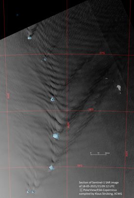
Description: The Sentinel-1 SAR image on the left was acquired on 18 May. It shows similar wave patterns as described in fig. 1. However, the propagation from the single islands is northwards, resulting in more interactions between the different packages. The length of the waves is about 12 km to 14 km. The extent of the packages from each island exceeds 200 km (107 nm) and more. Off Saunders Island, about 18 individual waves can be defined.
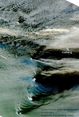
The MODIS visual image from NASA’s Earth Data satellite programme taken on the same day shows similar wave patterns. They are created by the mountains (volcanoes) on the islands rising up to 1550 m into the troposphere and thus disturbing the wind flow. The crests of the resulting waves with upwelling (condensing) air are formed by strips of clouds, the troughs with downwelling air are cloud-free. The length of the waves is similar to that of the oceanic waves projected to the sea surface.
Copyright: Contains modified Copernicus Sentinel data (2021)/ processed by K. Strübing

