Title: Comparison of Sea Surface Wind maps
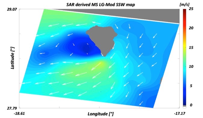
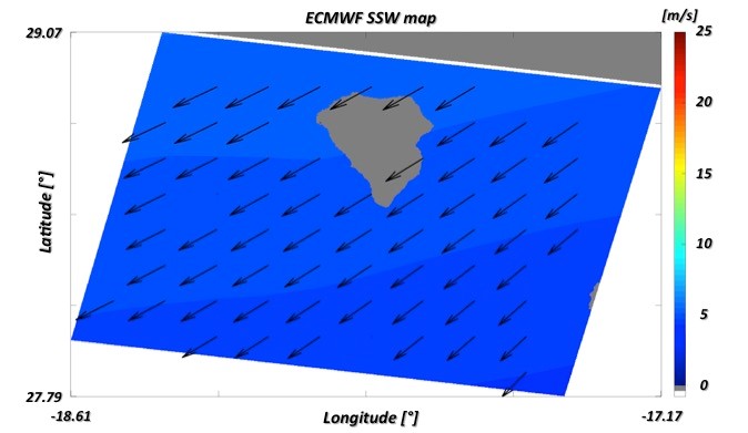
Description: Within Spain's La Palma study area, this image features an example of (a) MS LG-Mod SSW map (white arrows for direction, background for wind speed), estimated over a grid of about 0.125° by 0.125° (latitude by longitude), from a Copernicus Sentinel-1A IW image, acquired on 26 September 2018, 07:10:45 UTC, along descending orbit, with VV-polarisations; (b) ECMWF SSW map for the same date at 06:00:00 UTC (black arrows for direction, background for wind speed).
Copyright: Contains modified Copernicus Sentinel data (2018)/processed by e-shape