Title: Burnt areas
Description:
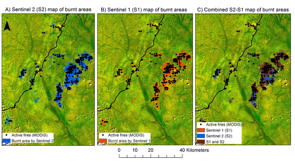
Spatial coherence in the location of the burnt areas as detected by Sentinel-2A (A) and Sentinel-1A (B) and MODIS active fire product (black dots). The map on the right (C) combines Sentinel-2 and Sentinel-1 based maps. Sentinel-2 data are in the background.
Copyright: contains modified Copernicus Sentinel data (2016), processed by ESA/NASA/JRC
