Fast-track to the right Sentinel scene
The Earth Observation metadata enhancer (EO-me) is a service that addresses the issue of identifying specific data tiles in the rapidly growing satellite data archives. In mid 2017 close to one million satellite images are available and it used to be difficult to find the right one for the problem to be solved.
The EO-me system enriches all tiles in the database with additional metadata characterising the tiles with their specific terrain statistics, average vegetation index, climatic parameters and other static and dynamic metadata making it very easy to locate appropriate data.
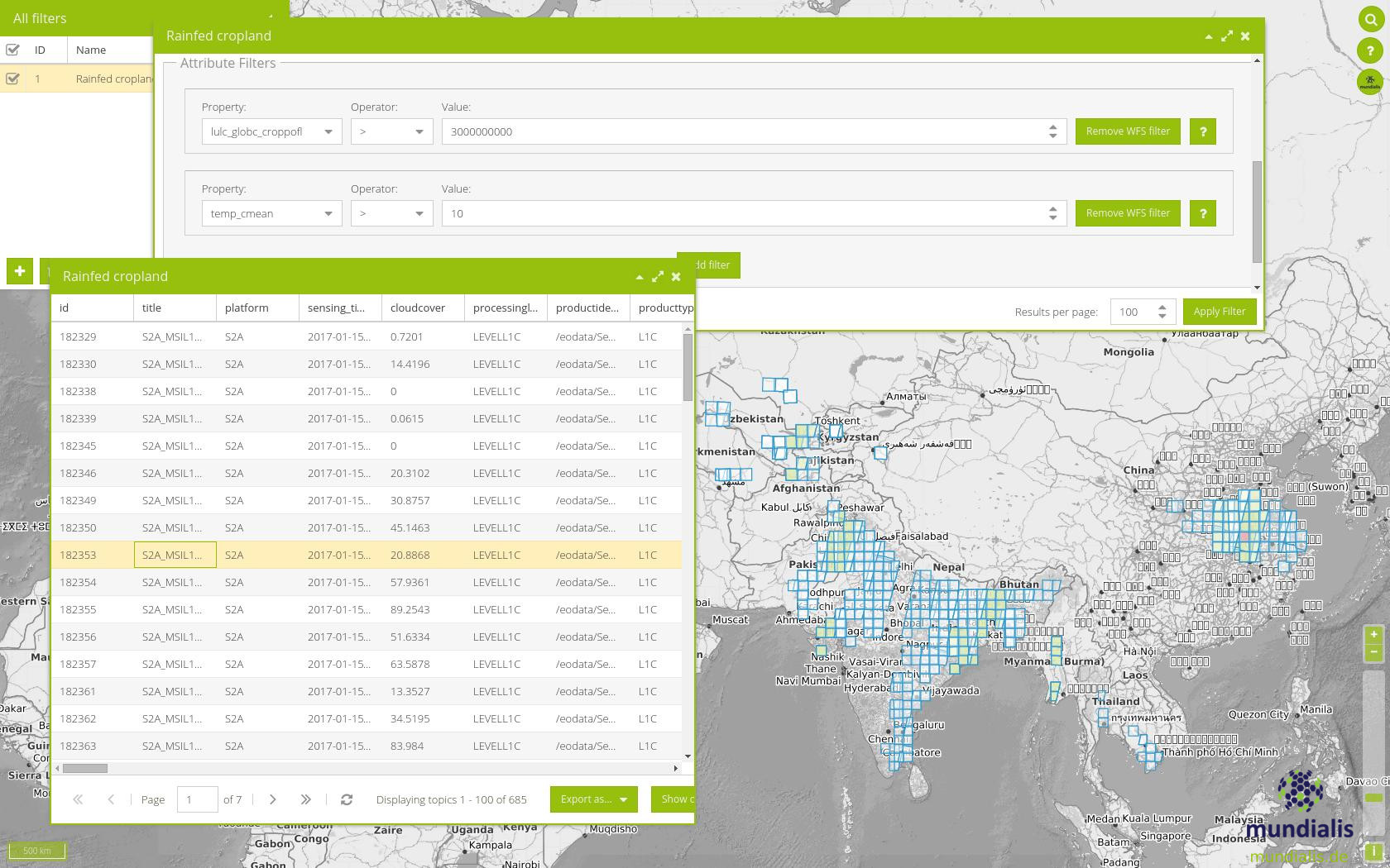
EO-me, consisting of a metadata processing backend and a web frontend, offers a filter system that can support any satellite mission. The resulting list of identified tiles grants one-click-access for download and further processing. The service is available at EO-me for you to try out.

Filtering Sentinel-2A scenes with EO-me.
About mundialis:
mundialis (https://www.mundialis.de) specializes in the evaluation of remote sensing data and the processing of voluminous geodata with the help of powerful computing centers. Based on satellite data mundialis offers scalable products for agriculture and forestry, space agencies, research institutes, international organizations, as well as the private sector in the fields of telecommunications, logistics and health.
