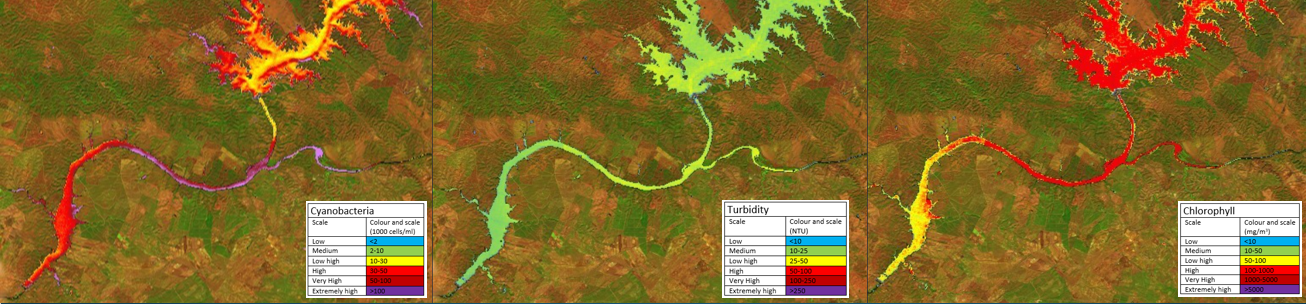
Title: Distribution map of cyanobacteria, turbidity and chlorophyll a in the Aqueva dam and Guadiana River
Description: These maps feature the distribution of three important parameters for the characterisation of water quality in the Alqueva Reservoir and in the Guadiana River in Alentejo, Portugal. The maps were generated with a custom script in the EO-Browser web-platform for cloud-computing, using L2A Copernicus Sentinel-2 products.
The background is generated from appropriate Copernicus Sentinel-2 SWIR bands to highlight the land use and land cover: bare soil represented in brown and vegetation in green. With an appropriate selection of bands from the multi-spectral sensor onboard Copernicus Sentinel-2, it is possible to monitor water quality and land use, on a single image. This information is of great value to all stakeholders, from the general public to economic agents involved in agriculture, leisure and tourism and natural resources management.
Copyright: Contains modified Copernicus Sentinel data (2017)/processed by M. Jongejan Escar, H. van der Veen, B. Sepac, L. Skapul