
/documents/4634164/4650239/Quirimbas-national-park-bathymetry.png
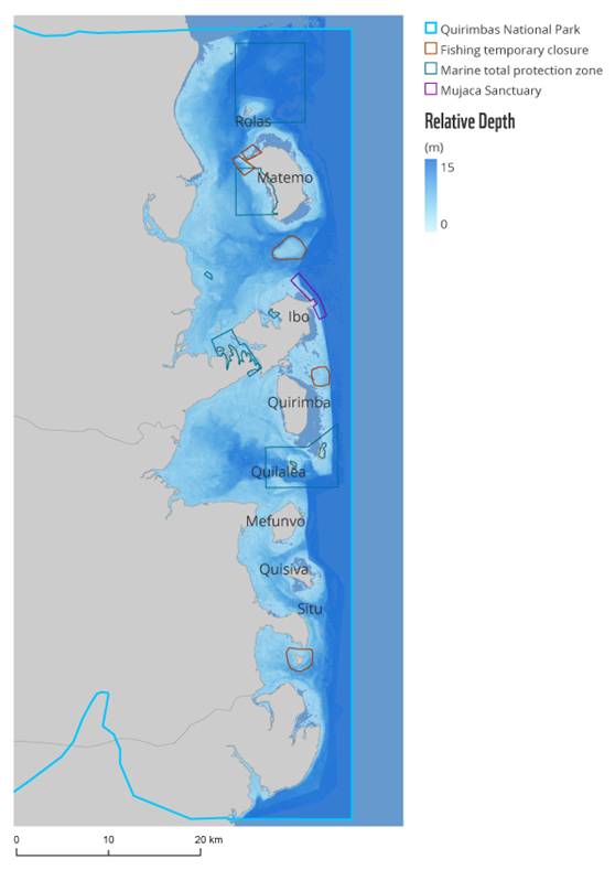
Title: Bathymetry of the Quirimbas National Park
Description: Satellite-derived relative depth in metres shows the extent of the shallow water shelf. The derived bathymetry shows the entire shallow reef shelf throughout the protected area and around the atolls.
The lagoon bathymetry was also retrieved, showing underwater channels, features and underwater topography in far greater detail than best available information in nautical maps or charts, which are out of date and limited in resolution in shallow waters.
Copyright: Contains modified Copernicus Sentinel data (2018)/processed by WWF-Germany