Title: Sentinel-2 to map tree-clearing in eastern Australia
Description:
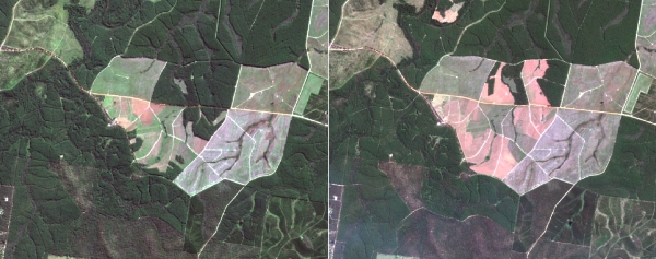
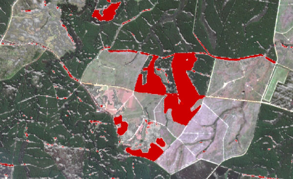
The example shows a pair of true-colour Sentinel-2 images (top row), from 20 May 2016 (left) and 7 October 2016 (right) over an area in eastern Australia. The bottom image is calculated from these two images, using an automated index of tree clearing originally developed for use with SPOT 5. Red areas show places that are likely to have been cleared of trees. Grey areas indicate lower likelihood of clearing, while non-cleared areas are transparent. Note the false positives in both red and grey owing to the slight image mis-registration, and also changes in visible shadows due to difference in Sun-angle.
Copyright: Contains modified Copernicus Sentinel data [2016]/The State of Queensland (Department of Science, Information Technology and Innovation)

