Carrying advanced radar instruments, which can image Earth's surface regardless of the weather and darkness, the Copernicus Sentinel-1 mission is bringing new insight into the aftermath of heavy rains and hurricanes.
The European Union's Copernicus Programme includes two advanced radar satellites, Sentinel-1A and -1B, which were launched in 2014 and 2016, respectively.
Both satellites carry an advanced radar instrument to provide an all-weather, day-and-night supply of imagery of Earth's surface.
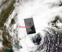
This makes them ideal for mapping flooded areas because satellite optical instruments cannot image through cloud, which is typically present during times of bad weather.
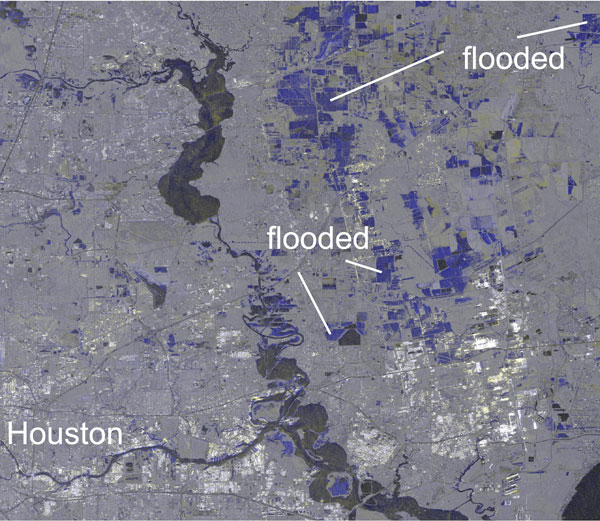
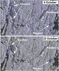
In addition, radar is sensitive to water on Earth's surface. Comparing images from before a flood to images taken during floods, the composite image here shows flooded areas in light blue.
Andreas Kääb from the Department of Geosciences at the University of Oslo, studied, for example, floods around Houston, Texas, during the end of Hurricane Harvey in August 2017 and floods in southern Norway after repeated and particularly heavy rain throughout October 2017.
In both cases, the Copernicus Emergency Management Service triggered radar acquisitions and produced maps to support regional authorities in coping with the floods' disastrous consequences.
Since Houston is also a test site used to carry out routine calibration and validation activities for Sentinel-1, some high-resolution Stripmap (SM) images are regularly acquired over the area.
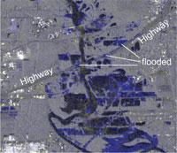
Related acquisitions had already been included in the Sentinel-1 observation plan and were used to characterise the floods. In comparison to the usual Interferometric-Wideswath (IW) mode, SM-mode data have a spatial resolution of 5 m x 5 m over a swath width of 80 km, allowing small flood details to be mapped. For instance, in the composite images one can even detect which sections of highways were flooded, thus hindering or preventing passage.
Similarly, railways and agricultural fields affected by floods can be detected and mapped with high accuracy.
The Sentinel-1 IW-mode data have a coarser resolution of 5 m x 20 m, but cover a swath width of 250 km compared to 80 km in SM-mode. This means that land can be mapped more frequently. Such data are therefore preferable over large areas affected by floods, as in the case of southern Norway where it was not clear in advance where floods would hit.
Typically, Sentinel-1 acquires images over land in IW-mode so emergency acquisitions can be incorporated to form consistent Sentinel-1 time series. During an emergency period, images of floods can be easily compared to earlier (and future) events.
Professor Andreas Kääb, says, "Once more, radar images have shown how important they are for disaster management when the sky is covered by clouds or during darkness, for instance, during the polar night. It is also remarkable that the involved authorities and scientists obtain these images just a few hours after acquisition."
About the Sentinels
The Sentinels are a fleet of dedicated EU-owned satellites, designed to deliver the wealth of data and imagery that are central to Europe's Copernicus environmental programme.
In partnership with EU Member States, the European Commission leads and coordinates this programme, to improve the management of the environment, safeguarding lives every day. ESA is in charge of the space component, responsible for developing the family of Copernicus Sentinel satellites and ensuring the flow of data for the Copernicus services, while the operations of the Sentinels have been entrusted to ESA and EUMETSAT.
