Celebrated today, the International Day of Forests raises awareness on the importance of forests globally. Some 30% of Earth's land surface is covered by forests. Every minute, an area of forest equal to ten football fields is lost (FAO FRA 2015).
Deforestation examples include conversion of forestland for the expansion of agriculture plantations, farms, ranches, or urban use.
Every year, some 3.3 million hectares of forest is lost worldwide – an area about the size of Greece. The most concentrated deforestation occurs in tropical regions, and although the rate of loss has slowed down in recent years, it remains high.
By contrast, 'forest degradation' is a gradual process where biomass declines and its species composition changes. Degradation often precedes deforestation.
Forest damage has long been recorded and is caused by natural phenomena (disease and pests, storms, fire, drought and other climatic stresses), by human activity (agriculture expansion, fire, economic overexploitation, overgrazing), and by natural causes.
In 2005, a discussion on deforestation was initiated within the United Nations Framework Convention on Climate Change (UNFCCC) negotiations. From this discussion, the concept of reducing emissions from deforestation and forest degradation (REDD+) emerged.
Following an update related to the Paris Agreement in 2015, the EU called for global forest cover loss to end no later than 2030, and for gross tropical deforestation to decline by at least 50% by 2020. To support this target, the EU and its member states are engaged in REDD+ and other activities, which directly or indirectly contribute to reducing deforestation and forest degradation.
So, where do the European Union's Copernicus Sentinel satellites come in? With the Sentinel-1 constellation now complete and Sentinel-2's constellation planned to be operational by the end of this year, the ability for near-real time monitoring of forest changes adds precious value in the sense of moving from months, to weeks, to days in terms of temporal satellite observations. This improves the availability of information for better management, and for enforcement and reaction in cases of illegal forest loss.
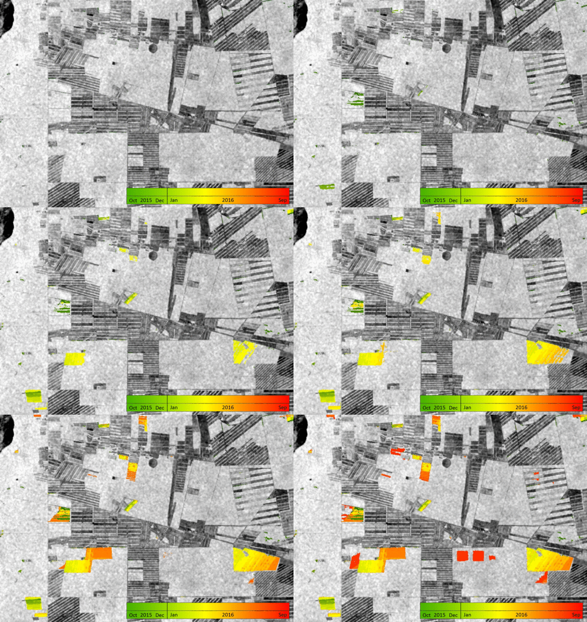
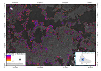
Using a multi-sensor combination of radar and optical data from Sentinel-1 and PALSAR-2, respectively, together with Landsat for near-real time forest change detection in tropical dry forests, such as those in Bolivia, has brought fruitful results.
ESA, together with the EU, FAO and GEO recently held the WorldCover 2017 conference. Open to land-cover users, scientists, students, representatives from national, European and international space agencies, value adding industries, laboratories and universities, the event was hosted last week at ESA–ESRIN.
Researchers of the Change Change Detection and Monitoring team at the University of Wageningen showed that when combining observations from multiple sensors, deforestation was detected with a higher spatial and temporal accuracy than when using observations from a single sensor.
They found that confident deforestation alerts can be provided with a mean time lag of three weeks, but these are associated with a higher commission error. This is on average six weeks earlier than when relying on Landsat observations alone, and will further improve when Sentinel-2B is fully operational.
In Peru, Ethiopia and Vietnam forest degradation was monitored in near-real time by combining Sentinel-2, Landsat and RapidEye data, within the ForMoSa project.
Financed by ESA, ForMoSa is led by Planet, in cooperation with the University of Wageningen and validated by the Forest Department of FAO. Using satellite data sources such as Landsat-8, Sentinel-2 and SPOT 5, in addition to RapidEye imagery for the first year, it aims to develop a methodology for near-real time forest degradation monitoring.
Such monitoring is carried out thanks to the increase of temporal frequency of acquisitions with the -B units of the Sentinel satellites also in orbit, and the multi-sensor optical approach followed in the project, to achieve more accurate results through time-series analysis.
The project includes the development of interoperability solutions for the mentioned sensors. The second year has been dedicated to the demonstration and validation of the methodology at three selected test sites (Kafa Tura in Ethiopia, Madre de Dios in Peru, and Bac Kan in Vietnam).
Sentinel-2, with its 13 bands covering the visible to the shortwave infrared spectrum, will allow an efficient mapping of vegetation at 10–20 m resolution, suitable for instance for pan-European high-resolution forest products. With its wide swath of 290 km and two satellites in orbit, the mission will significantly reduce the number of images needed to cover the continent and result in a very frequent revisit time (five days at the equator).
Sentinel-1's frequent revisits over the same area allow changes in land cover to be closely monitored. 12-day repeated observation for all tropical areas guarantees dense time series. Such time series of C-band can compensate environmental effects (for instance the sudden increase of soil moisture, resulting in increased backscatter), which was not possible in the past with single sensors.
C-band imagery in forestry was limited in the past, where L-band analysis dominated, but monitoring with Sentinel-1 is changing things, since it is particularly effective for keeping an eye on illegal logging in tropical forests.
This makes the Sentinel-1 radar mission a valuable complement to the Sentinel-2 multispectral optical mission.
Dr. Jan Verbesselt, Associate Professor in remote sensing at Wageningen University, said, "With the successful recent launch of the Sentinel-2B satellite, both Sentinel-1 (radar) and -2 (optical) now have two satellites in orbit completing the constellation, to make real-time forest monitoring possible."
Postdoctoral researcher in remote sensing at Wageningen University, Dr Johannes Reiche, says, "Efforts towards the operationalised combination of Sentinel-1 and Sentinel-2 data are paramount if we want to exploit the Sentinels in a way that really improves the consistency and robustness of tropical forest monitoring."
About the Sentinels
The Sentinels are a fleet of dedicated EU-owned satellites, designed to deliver the wealth of data and imagery that are central to Europe's Copernicus environmental programme.
In partnership with EU Member States, the European Commission leads and coordinates this programme, to improve the management of the environment, safeguarding lives every day. ESA is in charge of the space component, responsible for developing the family of Copernicus Sentinel satellites and ensuring the flow of data for the Copernicus services, while the operations of the Sentinels have been entrusted to ESA and EUMETSAT.


