As we reach for our clean fluffy towels and white T-shirts this summer, more and more of us demand our cotton to be eco-friendly. A study funded by ESA uses satellite data to promote the sustainable production of cotton.
While cotton may seem to be clean, its production is a filthy business. In India, the world’s second largest cotton producer, conventional cultivation of cotton uses nearly 50% of the country’s total chemical pesticides and 30% of its water for irrigation [1].
Strict international standards, where few chemicals are permitted and water use is limited, promise cleaner cotton. The Better Cotton Initiative (BCI) is one such standard, ambitiously aiming to transform the cotton sector with sustainable practices, improving water management, greenhouse gas emissions and soil health.
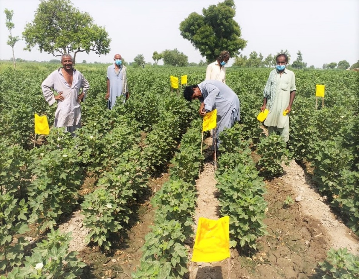
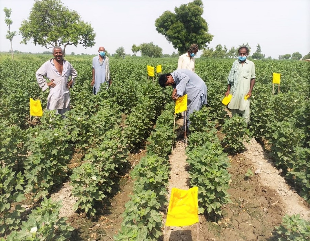
Cotton farmers working to the standards of the Better Cotton Initiative
Global retail leaders, such as IKEA, support the BCI and over a fifth of the world’s cotton is produced under this standard. However, much of India’s cotton is grown by smallholders, often in remote fields that are inaccessible by road. Ensuring conformity to the standard is challenging.
A recent feasibility study funded by ESA’s programme of Advanced Research in Telecommunications Systems (ARTES), focuses on supporting BCI compliance using satellite based agricultural monitoring.
The study drew on remote sensing data delivered by Sentinel-2 of the European Union’s Copernicus Programme and targeted a pilot study area of more than 1000 cotton fields in remote smallholder farms of the Gujarat, Maharashtra and Telangana regions of India.
Dimo Dimov, study leader for the “Greener Cotton” project at Geocledian, a start-up and SME remote sensing company in Germany, says, “The multispectral and multitemporal sensing capabilities of the Copernicus Sentinel-2 satellites enable near-real time monitoring and agricultural information extraction for cotton fields.
“The high resolution of the data were necessary to monitor the small fields from the subsistence farmers in our study area.”
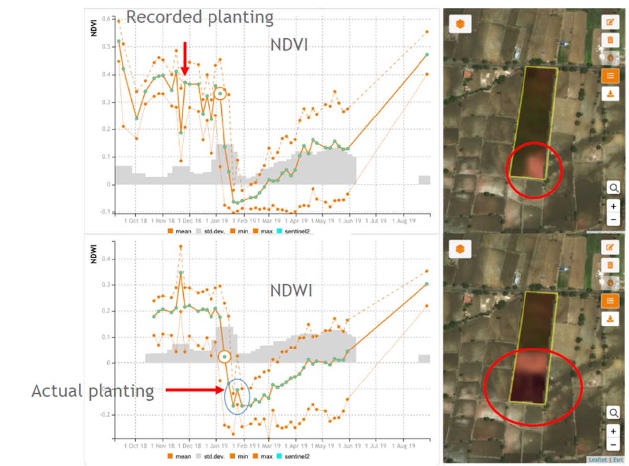
Data verifies planting and harvesting dates
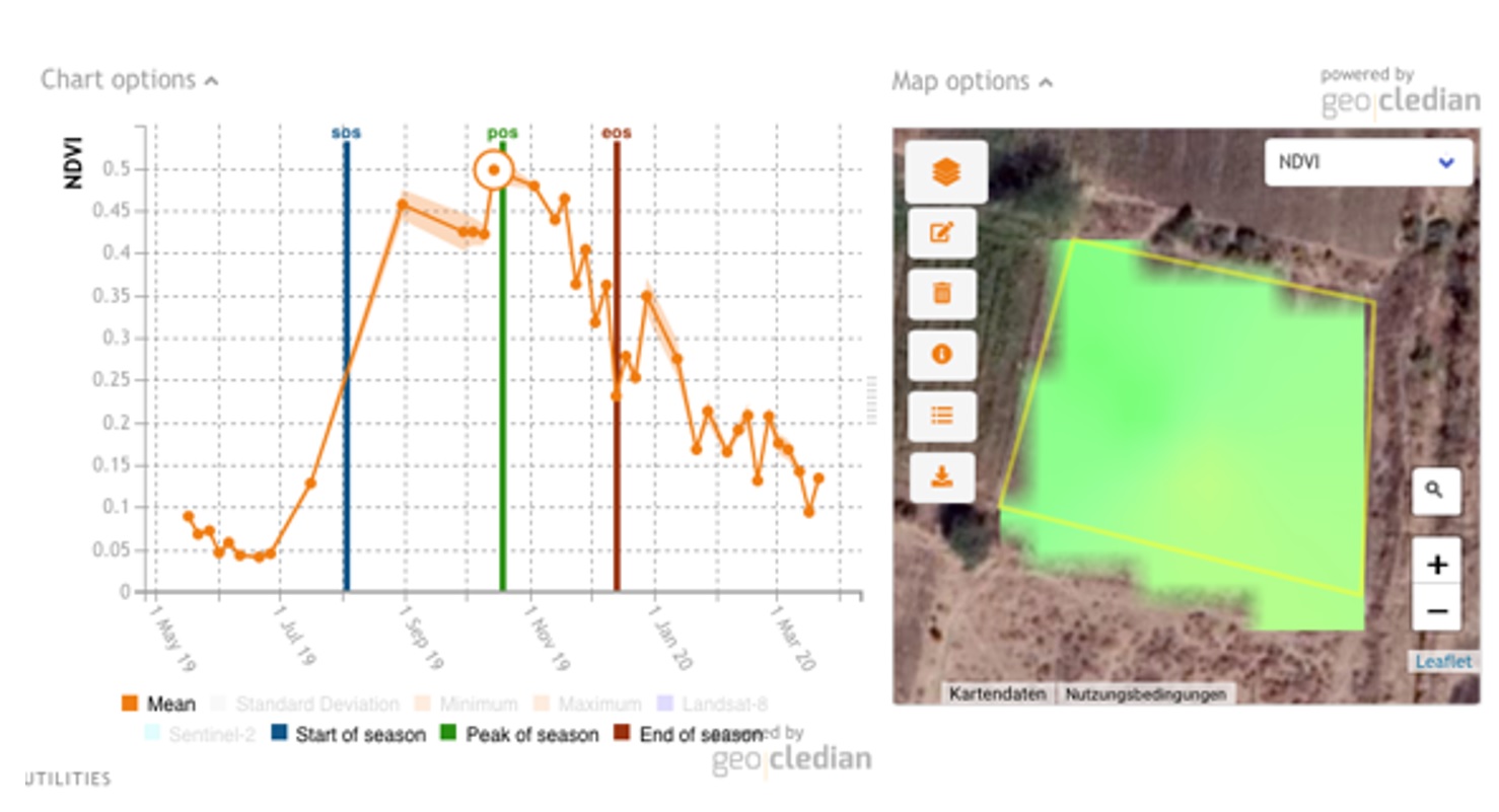
Sentinel-2 data were processed for targeted cotton field parcels to derive a time series of phenological indicators. These data were used to trace crop management practices in the study area.
The BCI criteria demand efficient use of scarce irrigation water and sustainable soil use through crop rotation.
“To comply with the BCI standard, farmers should harvest their crops by certain dates. We used the data to monitor harvesting periods and validate crop rotation practices,” explains Dimov.
Farmers seeking BCI accreditation may claim they sowed and harvested their crops on certain dates. However, the Normalised Difference Vegetation Index (NDVI) time series derived from Sentinel-2 data can reveal deviations from these claims.
Monitoring planting and harvesting dates
Sustainable soil use is achieved by rotating cotton with other crops, such as grain.
“Multiple peaks in the NDVI time series can indicate multiple harvests or crop rotation. This method could also be applied to flag irresponsible soil-use, or over planting,” says Dimov.
Monitoring responsible land and water use
The study revealed how satellite data can be used to ensure responsible land usage, tracking whether cotton crops are planted too close to key biodiversity areas, intact forest landscapes or protected areas.
The location-based analysis from this study can also improve irrigation advice by identifying crop water requirements and deficits. Using Copernicus Sentinel-2 data and meteorological information on drought and weather extremes, drought, flood and storm damage can be identified and localised.
The researchers applied their method to other crops, such as palm oil and sugarcane. A recently published article from the team is based on the derivation of time series metrics from Copernicus Sentinel-2 data to estimate sugarcane yields in farms located 180 km east of Ethiopia’s capital, Addis Ababa [1].
Later this year, the researchers plan to enhance their method using Synthetic Aperture Radar (SAR) data from the Copernicus Sentinel-1 satellite. Since radar can penetrate cloud coverage, this will allow for more accurate monitoring, especially during India’s rain season.
Looking to the future, the team aim to further expand this project to integrate remote sensing data in cotton supply chain platforms.
The study has proven that remote sensing data works well as an independent tool for traceability in the supply chain. These greener cotton initiatives also improve the conditions of cotton farm workers.
About the Copernicus Sentinels
The Copernicus Sentinels are a fleet of dedicated EU-owned satellites, designed to deliver the wealth of data and imagery that are central to the European Union's Copernicus environmental programme.
The European Commission leads and coordinates this programme, to improve the management of the environment, safeguarding lives every day. ESA is in charge of the space component, responsible for developing the family of Copernicus Sentinel satellites on behalf of the European Union and ensuring the flow of data for the Copernicus services, while the operations of the Copernicus Sentinels have been entrusted to ESA and EUMETSAT.
Did you know that?
Earth observation data from the Copernicus Sentinel satellites are fed into the Copernicus Services. First launched in 2012 with the Land Monitoring and Emergency Management services, these services provide free and open support, in six different thematic areas.
The Copernicus Land Monitoring Service (CLMS) provides geographical information on land cover and its changes, land use, vegetation state, water cycle and Earth's surface energy variables to a broad range of users in Europe and across the World, in the field of environmental terrestrial applications.
It supports applications in a variety of domains such as spatial and urban planning, forest management, water management, agriculture and food security, nature conservation and restoration, rural development, ecosystem accounting and mitigation/adaptation to climate change.
References
[1] Murli Dhar, P. Vamshi Krishna, Sumit Roy: “Manual: Better Management Practices for Cotton Cultivation”, WWF 2010
[2] Dimov, D., Uhl, J., Löw, F., & Seboka, G. Sugarcane yield estimation through remote sensing time series and phenology metrics. Smart Agricultural Technology, 2022, 2. https://doi.org/10.1016/j.atech.2022.100046


