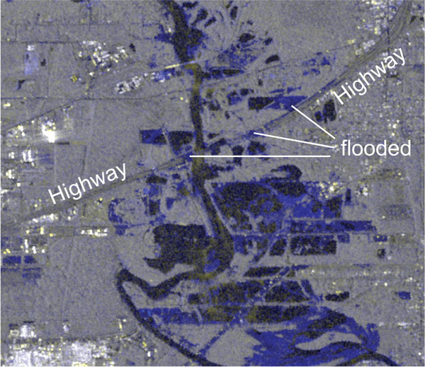
Title: Sentinel-1 focuses on flood details
Description:
Over Houston, high-resolution Stripmap (SM) images are regularly acquired by the Copernicus Sentinel-1 satellites, and were used to assess the impact of Hurricane Harvey in August 2017. In comparison to the usual Interferometric-Wideswath (IW) mode, the SM-mode data allow to detect even flooded highways.
Copyright: Contains modified Copernicus Sentinel data (2017), processed by A. Kääb at University of Oslo