Data from the Copernicus Sentinels, which are developed by ESA, feed into the Copernicus Services, help address challenges such as urbanisation, food security, rising sea levels, diminishing polar ice, natural disasters and, of course, climate change.
Following the launch of the latest mission (Copernicus Sentinel-6 Michael Freilich), the focus is now on the future.
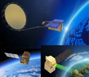
Hence, six high-priority candidate missions (Copernicus Expansion Missions) are being studied, to address EU policy and gaps in Copernicus user needs, and to expand the current capabilities of the Copernicus space component. The full implementation of the programme is pending an important decision point with the European Commission in 2021, but the key missions under study are the following:
| Mission | Description |
| CHIME: Copernicus Hyperspectral Imaging Mission | Complementing Copernicus Sentinel-2 for applications such as land-cover mapping, it would carry a unique visible to shortwave infrared spectrometer, providing routine hyperspectral observations to support new and enhanced services for sustainable agricultural and biodiversity management, as well as soil property characterisation.
|
| CIMR: Copernicus Imaging Microwave Radiometer | Responding to high-priority requirements from key Arctic user communities, the mission would carry a wide-swath conically-scanning multi-frequency microwave radiometer, to provide observations of sea-surface temperature, sea-ice concentration and sea-surface salinity, while uniquely also observing a wide range of other sea-ice parameters.
|
| CO2M: Copernicus Anthropogenic Carbon Dioxide Monitoring | This mission would carry a near-infrared and shortwave-infrared spectrometer to measure atmospheric carbon dioxide produced by human activity, providing the EU with a unique and independent source of information, to assess the effectiveness of policy measures, and to track their impact towards decarbonising Europe and meeting national emission reduction targets. The measurements from the mission would reduce current uncertainties in estimates of emissions of carbon dioxide from the combustion of fossil fuel at national and regional scales.
|
| CRISTAL: Copernicus Polar Ice and Snow Topography Altimeter | The mission would contribute to a better understanding of climate processes, with its dual-frequency radar altimeter and microwave radiometer to measure and monitor sea-ice thickness and overlying snow depth. It would also measure and monitor changes in the height of ice sheets and glaciers worldwide, while measurements of sea-ice thickness would support maritime operations in polar oceans and, in the longer term, would help in the planning of activities in the polar regions.
|
| LSTM: Copernicus Land Surface Temperature Monitoring | The mission would respond to priority requirements of the agricultural user community, for improving sustainable agricultural productivity at field-scale in a world of increasing water scarcity and variability. It would carry a high spatial-temporal resolution thermal infrared sensor to provide observations of land-surface temperature. Such measurements and derived evapotranspiration are key variables to understand and respond to climate variability, manage water resources for agricultural production, predict droughts and also to address land degradation, natural hazards such as fires and volcanoes, coastal and inland water management as well as urban heat island issues.
|
| ROSE-L: L-band Synthetic Aperture Radar | The mission would provide additional information that cannot be gathered by the Copernicus Sentinel-1 C-band radar mission, since it would carry an L-band SAR, whose longer L-band signal can penetrate through many natural materials such as vegetation, dry snow and ice. It would be used in support of forest management, to monitor subsidence and soil moisture and to discriminate crop types for precision farming and food security.
|